- Let’s go to the “other side” of Mt. Asahidake
- Starting out with better weather than expected
- Not that easy, after all…
- A reward at the summit – A white rainbow
- Through Ura-Asahidake Campsite to Mt. Mamiya
- The highlight of the loop – Ohbachidaira
- To Nakadake Onsen to soothe our tired feet
- Still surprisingly far…
- Alpine plants found along the way
Let’s go to the “other side” of Mt. Asahidake
It’s been 7 or 8 years since I started visiting Higashikawa. The first time I took my child up Mt. Asahidake was when they were in the 2nd grade. Despite nearly giving up several times, they managed to reach the summit with the encouragement of the adults around us. Since then, climbing Mt. Asahidake had become an annual summer tradition until the pandemic. During the two years we couldn’t go, my kid built up some stamina through club activities and is now much more confident. Last summer, we even handled a 7-hour round trip from Bogakudai to Mt. Tokachi. So, instead of our usual out-and-back trek to the Asahidake summit, we decided to enjoy more of the Daisetsuzan range with this loop course, which takes a little over 7 hours.
Sugatami Ropeway Station → Sugatami Pond → Mt. Asahidake → Mt. Mamiya → Nakadake Junction → Nakadake Onsen → Susoai Junction → Susoaigahara → Sugatami Ropeway Station
Starting out with better weather than expected
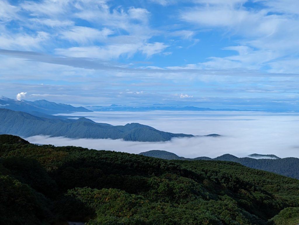
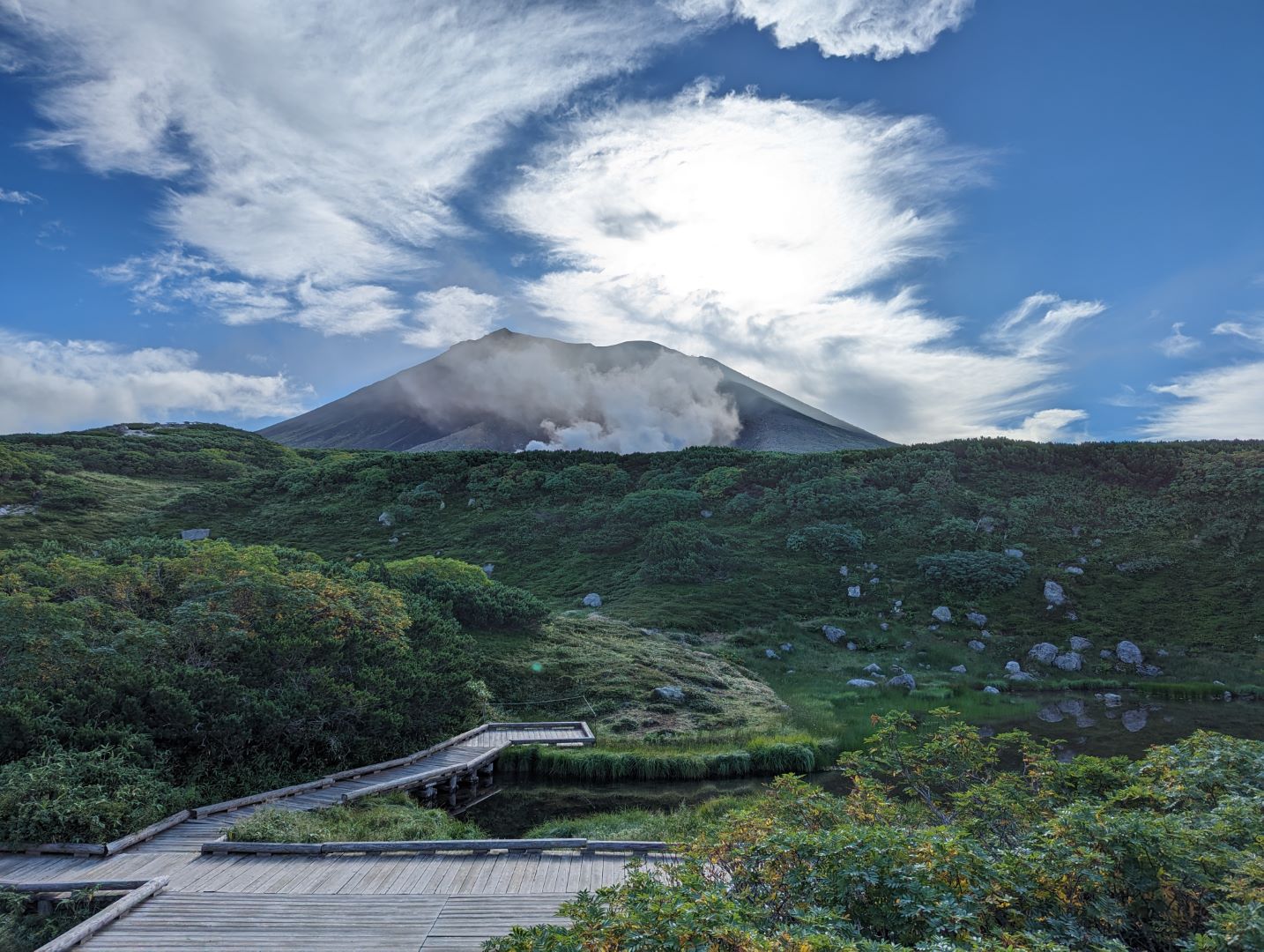
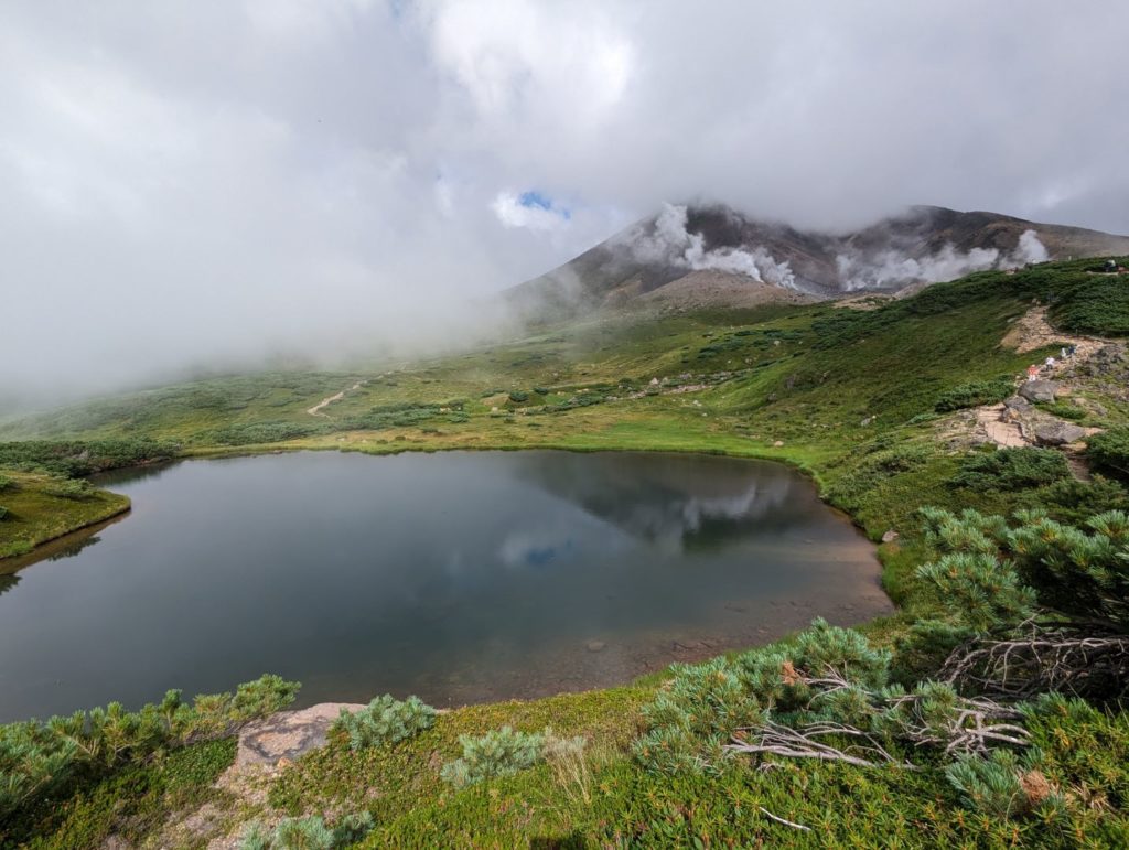
The weather forecast had been flipping back and forth for a few days, and it was cloudy all the way from the town of Higashikawa up to the middle of the mountain. I wasn’t sure how it would turn out, but as soon as we reached Sugatami Station via the ropeway, we were greeted by a magnificent sea of clouds and clear blue skies.
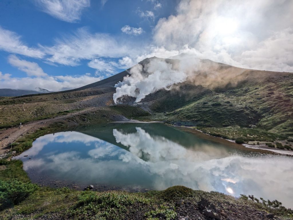
Since it was early morning and the wind was calm, Mt. Asahidake was perfectly reflected in Sugatami Pond. It’s a stunning sight that takes my breath away every single time.
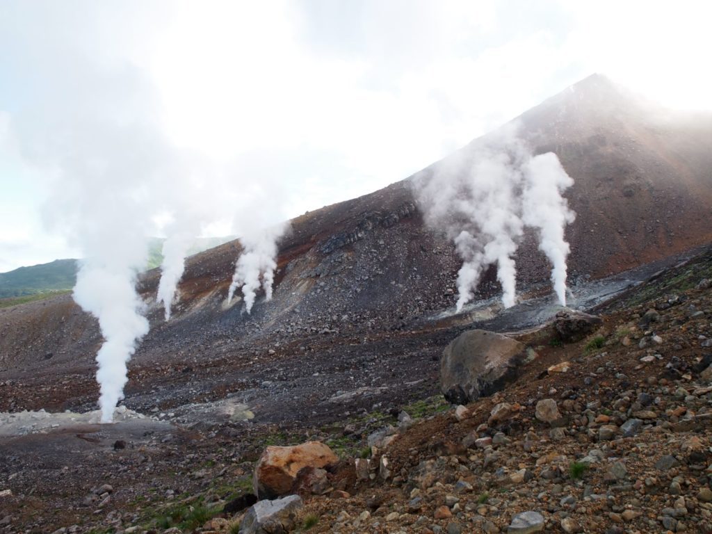
Around Sugatami Pond, volcanic vents were roaring and hissing with steam. It brought back memories of how my child used to be so scared of seeing this from the trail when they were little.
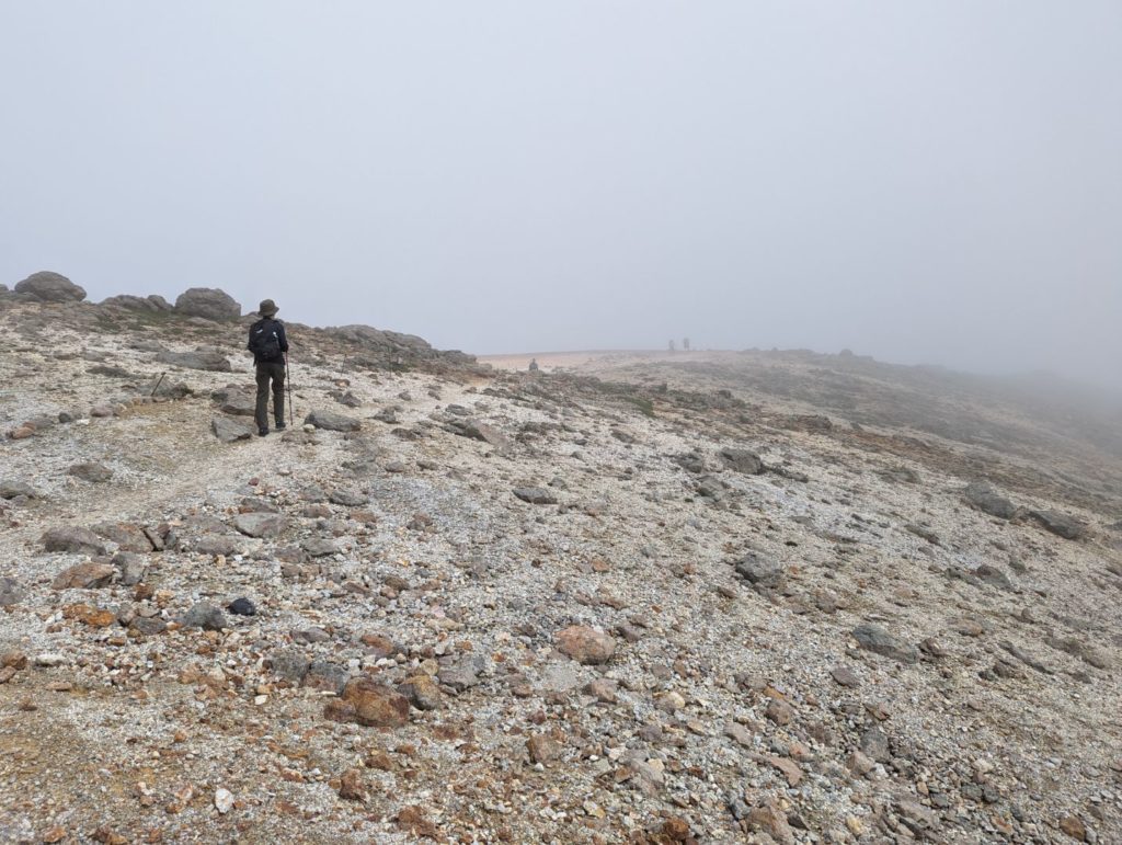
Not that easy, after all…
By the time we reached the 6th station, the fog rolled in quickly. Looking up or looking back toward Sugatami Pond, everything was turning white. To make matters worse, both my kid’s glasses and mine kept fogging up, making it impossible to see! (lol)
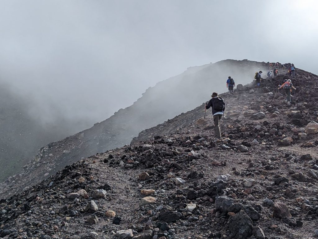

As we neared the summit, the fog got even thicker. It started to feel like we wouldn’t get much of a view from the top.
A reward at the summit – A white rainbow
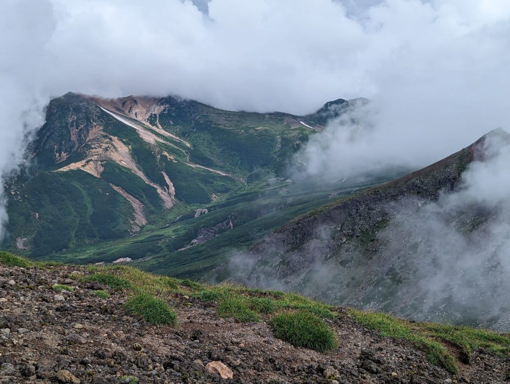
Many people were already at the summit, seemingly waiting for the fog to clear. Then, someone shouted, “Oh! I can see it!” The fog swept away in an instant, revealing the deep green mountains right before our eyes. It only lasts for a moment, but it’s these glimpses that make it so hard to leave the summit.
Looking back toward Sugatami, the patterns in the landscape looked like beautiful layers. It’s truly amazing how nature creates these scenes. While we were watching, the fog started rolling back in, but then I noticed a faint white ring in the air.
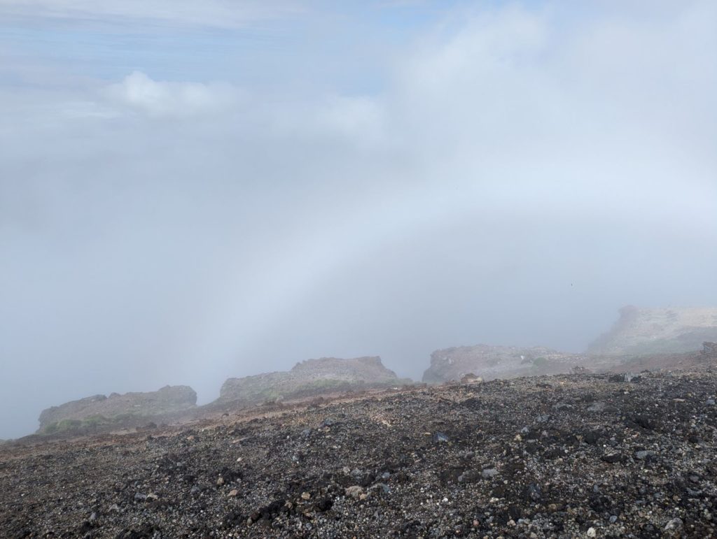
It was a white rainbow (fog bow). It was my first time seeing one! It only appeared for a split second, but I’m so glad I could point it out to my child so we could see it together.
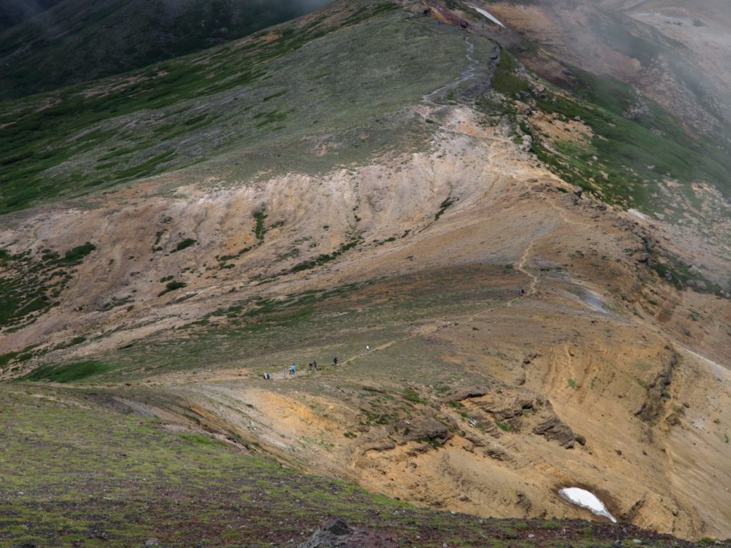
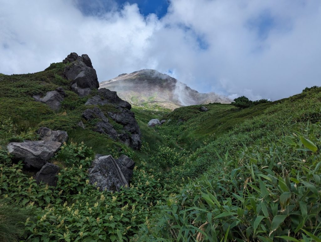
Through Ura-Asahidake Campsite to Mt. Mamiya
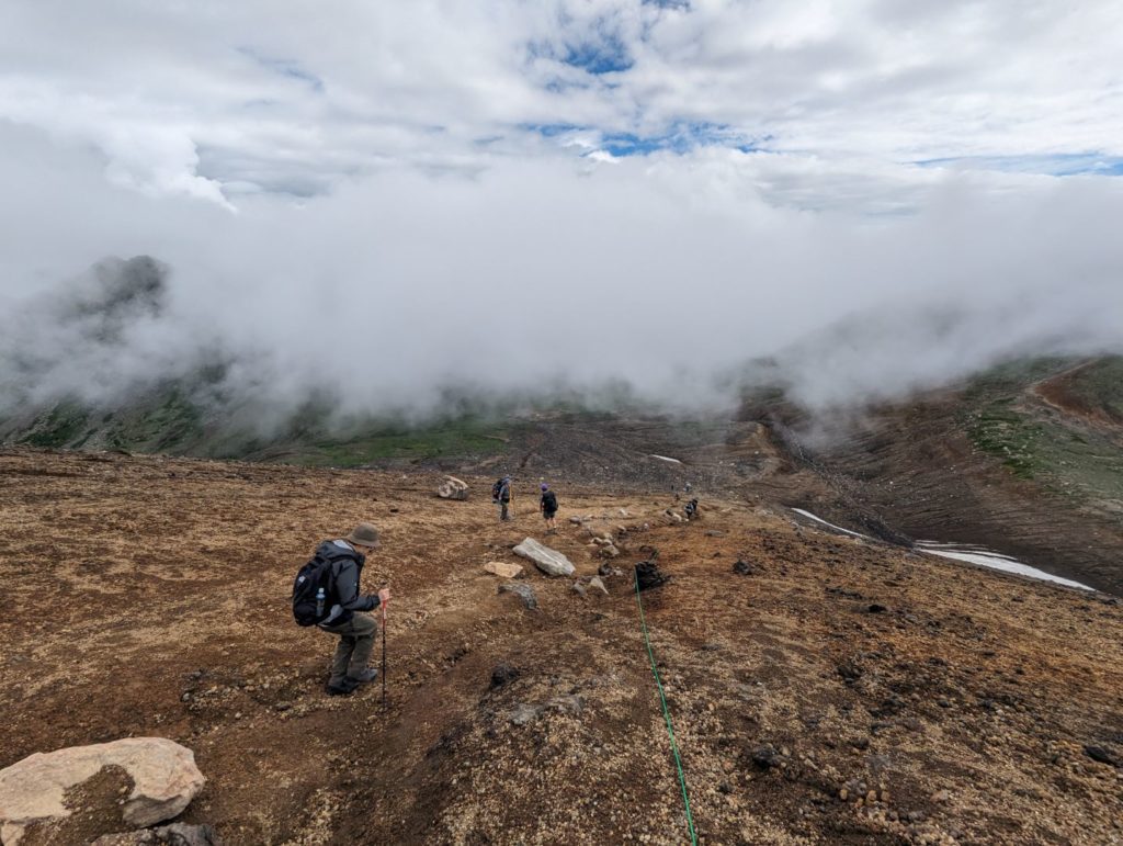
For my child, everything from here on was new territory. The scree slope from the summit of Asahidake down toward the Ura-Asahidake campsite is really slippery and can be tough if you’re not used to it. When I came here a few years ago, there was still a snow patch, and it was a bit of a struggle since I didn’t have crampons.
My kid was pretty cautious on the way down, but by the time we reached the bottom, the clouds had cleared up and it was turning into a beautiful sunny day. Looking good!
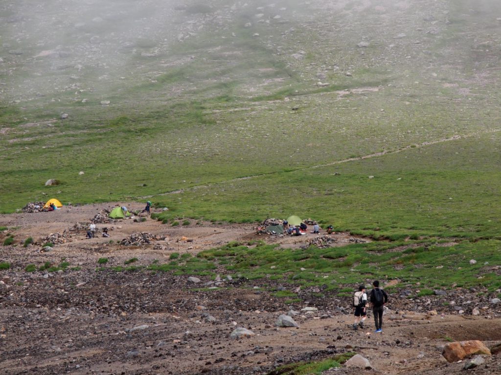
There were a few tents scattered at the campsite. I imagine they’re hikers traversing the Daisetsuzan range. It would be so much fun to spend a few nights out here, visiting places like Mt. Hakuun or Mt. Tomuraushi.
After walking a bit further, the scenery changed completely into a wide-open, white landscape. The last time I was here, it was covered in fog so thick I almost lost the trail. It’s no problem when it’s clear, but there aren’t many landmarks, so you definitely have to be careful.
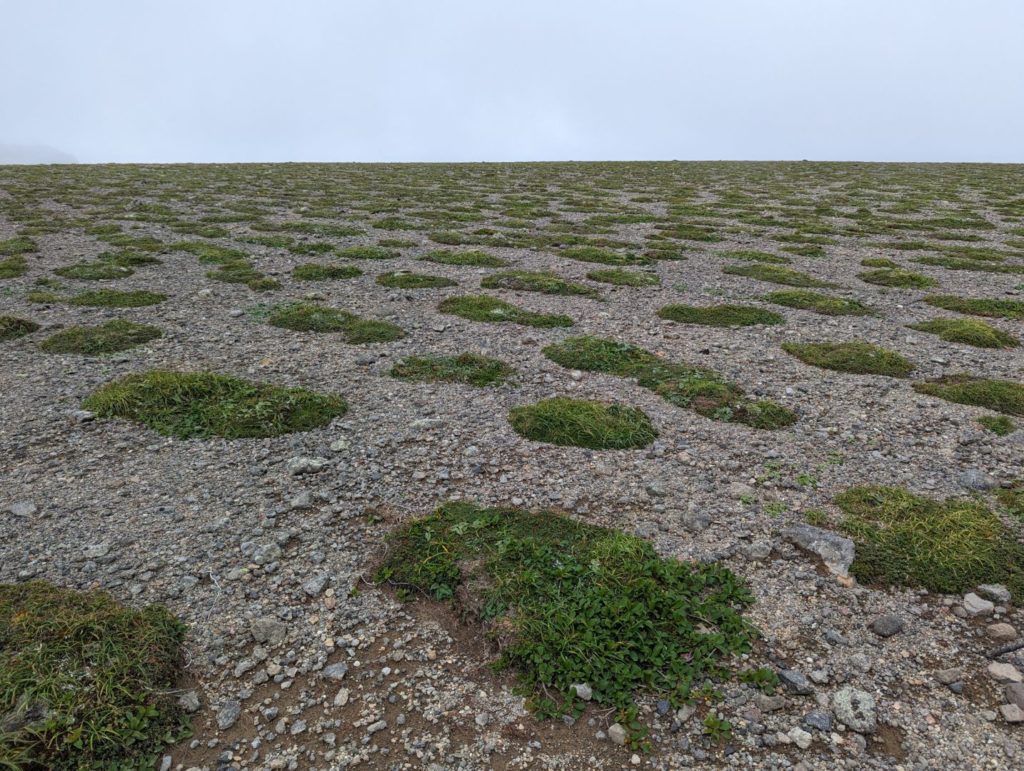
The area near the summit of Mt. Mamiya is almost flat. On this day, there were dots of green appearing like little round islands, creating a very mystical atmosphere.

Even though there’s a marker for the summit, it’s so flat that you almost wonder, “Is this really the top?”
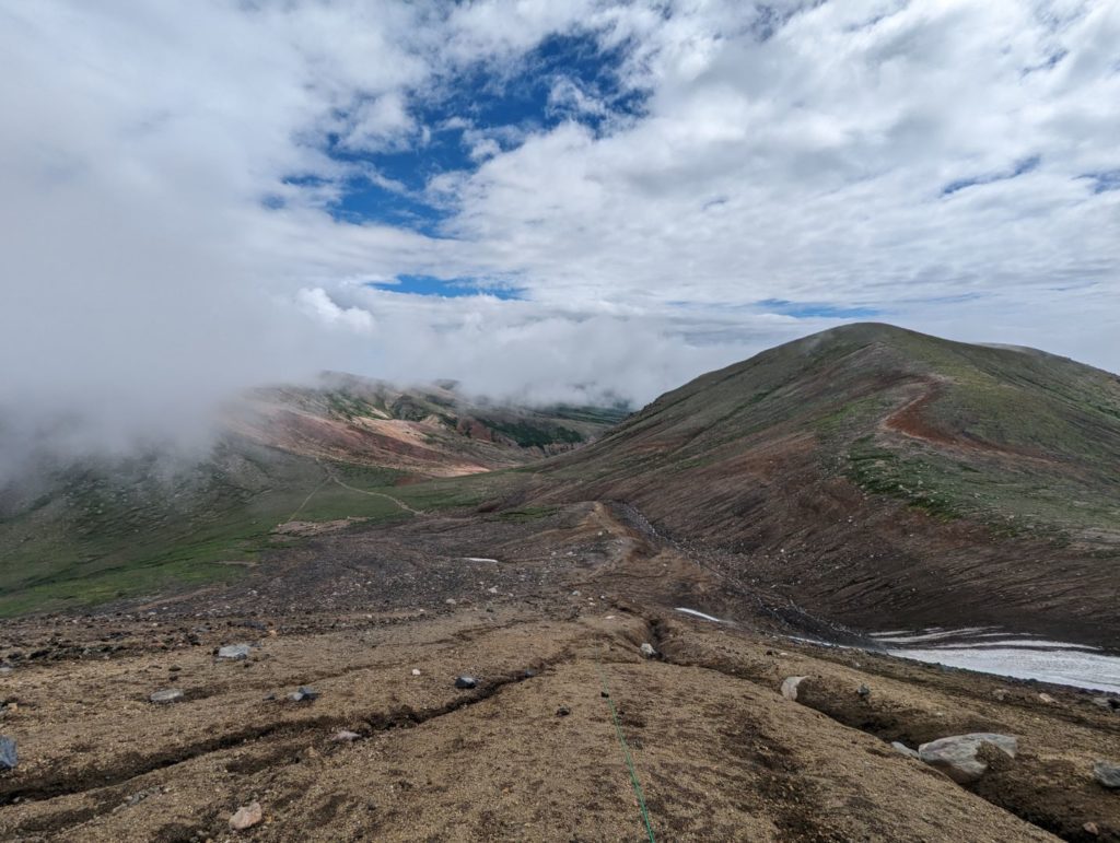
The highlight of the loop – Ohbachidaira
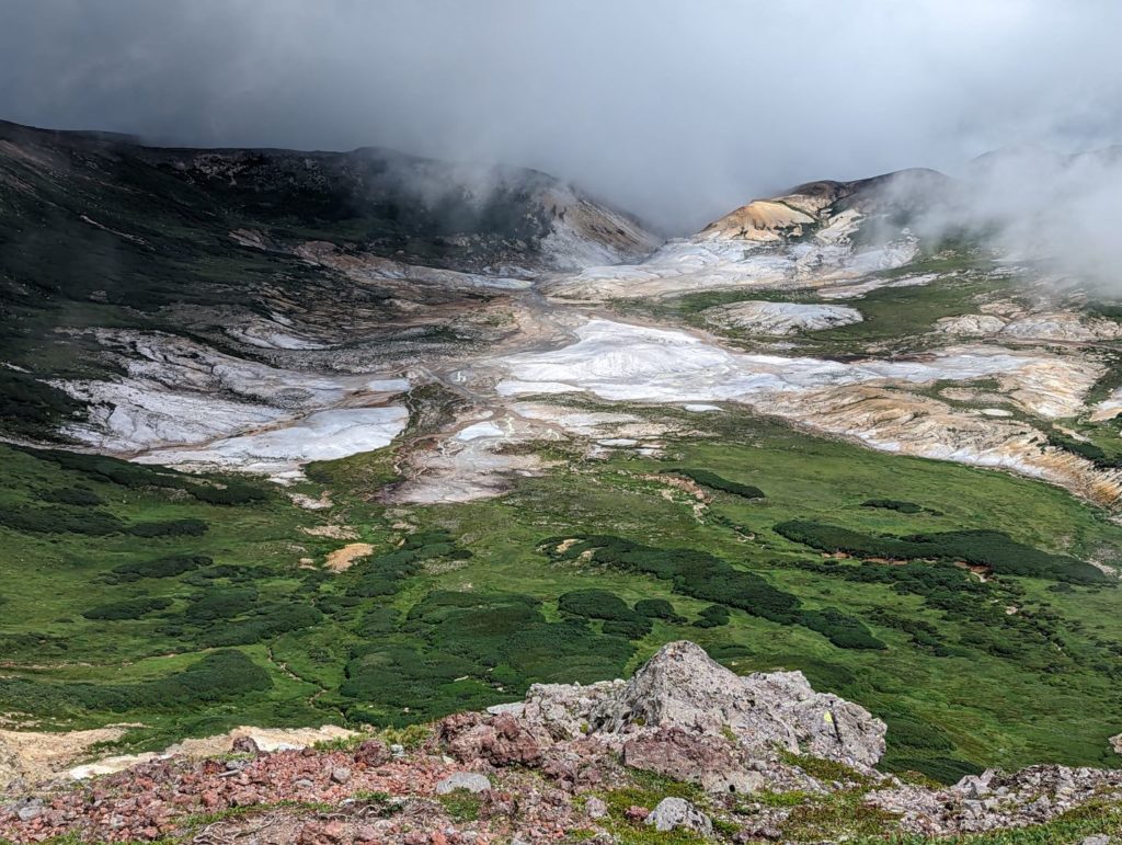
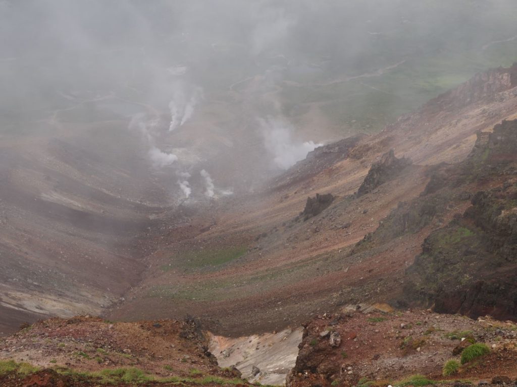
Walking a bit further from Mt. Mamiya, a massive caldera appears on the right. One of the views I really wanted to show my kid was this: Ohbachidaira. Entry is currently forbidden because toxic gases are still being emitted, but on the map, there’s a hot spring symbol right in the middle labeled “Yudoku Onsen” (Toxic Hot Spring). I’m so curious about it! (lol)
Walking along the ridge toward the Nakadake Junction with Ohbachidaira on the right is one of my personal favorite spots. It really shows off the grand scale of Hokkaido’s mountains.
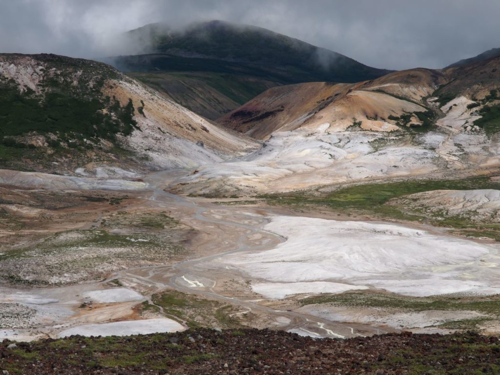
The intensity of Ohbachidaira—with its yellow and white hues from volcanic minerals like sulfur—is just incredible. I couldn’t stop taking pictures, and my kid was teasing me, saying, “You’re too slow!” as we walked.
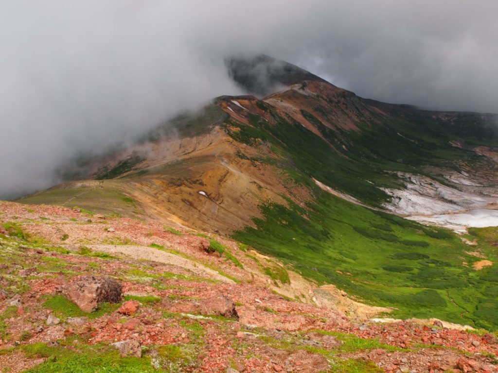
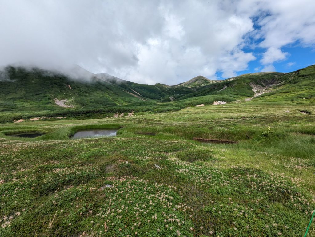
To Nakadake Onsen to soothe our tired feet
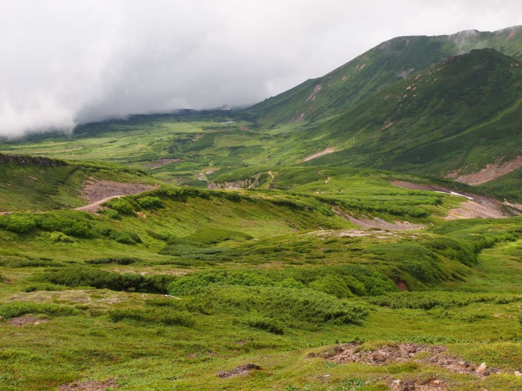
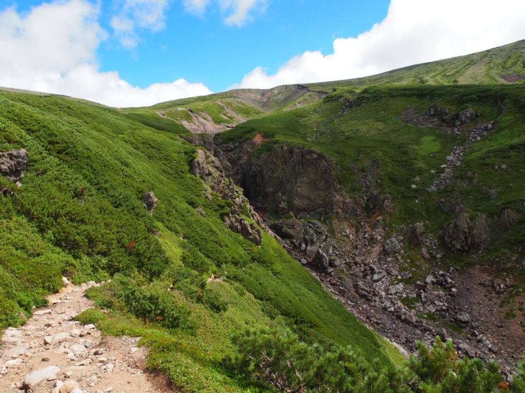
After saying goodbye to Ohbachidaira at the Nakadake Junction and turning left, the view immediately shifts to lush green landscapes. One of the best things about this loop is how dynamically the scenery changes.
With the blue sky peeking out, we enjoyed the beautiful contrast of green hills and white clouds while strolling along a relatively flat path.
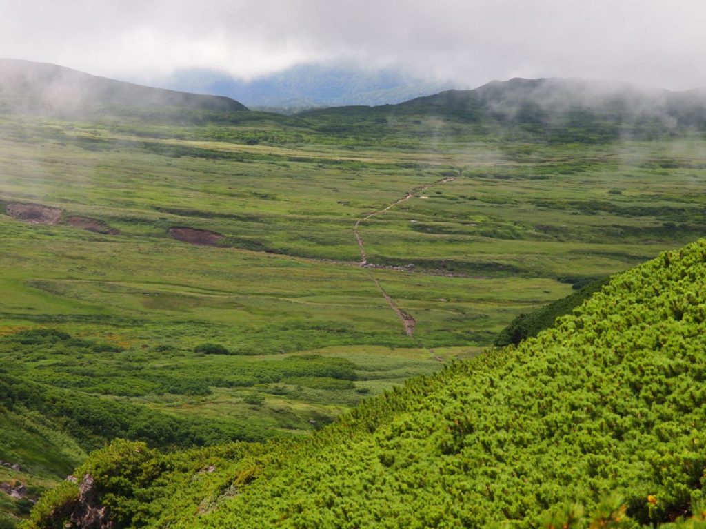
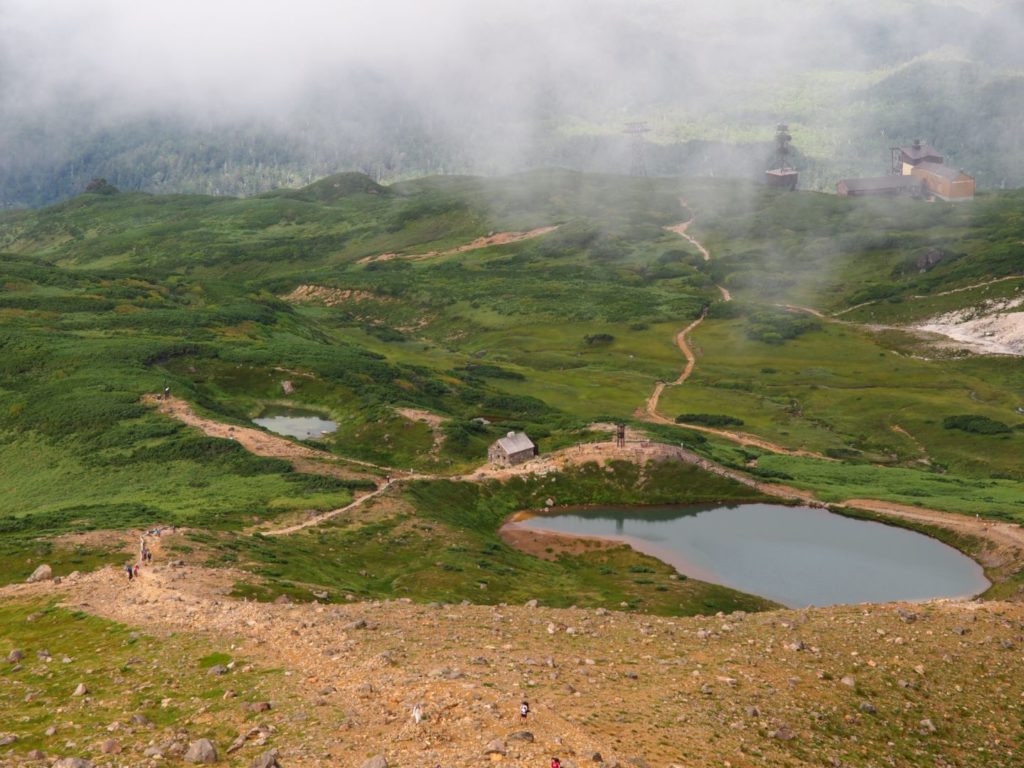
After a while, we could see Susoaigahara in the distance and the trail cutting straight through it. Before descending there, we reached Nakadake Onsen.
Nakadake Onsen is tucked away down there on the right at the bottom of the valley.
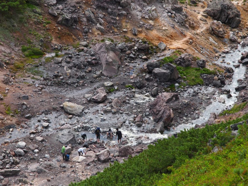
A few people were already enjoying the footbath. It’s a spot where hot spring water boils up and mixes with the cold river water to create the perfect temperature. It seems to be a very strong sulfur spring, as the stream further down is completely white.
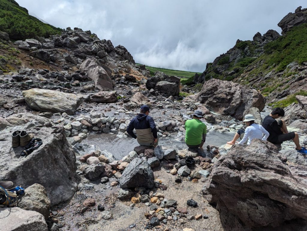
A footbath sounds so good, doesn’t it? But my kid was like, “Taking my boots off is too much work, and I’m tired, so let’s just get back.” So we had to skip it this time… such a shame!
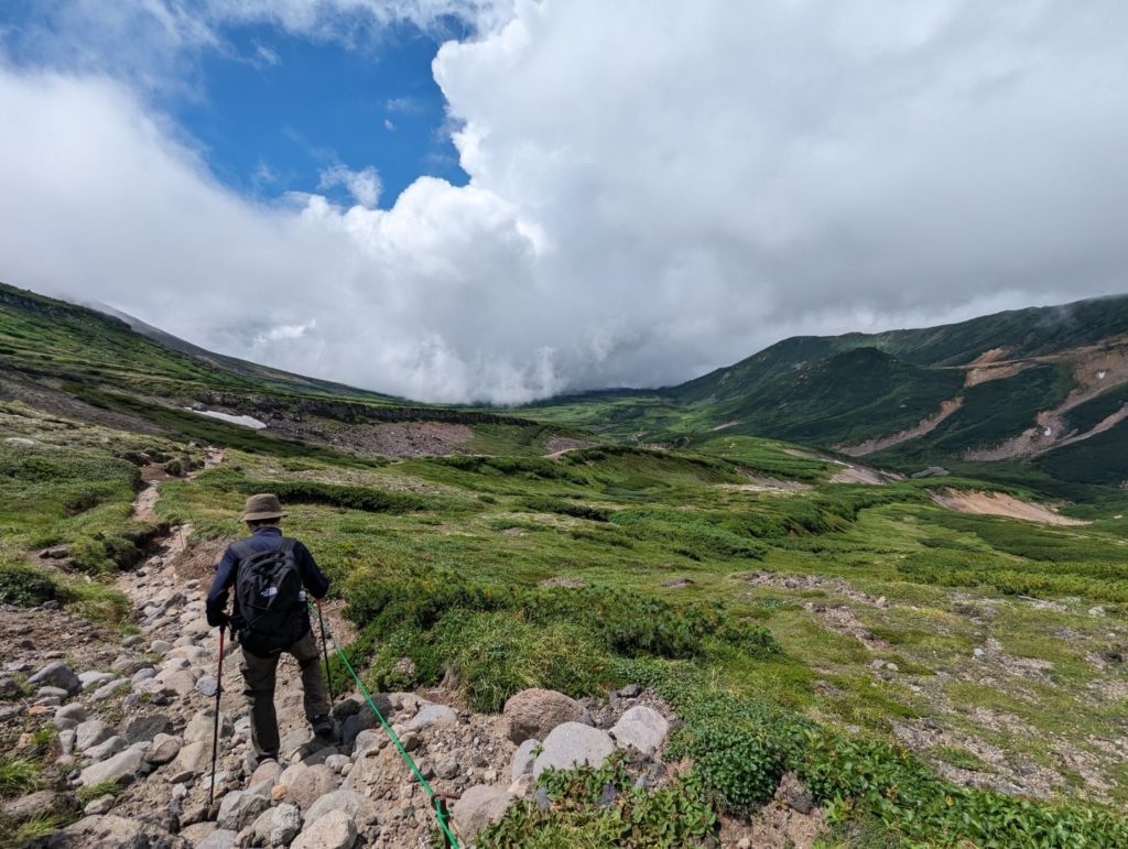
Still surprisingly far…
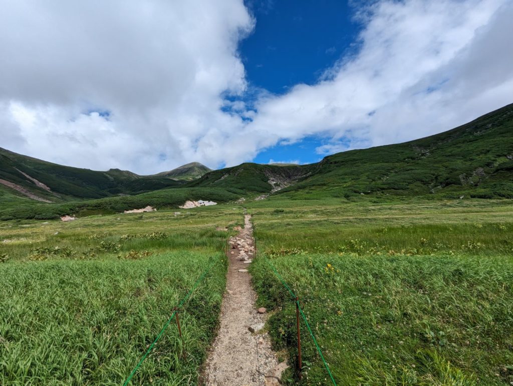
Susoaigahara is mostly flat, and while you know you just have to walk straight to get back to Sugatami Pond, it’s still more than a 3-hour trek from Nakadake Onsen according to the course time. It’s actually quite far.
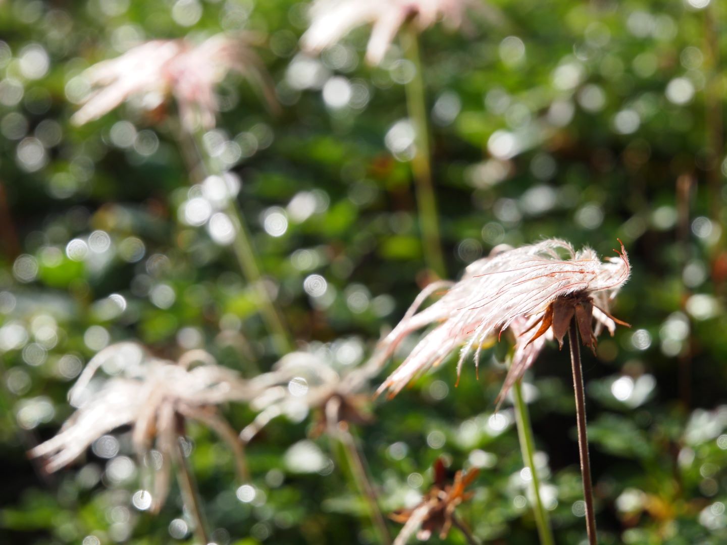
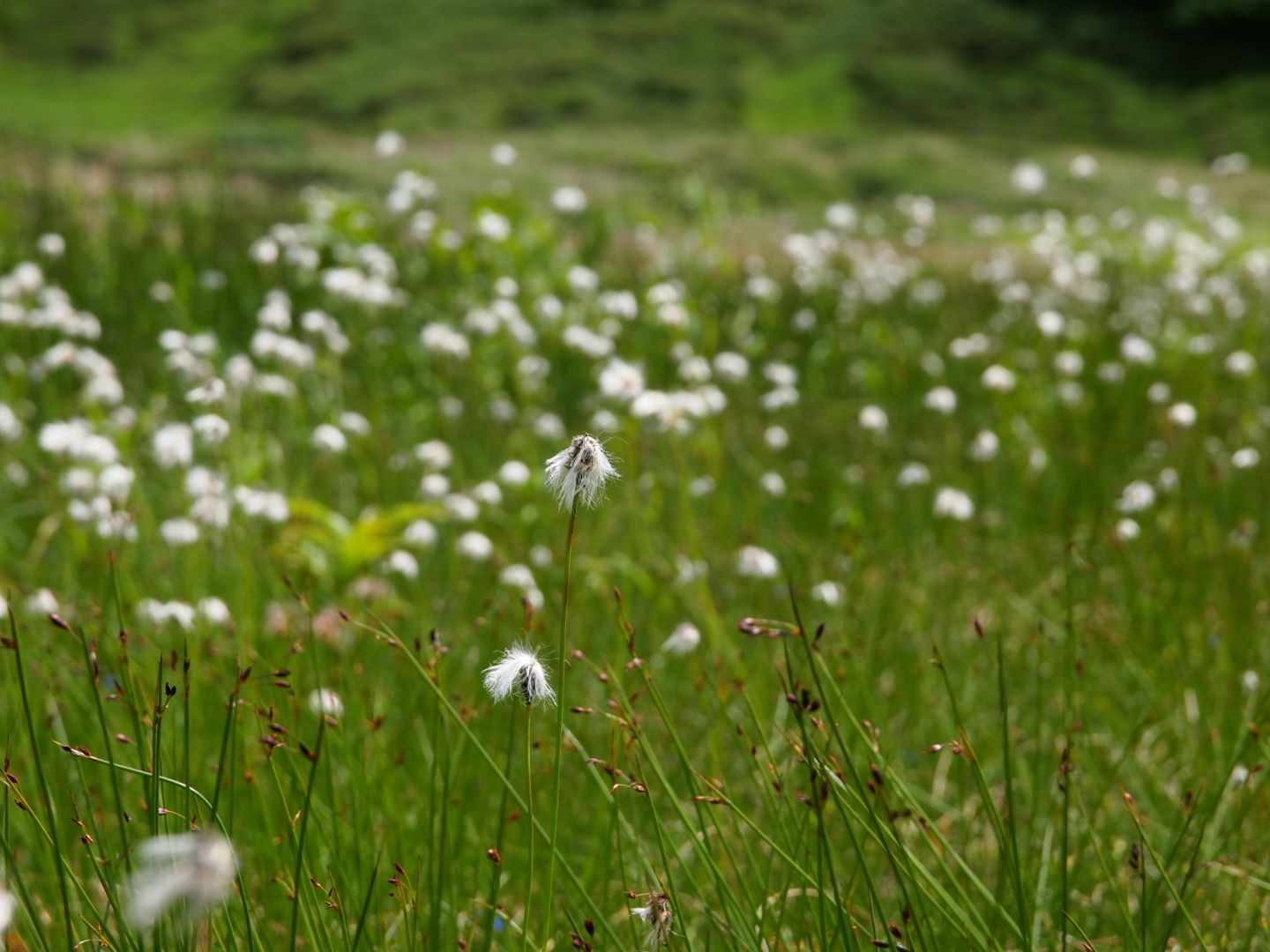
Still, you never get bored. Susoaigahara is like a marshland with small ponds, views of the surrounding mountains, and even though their flowering season was over, the fields were covered in the fluffy seed heads of Aleutian avens (Chinguruma).
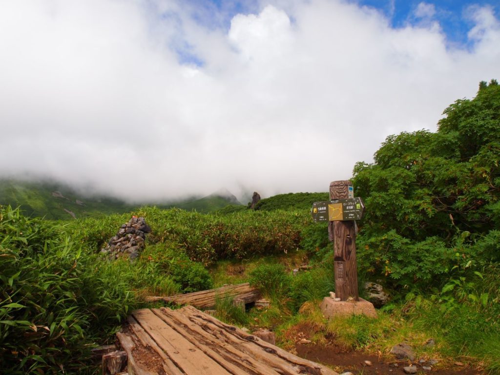
We finally reached the Susoai Junction. Even though we still had a way to go, seeing “Sugatami Ropeway Station” on the sign felt like progress. My kid was a bit shocked to see “1.9 km” left, but hey, we were almost there.
Before we knew it, Mt. Asahidake appeared close on our left, and we were in the final stretch of the loop.
Finally, we saw the familiar Sugatami loop trail, and the goal was right in front of us. By this time, as you can see in the photo, the clouds had covered the summit again. We were really lucky to have seen the clear views earlier in the morning. We made it back almost exactly on the estimated course time, including breaks. I was honestly amazed at how much my child has grown!
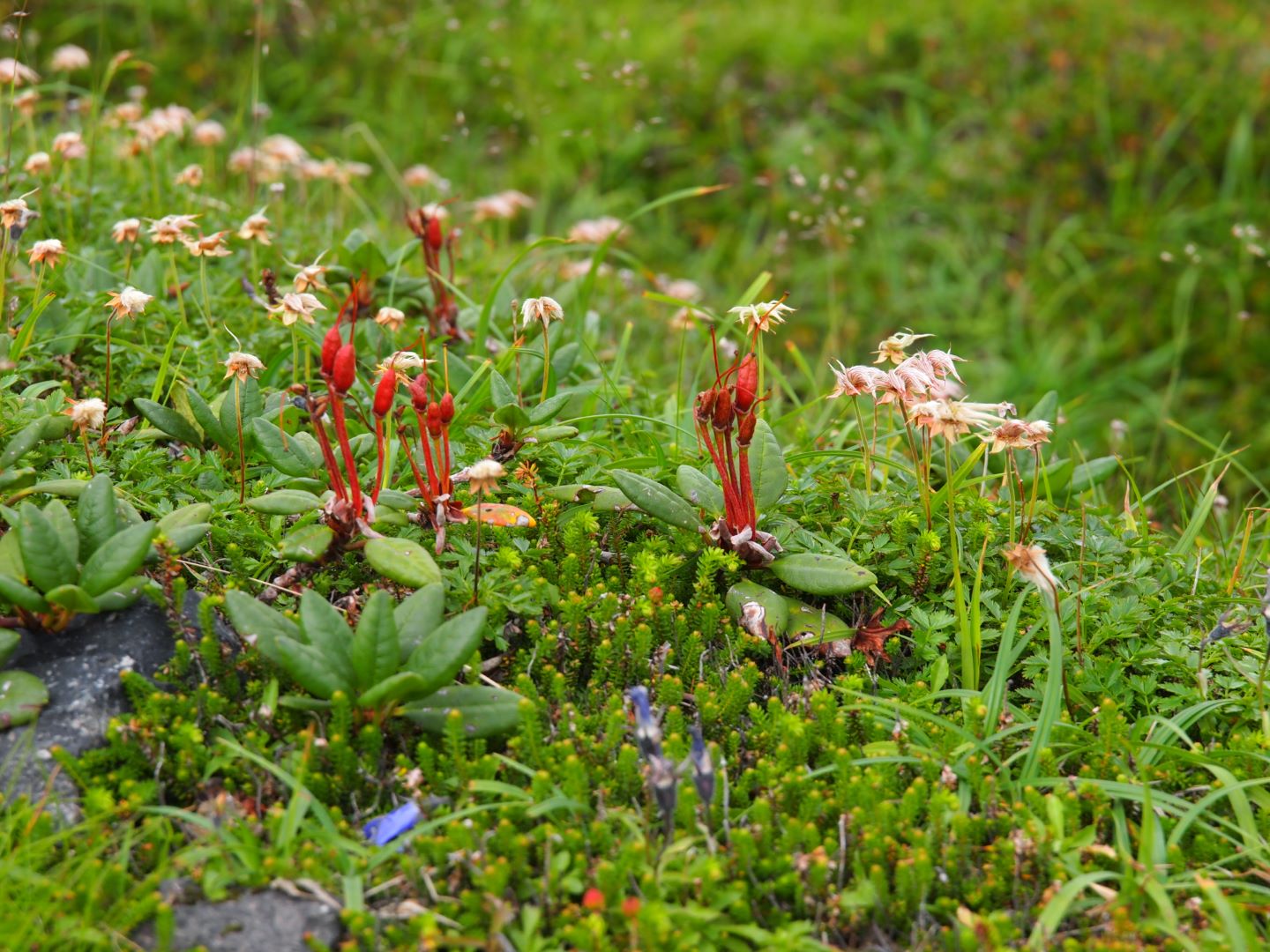
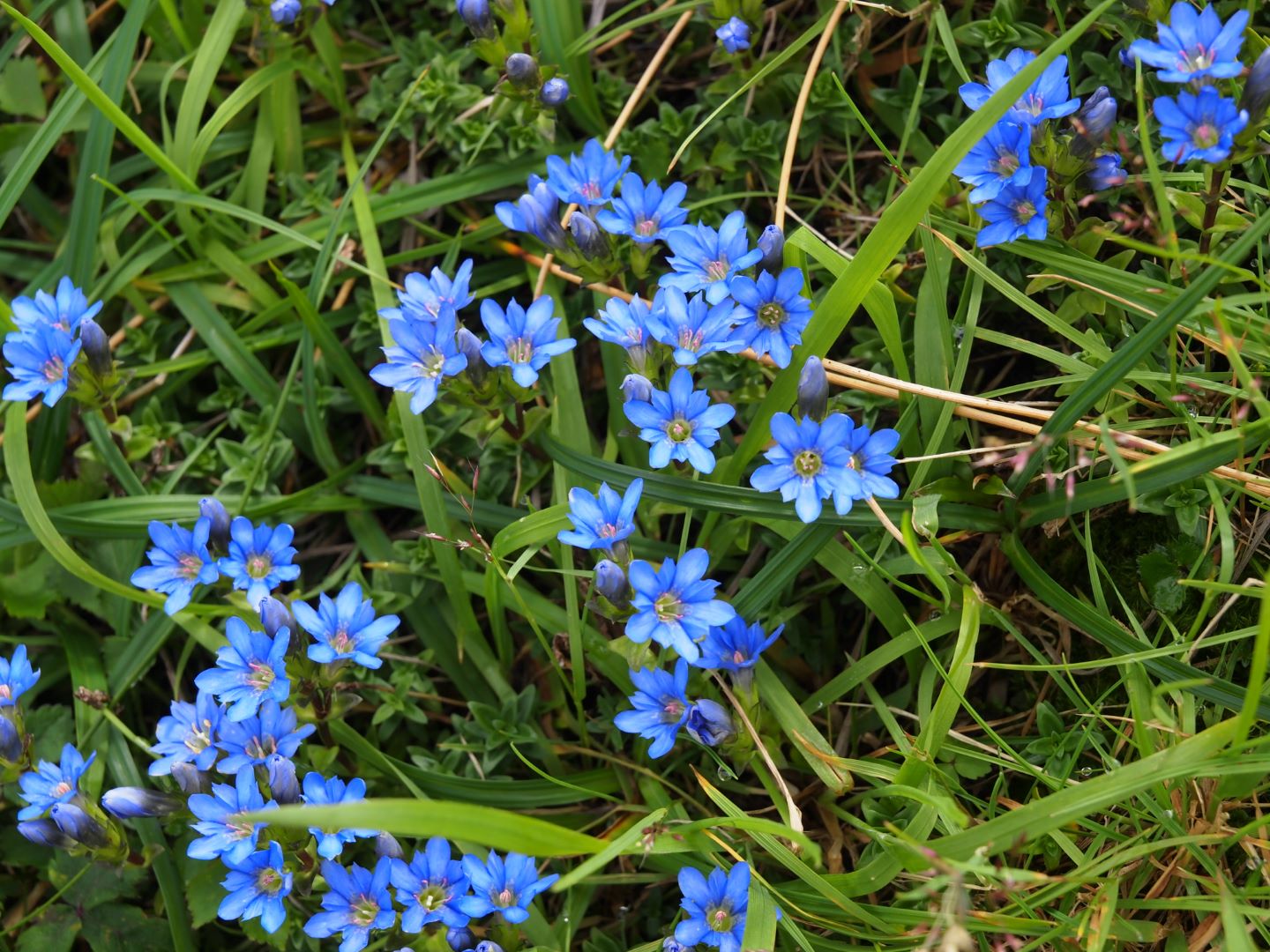
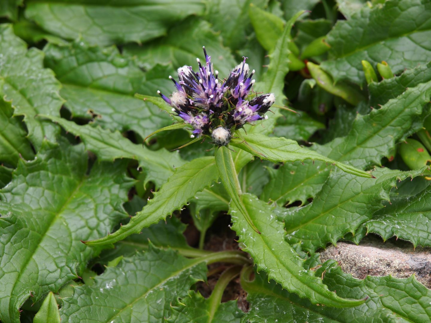
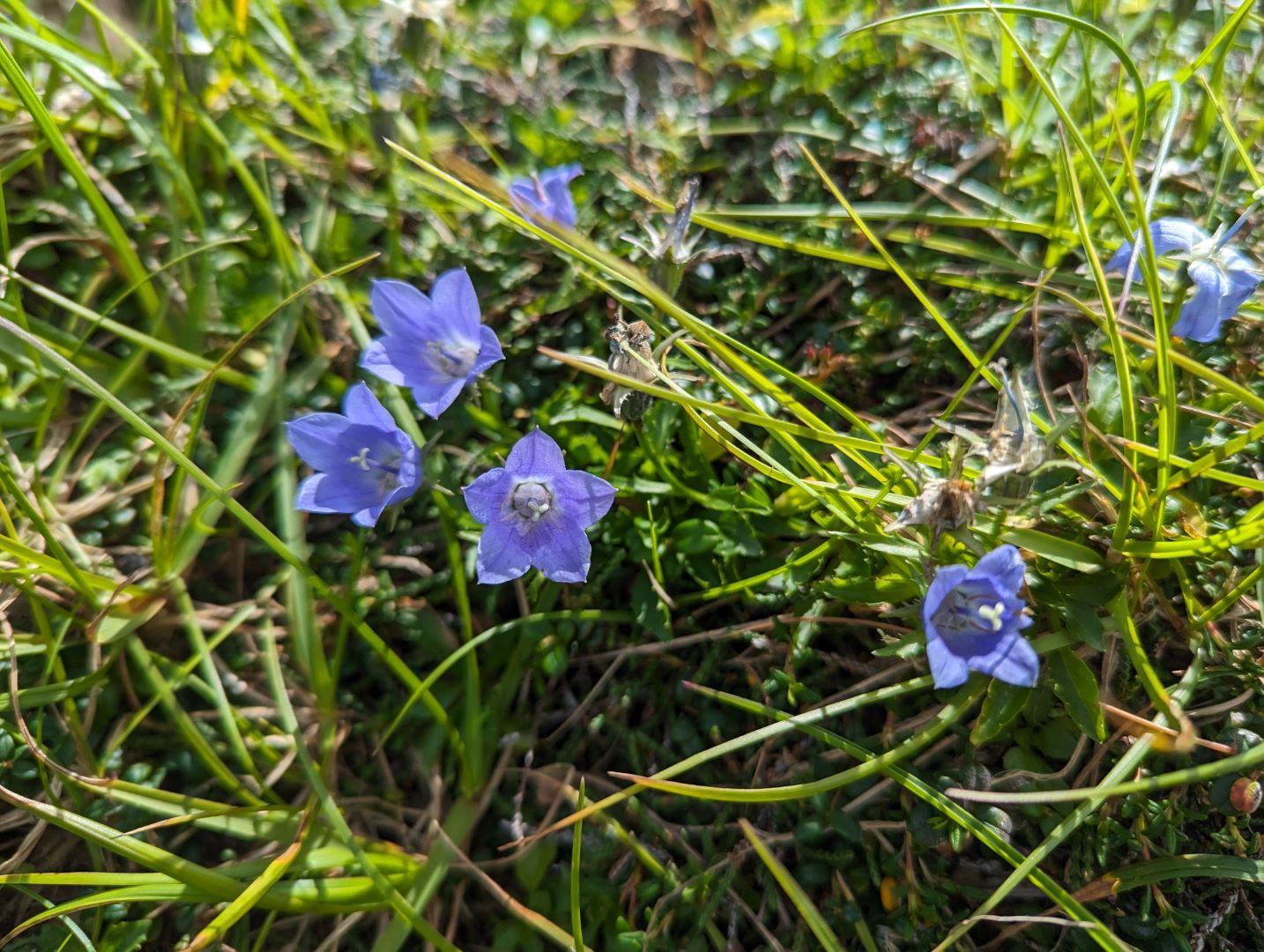
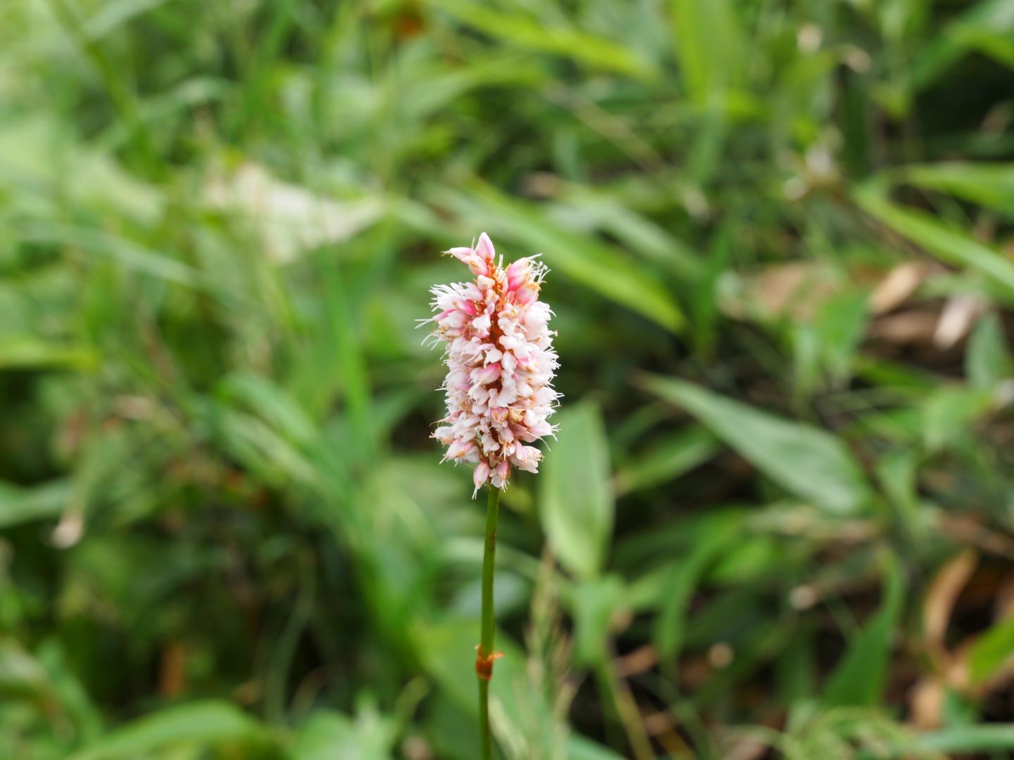
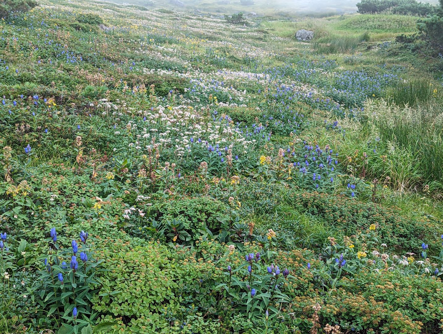
Alpine plants found along the way
If you want to see the flowers in full bloom, you should probably come between June and early July, but we still found plenty to enjoy.
コメント