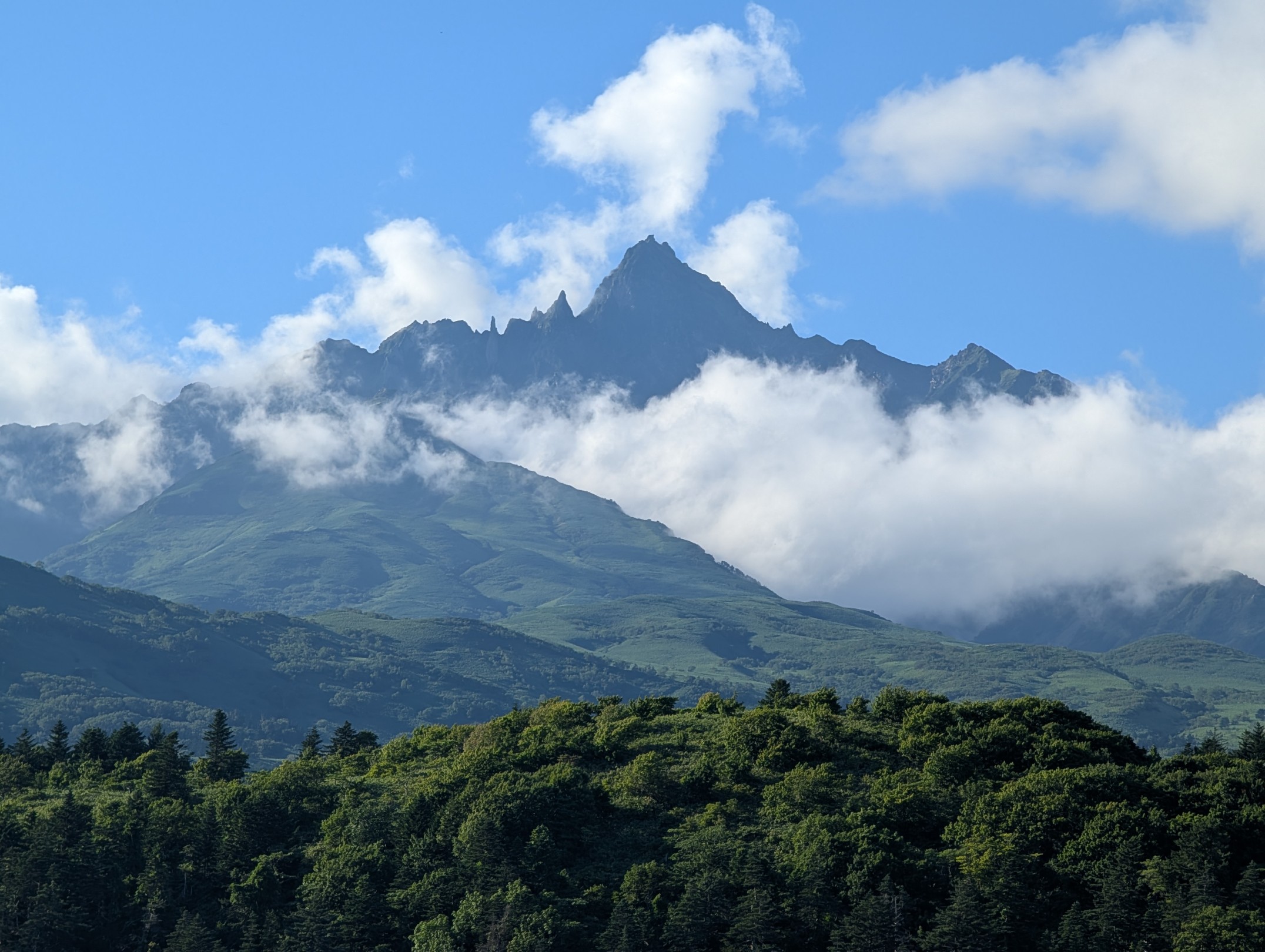
Mount Rishiri-Fuji, praised by Kyuya Fukada in his “One Hundred Mountains of Japan” as “The entire island converges to a single peak, soaring towards the heavens. There is no other magnificent sea-bound mountain like Rishiri-zan.” I came to Rishiri Island wanting to climb this mountain, but from some angles, it even exuded an atmosphere like a demon king’s castle. My family asked, “Are you really going to climb THAT?”, which actually made me feel a little more excited.
- One of the Two Climbing Trails, Kutsugata Route, is Closed
- Rishiri Hokuroku Campsite ~ 6th Station: Through the Forest Belt
- 6th Station ~ 8th Station: The Scenery Opens Up
- 8th Station ~ 9th Station: Climbing While Enjoying Mount Rishiri’s Spectacular Views
- 9th Station ~ Summit: This is Where the Real Challenge Begins
- Summit: Majestic Candle Rock and 360-Degree Views Surrounded by the Sea
- Descending While Spotting Rare Insects
One of the Two Climbing Trails, Kutsugata Route, is Closed
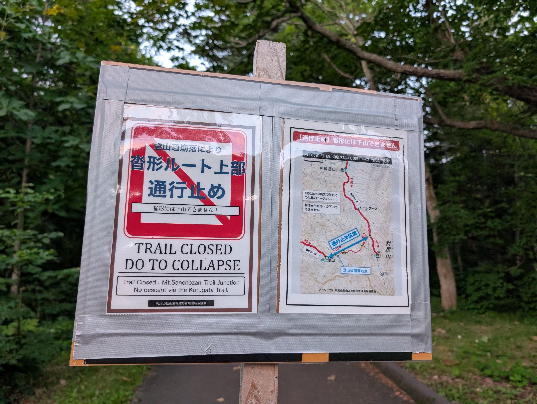
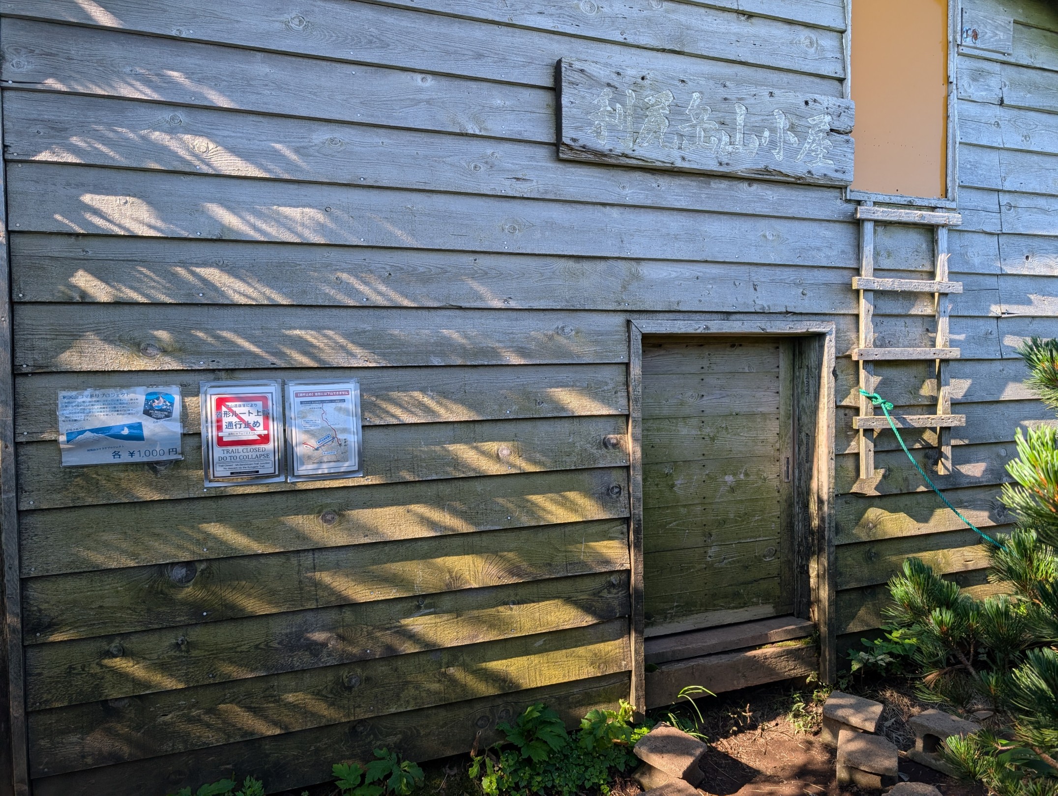
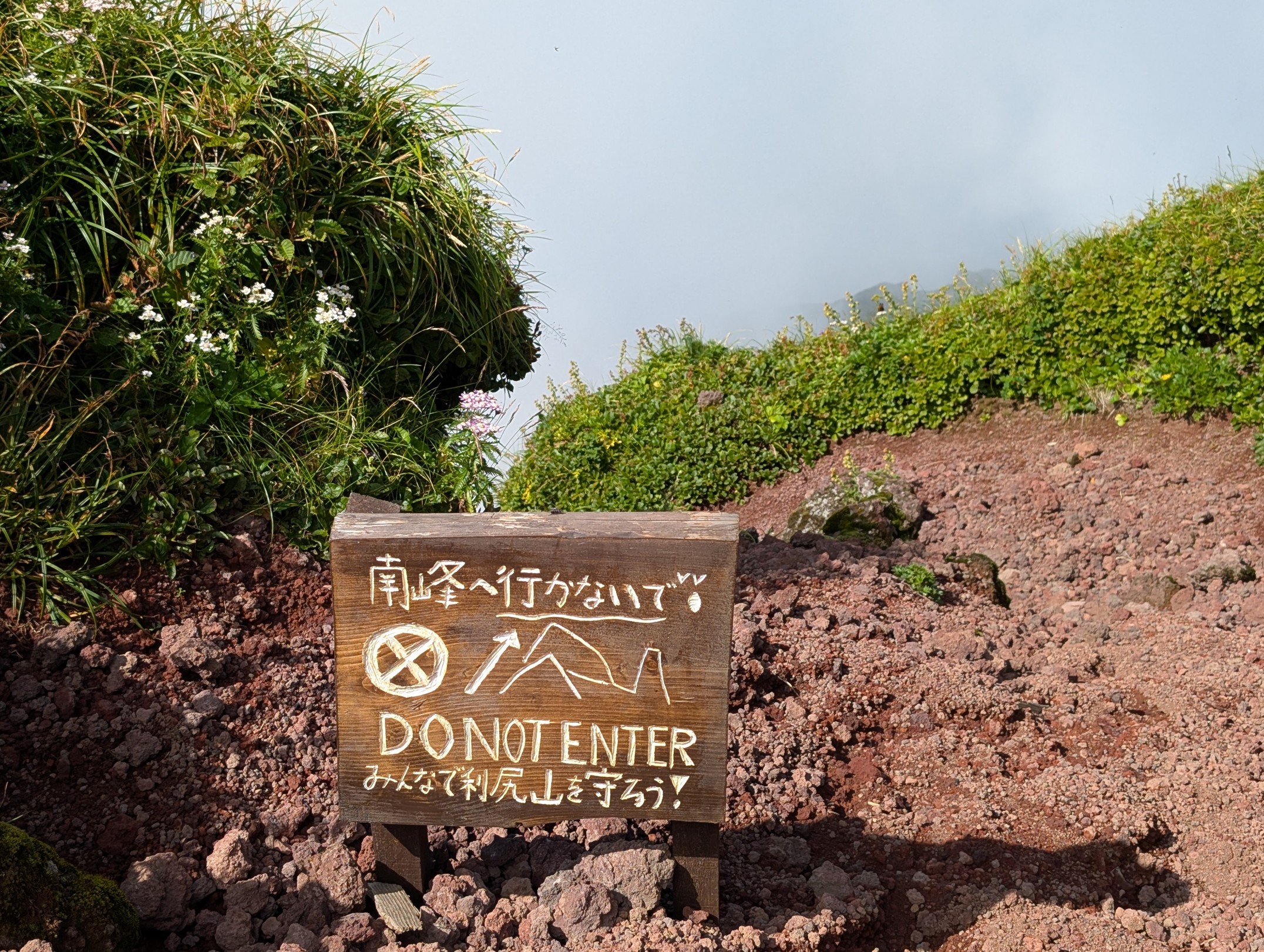
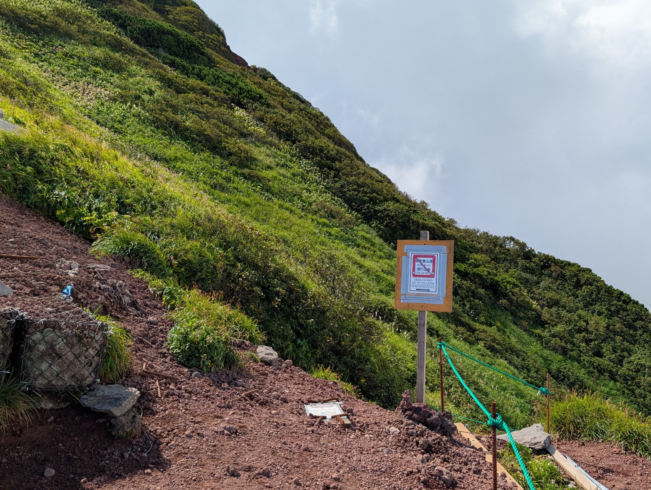
There are two main climbing routes to Mount Rishiri, excluding variant routes. One is the Oshidomari Route, used by most climbers, and the other is the Kutsugata Route. The Kutsugata Route has a higher trailhead elevation and a slightly shorter course time compared to Oshidomari, but it’s considered for advanced climbers due to many dangerous sections where collapses are progressing. Since I was staying at Rishiri Hotel in Kutsugata, I had considered the Kutsugata Route. However, seeing a notice like the one pictured at the hotel, I realized it was closed, so I decided to climb the Oshidomari Route as an out-and-back without hesitation. The course time was estimated to be 8 to 9 hours round trip, so I departed before sunrise.
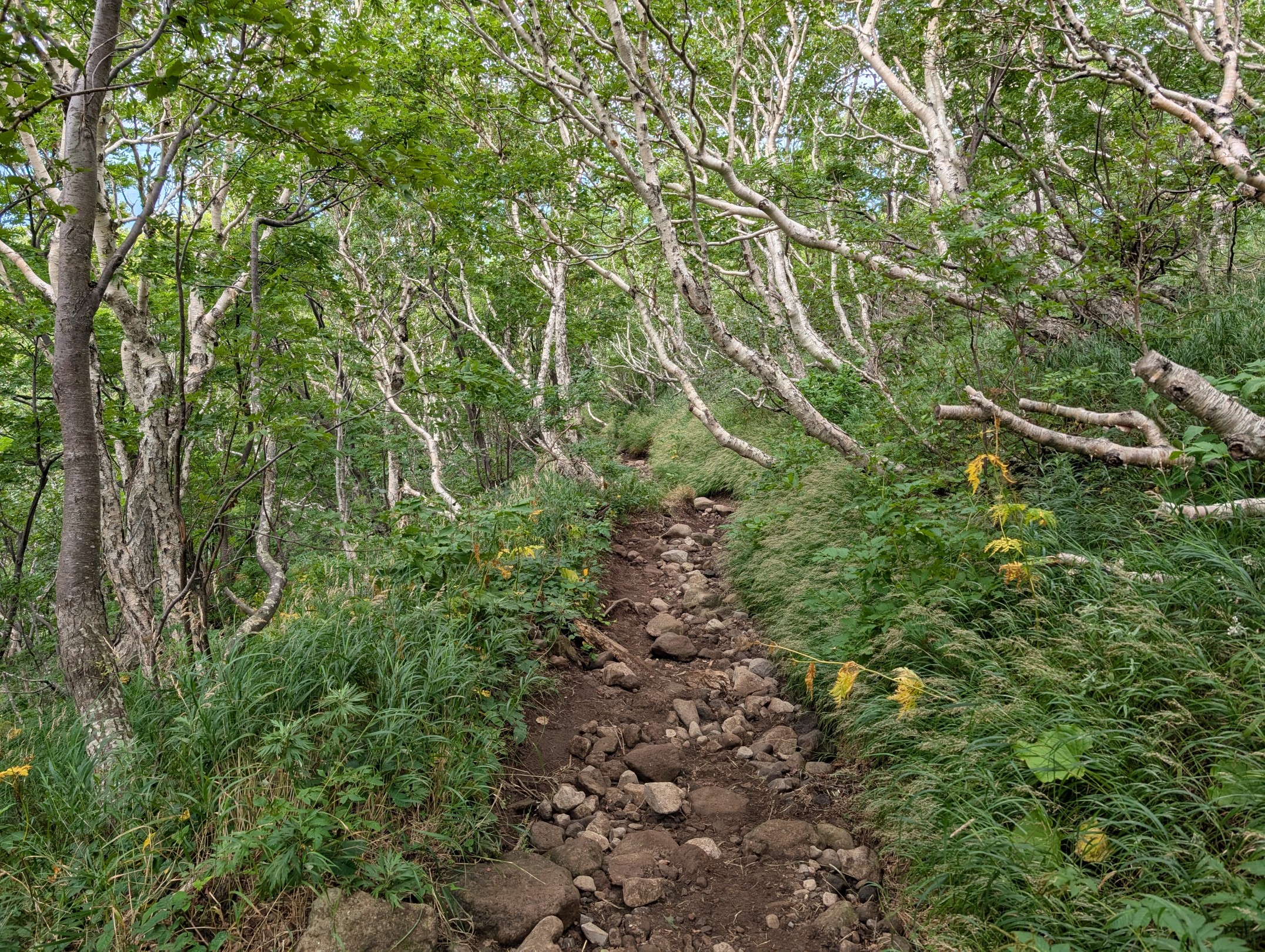
Rishiri Hokuroku Campsite ~ 6th Station: Through the Forest Belt
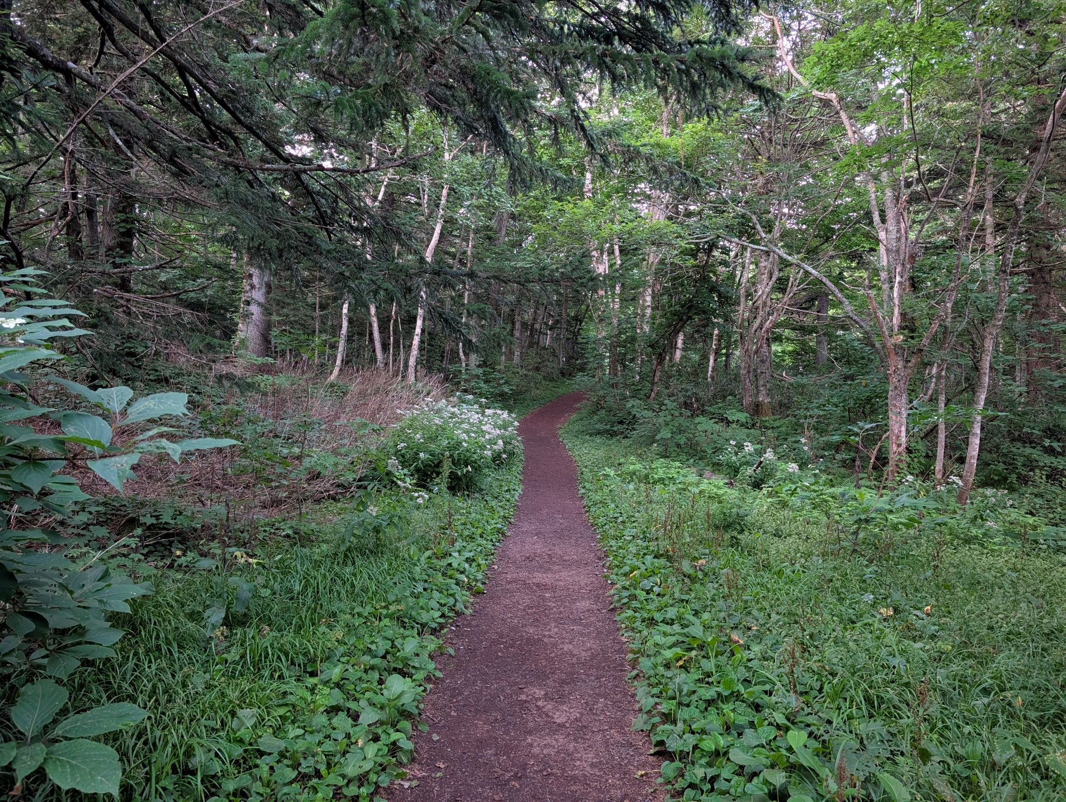
The trailhead for the Oshidomari Route is a campsite, and there were quite a lot of tents pitched. It seemed many people stayed here before heading out to climb. So, we started by walking along a well-maintained path, almost like a promenade.
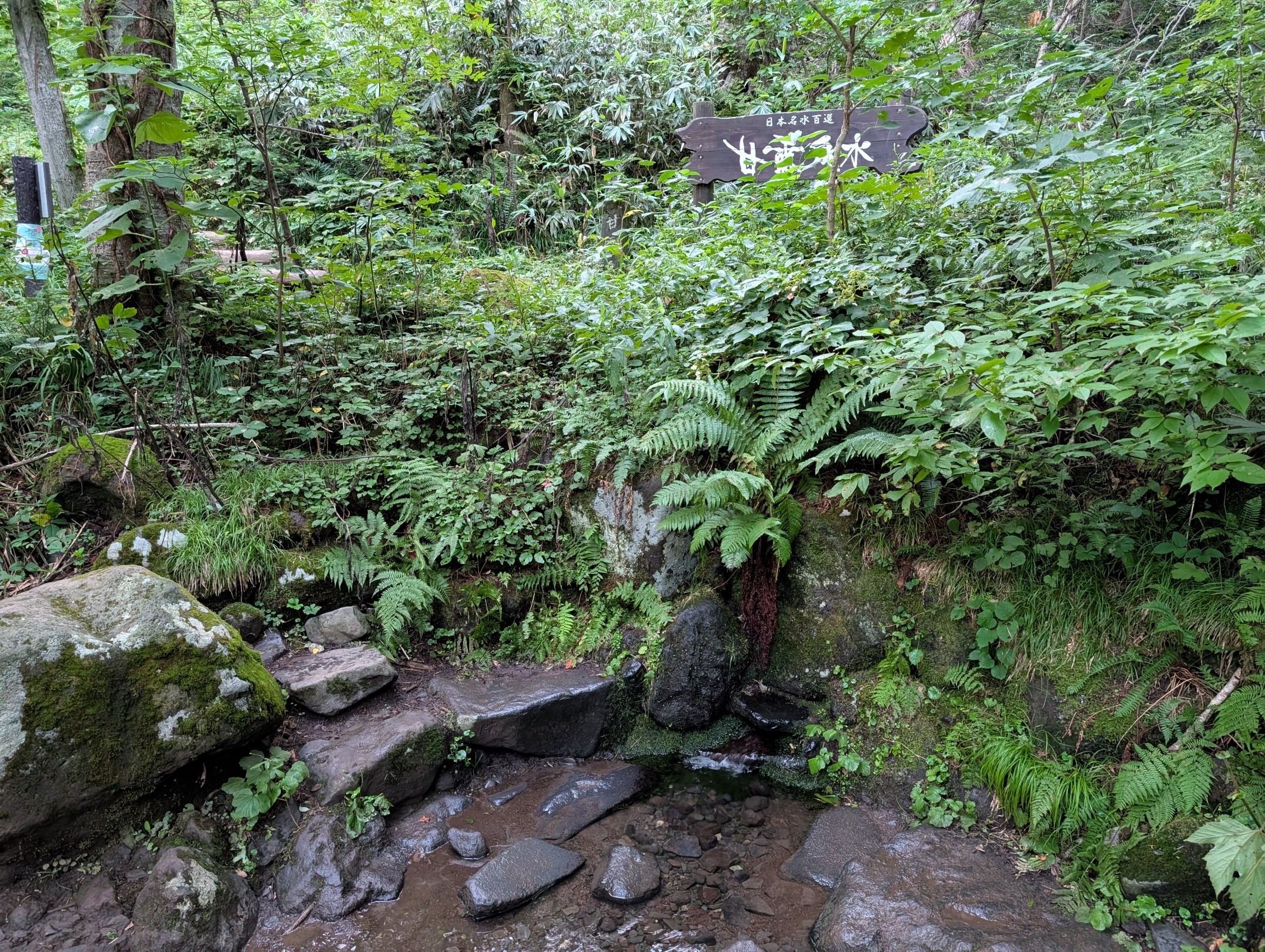
Quite soon after the campsite, you’ll find Kanro Sensui (Sweet Dew Spring Water), the only water source on the Oshidomari Route. I had plenty of water with me, so I didn’t need to rely on it, but when I lightly touched it, it was refreshingly cold, and a small sip revealed delicious water. While Hokkaido is known for concerns about E. multilocularis, this particular water source has been selected as one of Japan’s best waters and is considered safe.
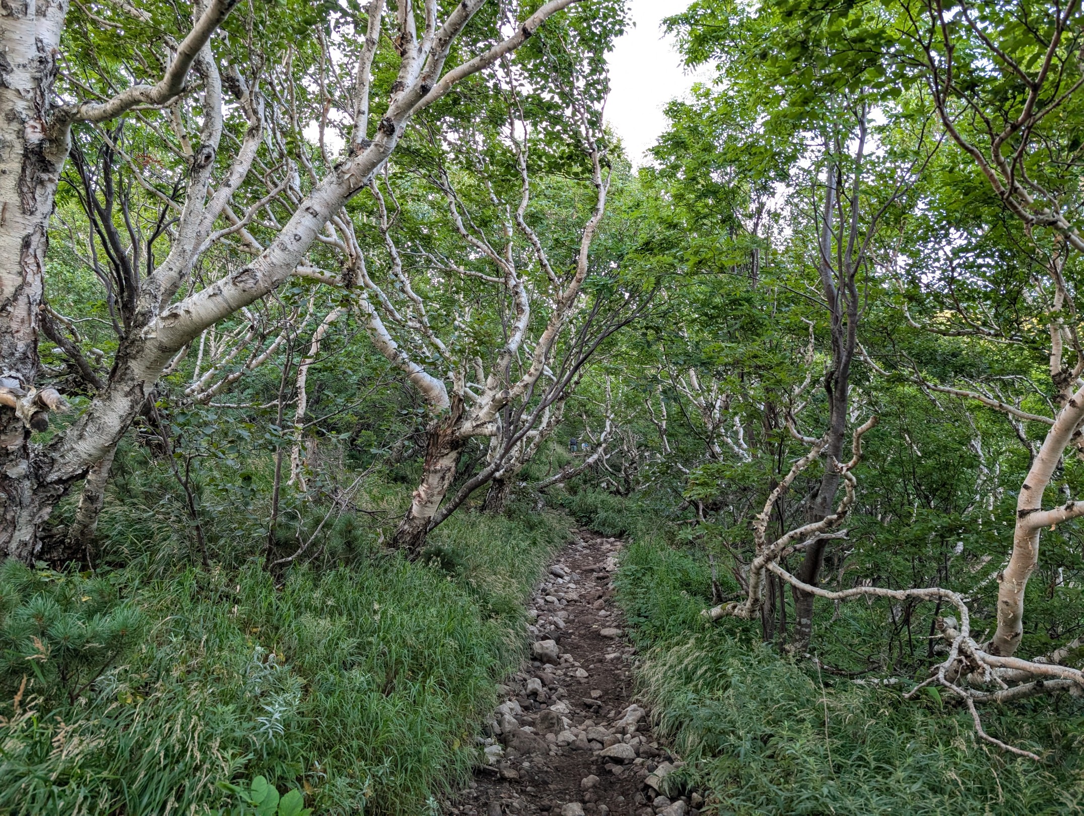

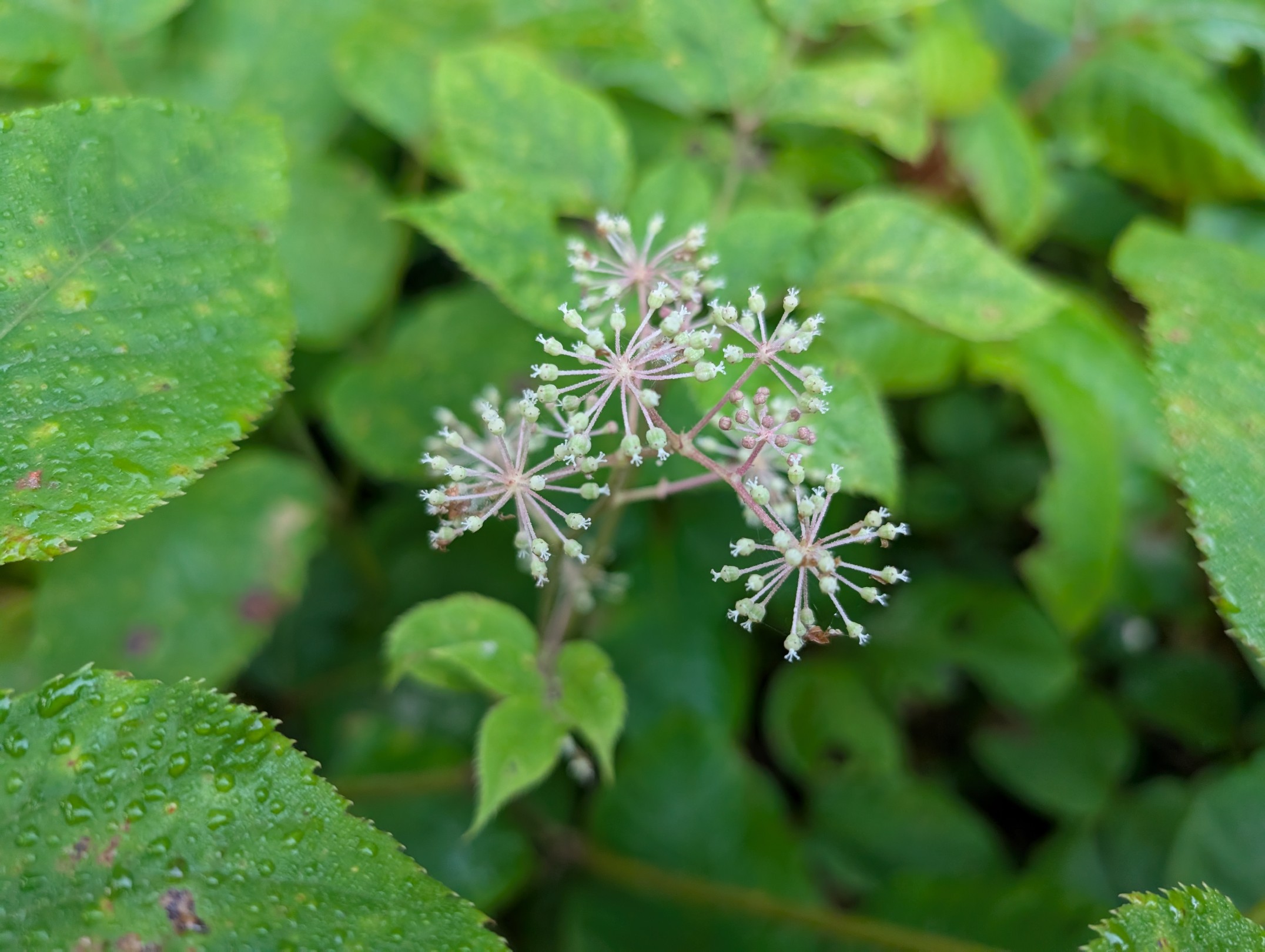
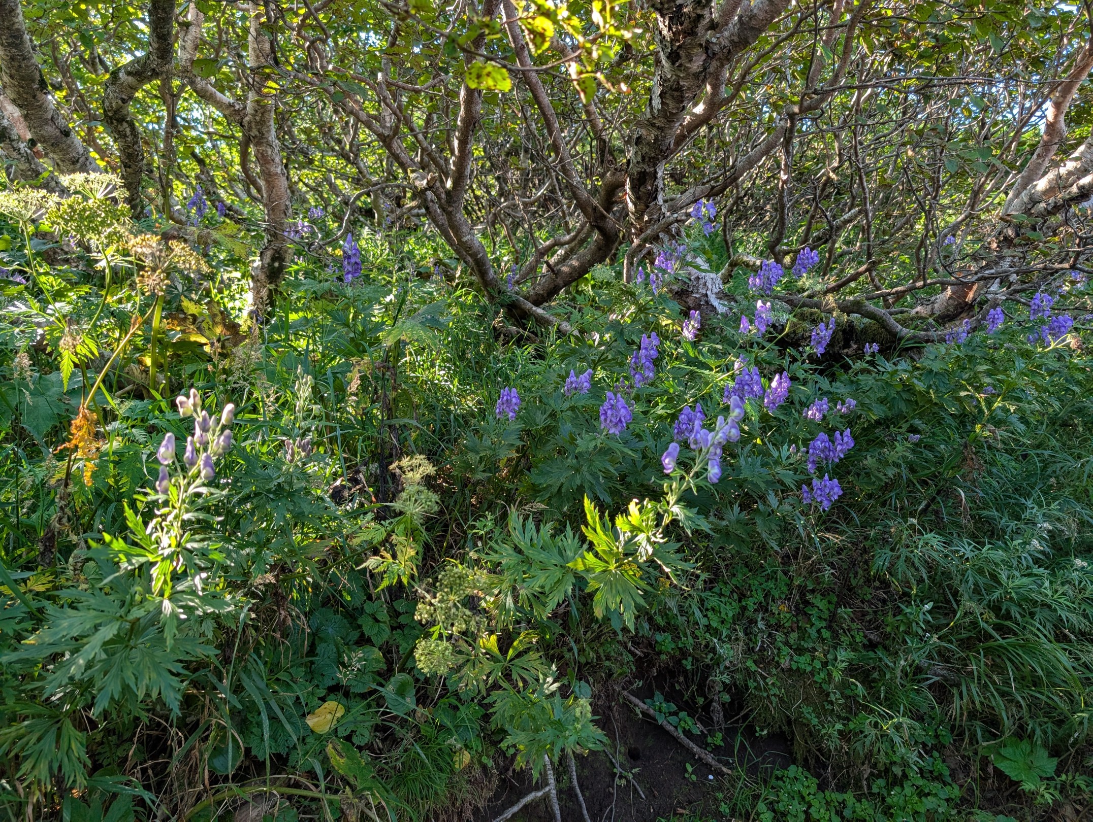
From the trailhead, which is essentially the 3rd station, up to around the 5th or 6th station, we hiked through a forest belt. It was mid-August, but there were eye-catching wildflowers here and there, making for a pretty smooth and easy ascent.
6th Station ~ 8th Station: The Scenery Opens Up
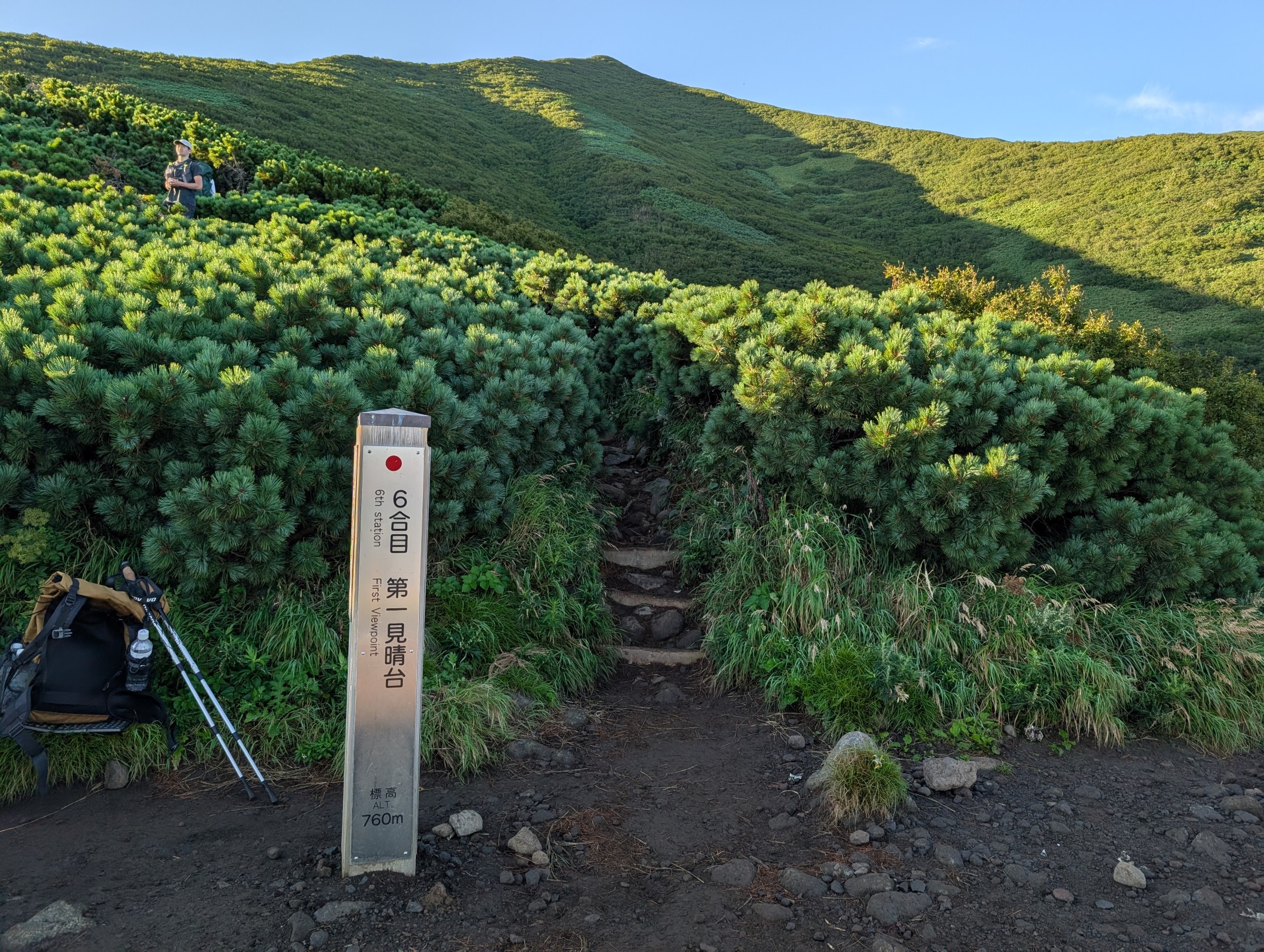
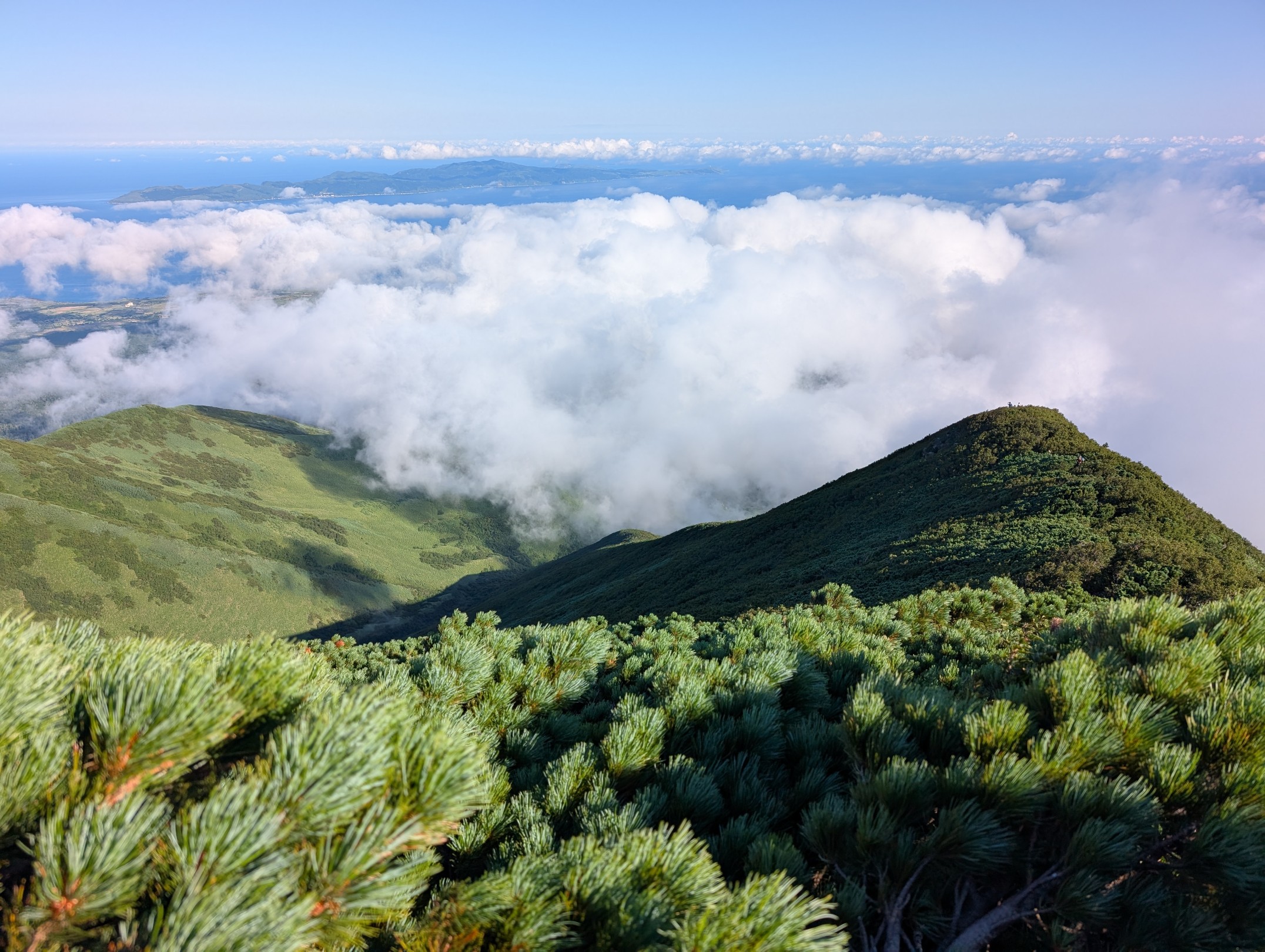
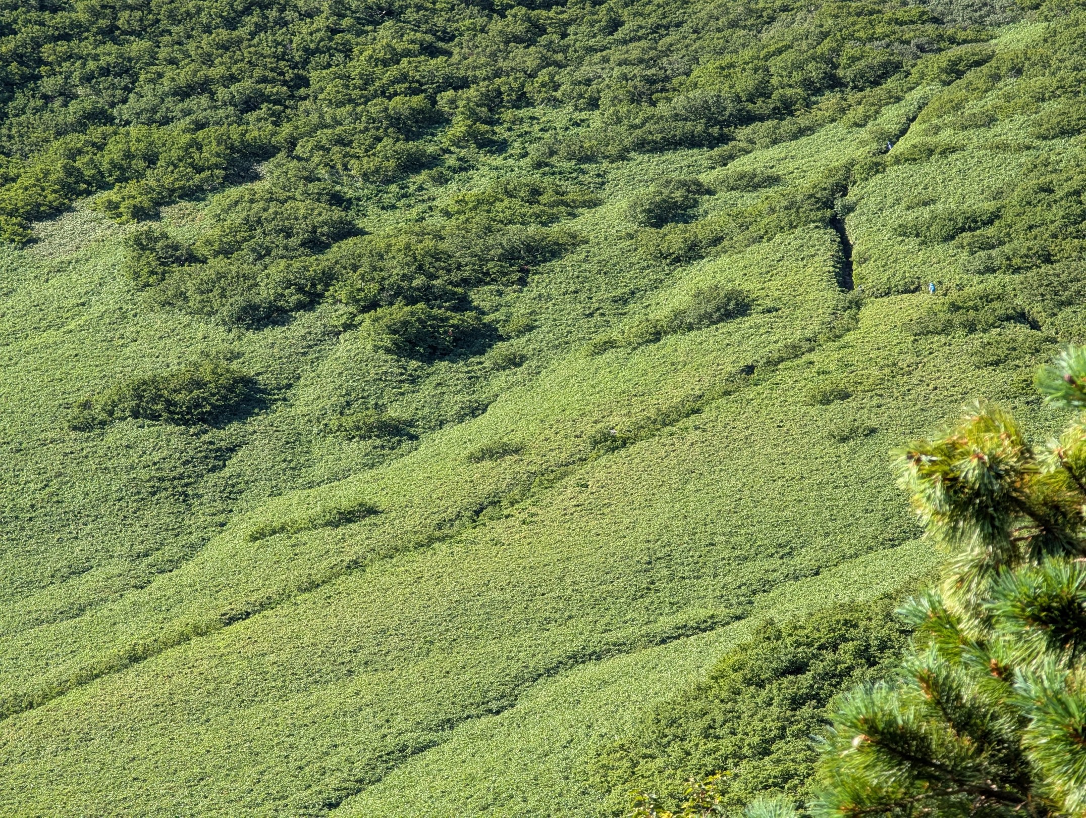
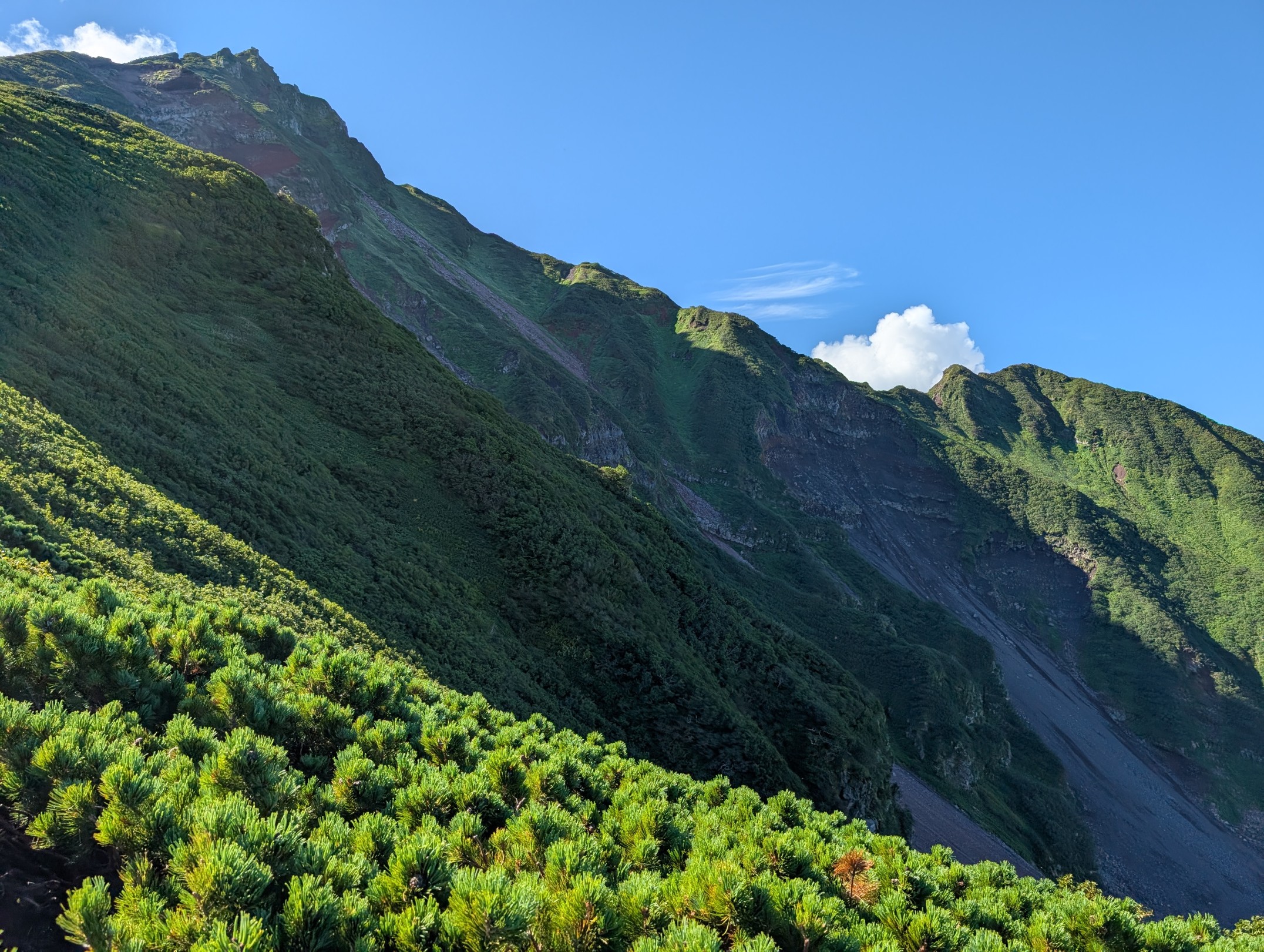
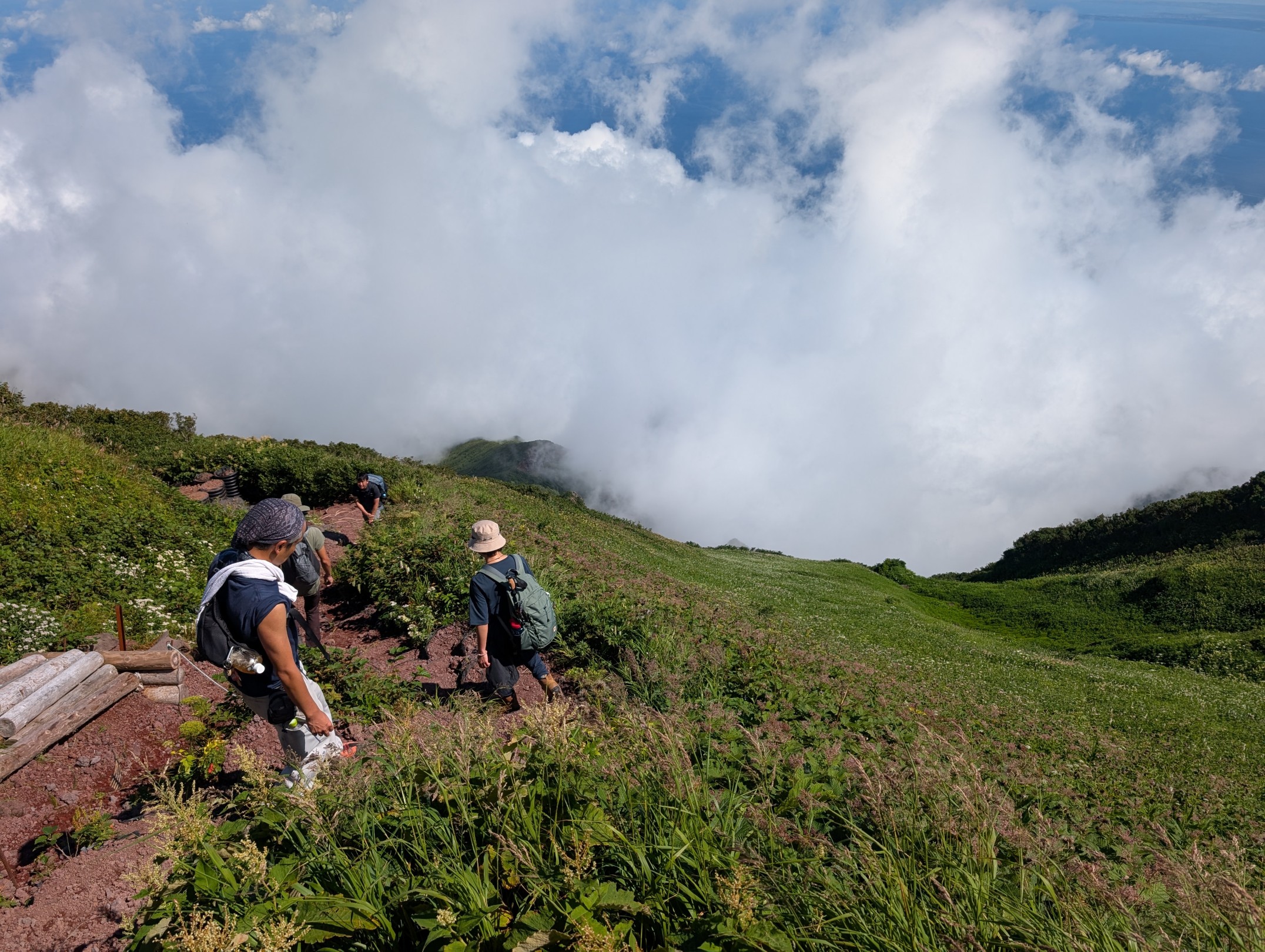
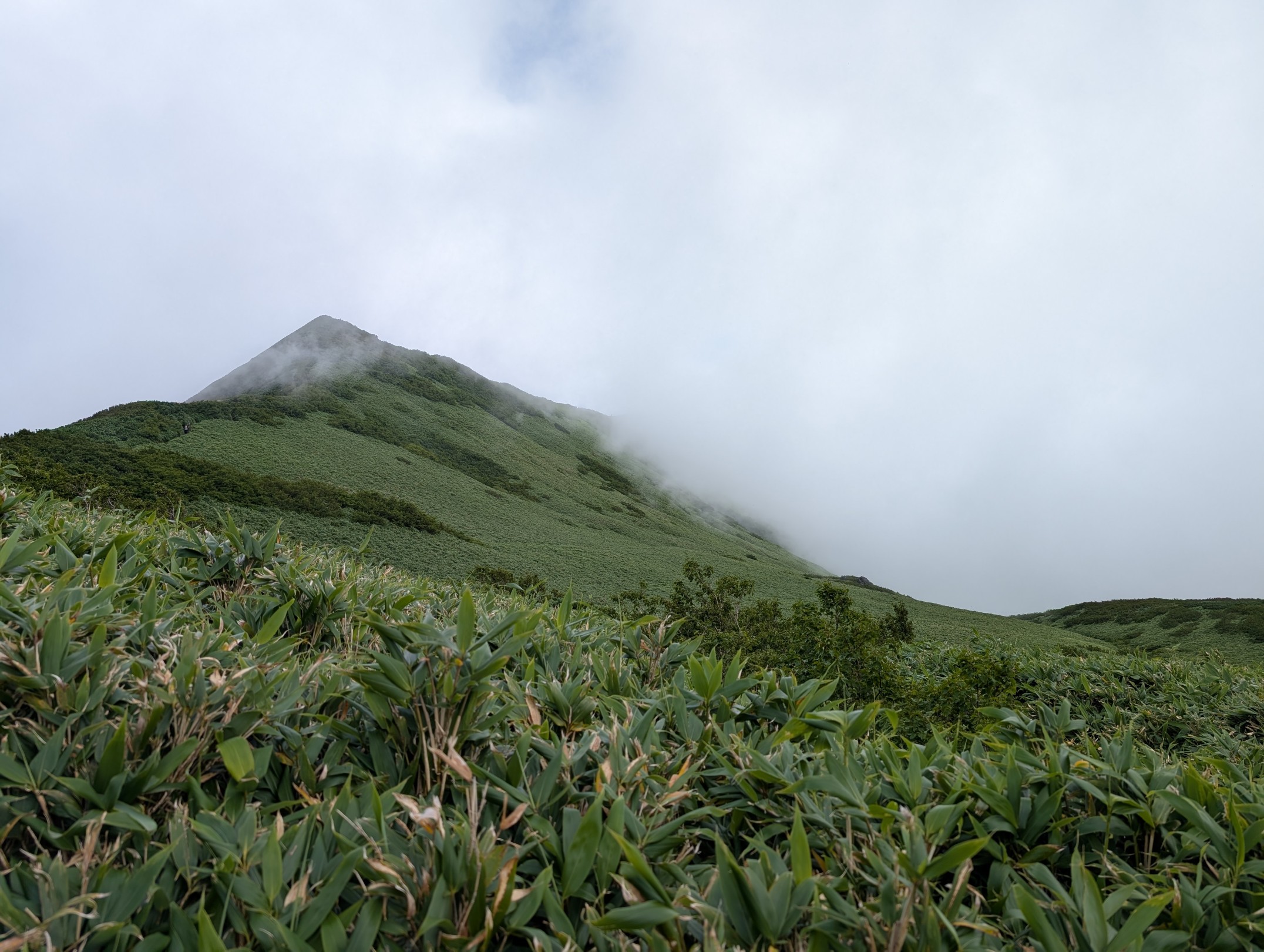
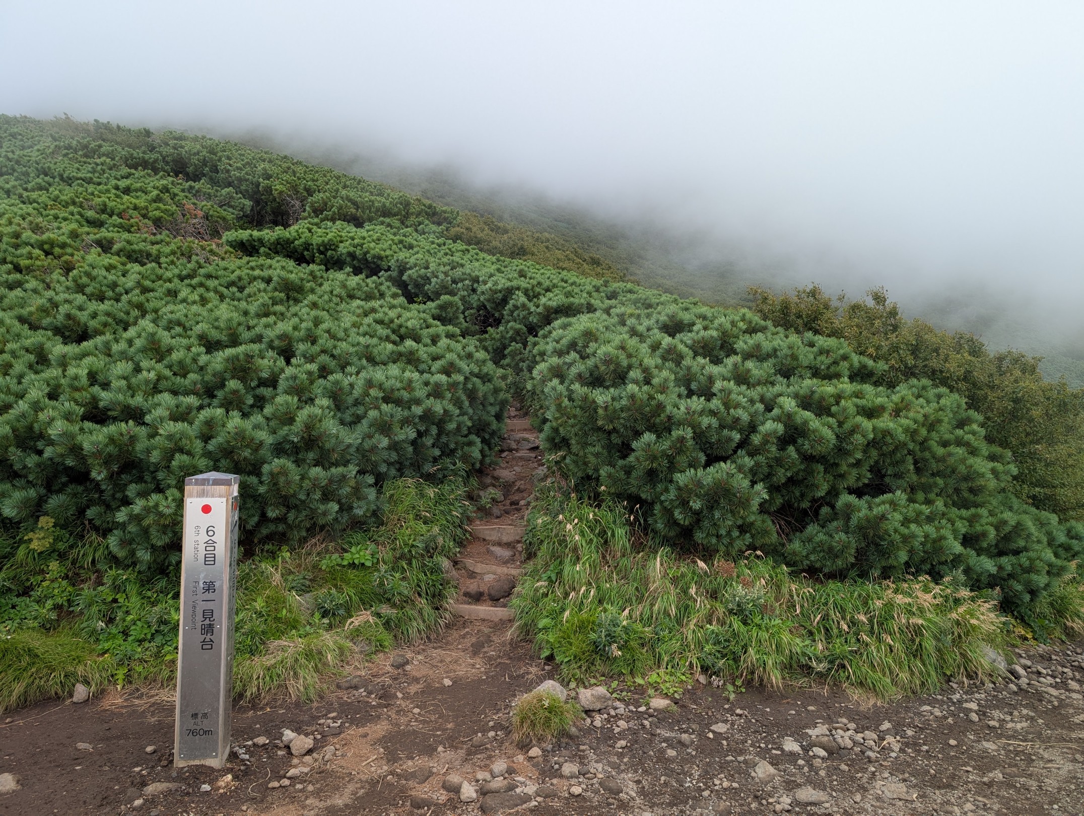
Once you reach the 6th station, the scenery really opens up, becoming low-growing shrubs like Siberian dwarf pines. Being a mountain floating in the sea, the sense of openness was incredible. On this beautiful day, we could even see Rebun Island, and the stunning mountain profile covered in bright green definitely motivated us to keep climbing.
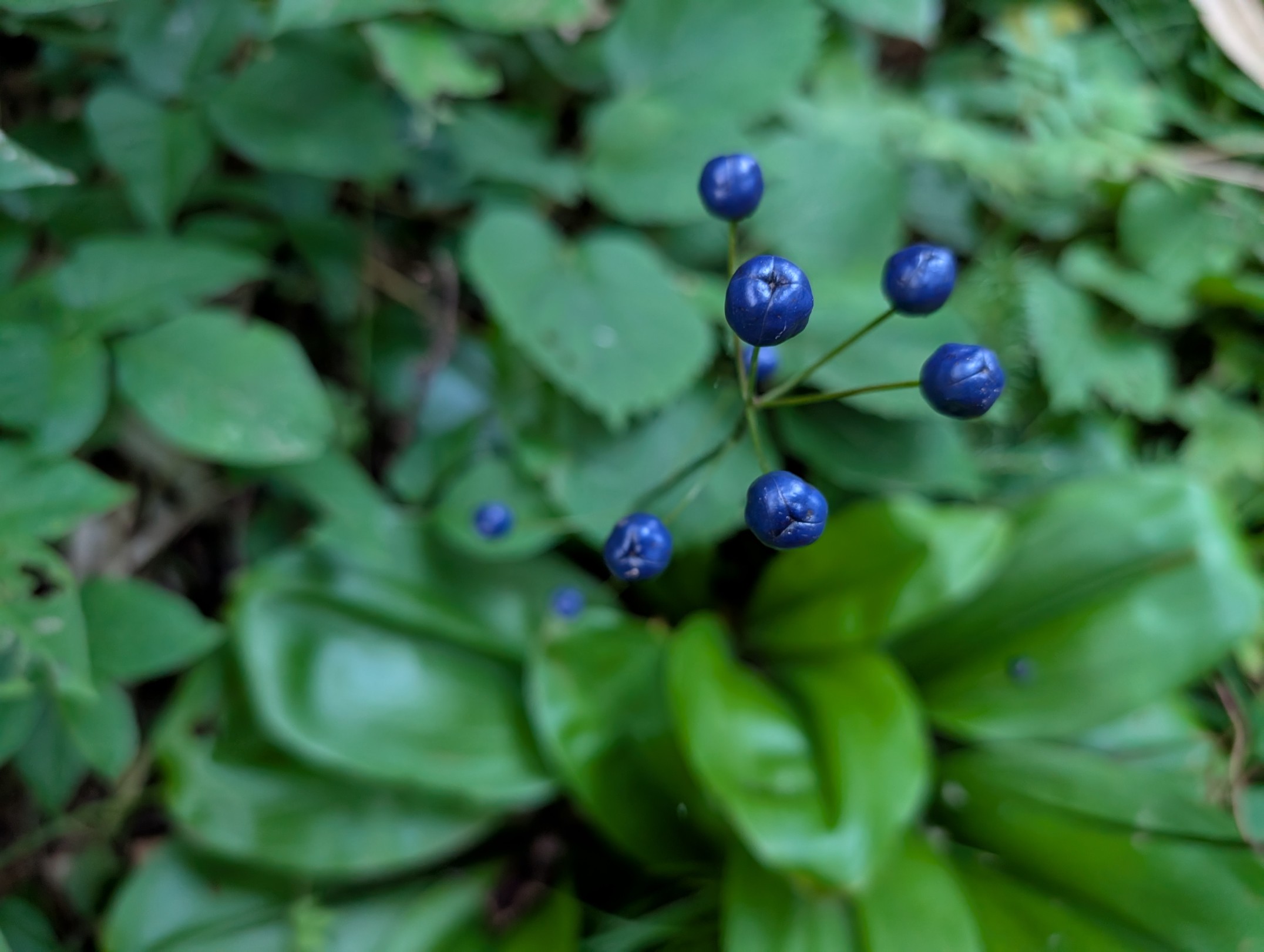
What’s more, in addition to the spectacular views, there were adorable flowers blooming everywhere. This led to a lot of photo stops, and unlike hiking through the forest, we didn’t make much progress, haha!
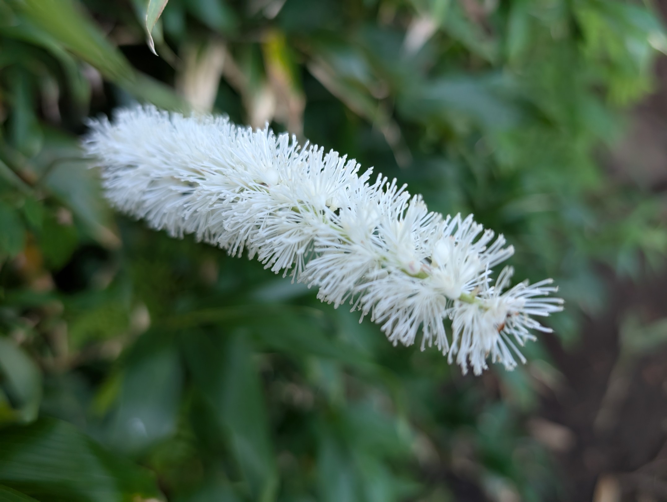
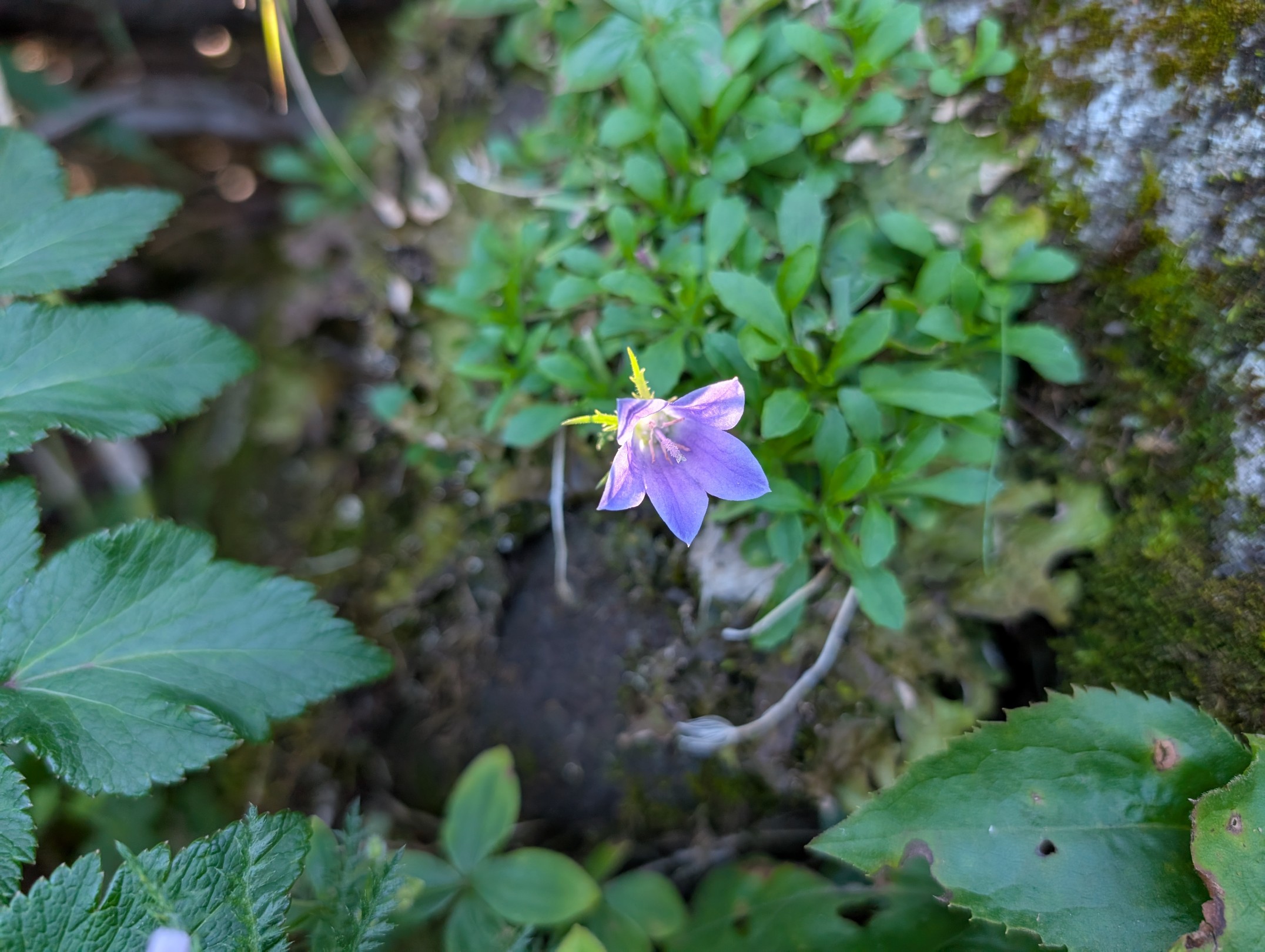
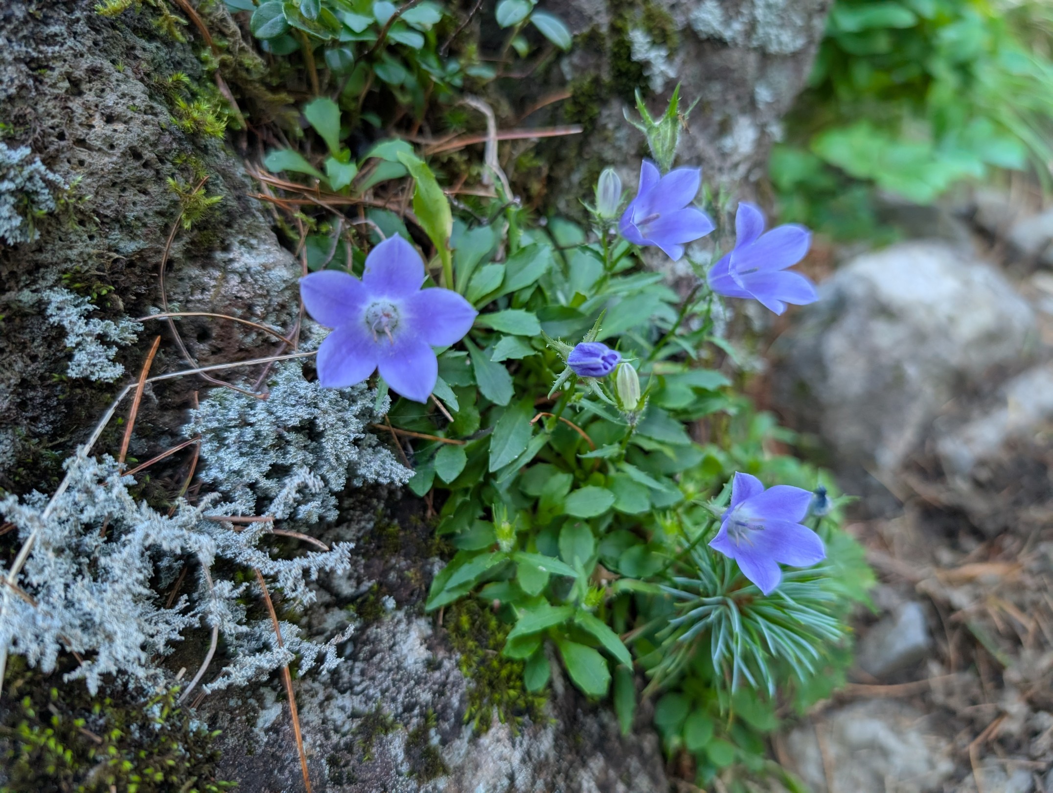
I feel like flowers seen in the mountains during summer are often white, yellow, or blue (purple). Personally, I love blue (purple) flowers, and whenever I spot one, I can’t help but stare. These days, phone camera performance has improved, and I feel like they can reproduce such beautiful blue colors, whereas before, they often came out too reddish and I struggled to get good shots.
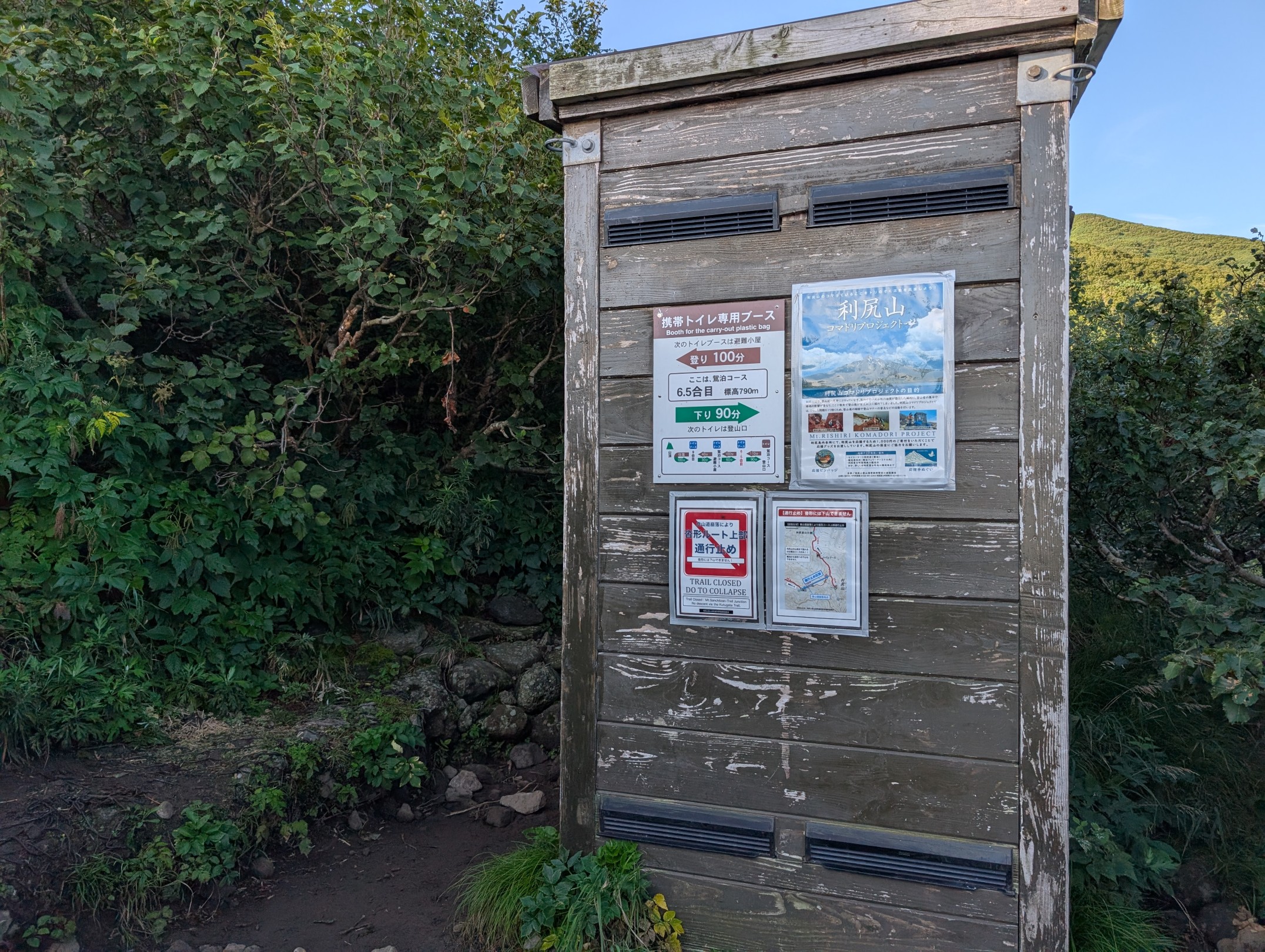
This route takes about 8 to 9 hours round trip, and since there are no mountain huts for resting, portable toilet booths have been installed. I always carry a portable toilet when hiking, but despite drinking over 3 liters of water, I sweat so much that I’ve never actually had to use one of these booths before.
8th Station ~ 9th Station: Climbing While Enjoying Mount Rishiri’s Spectacular Views
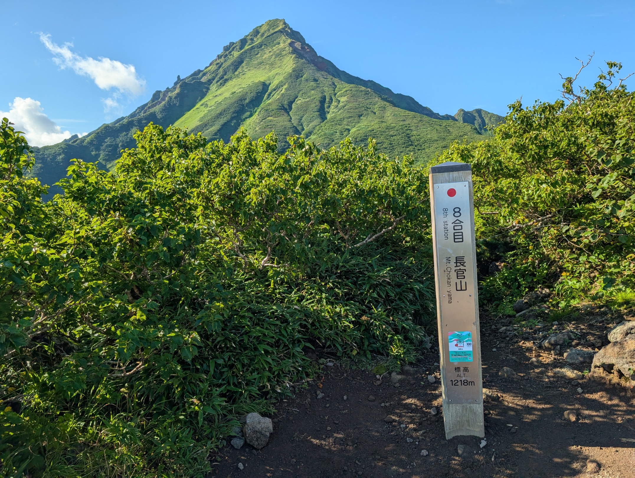
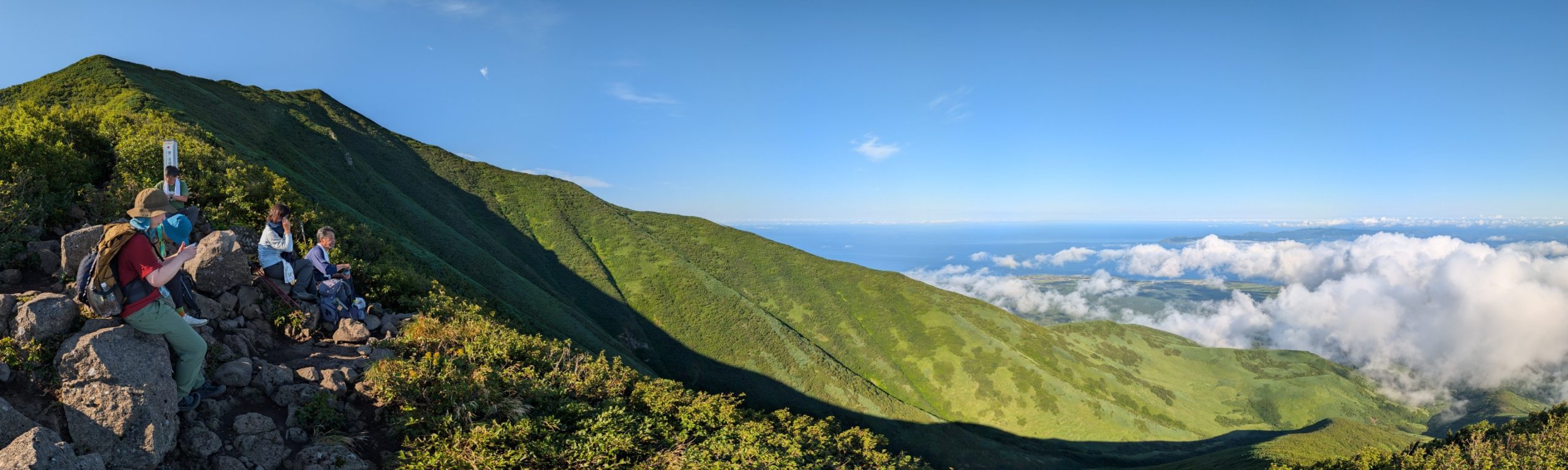
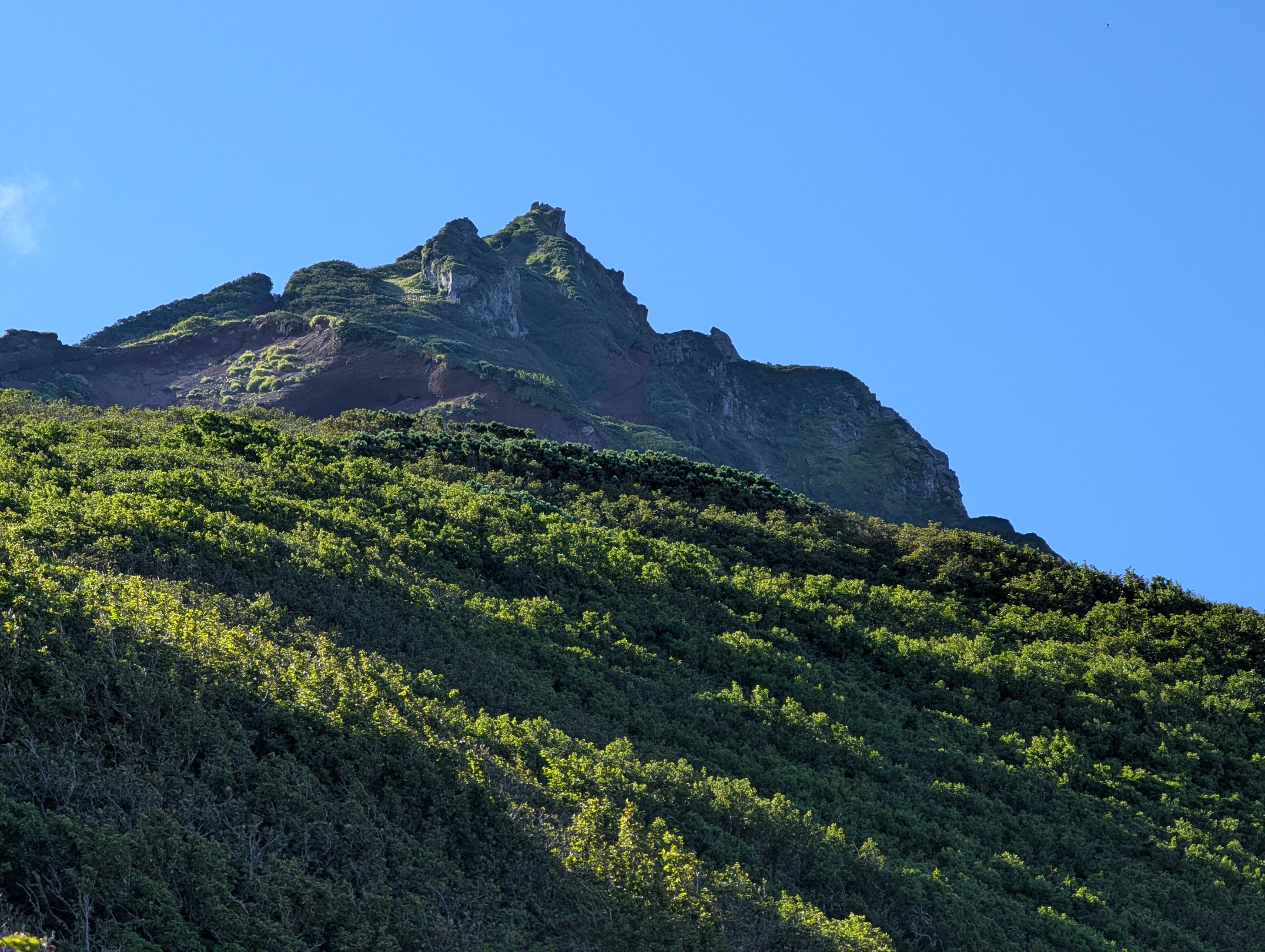
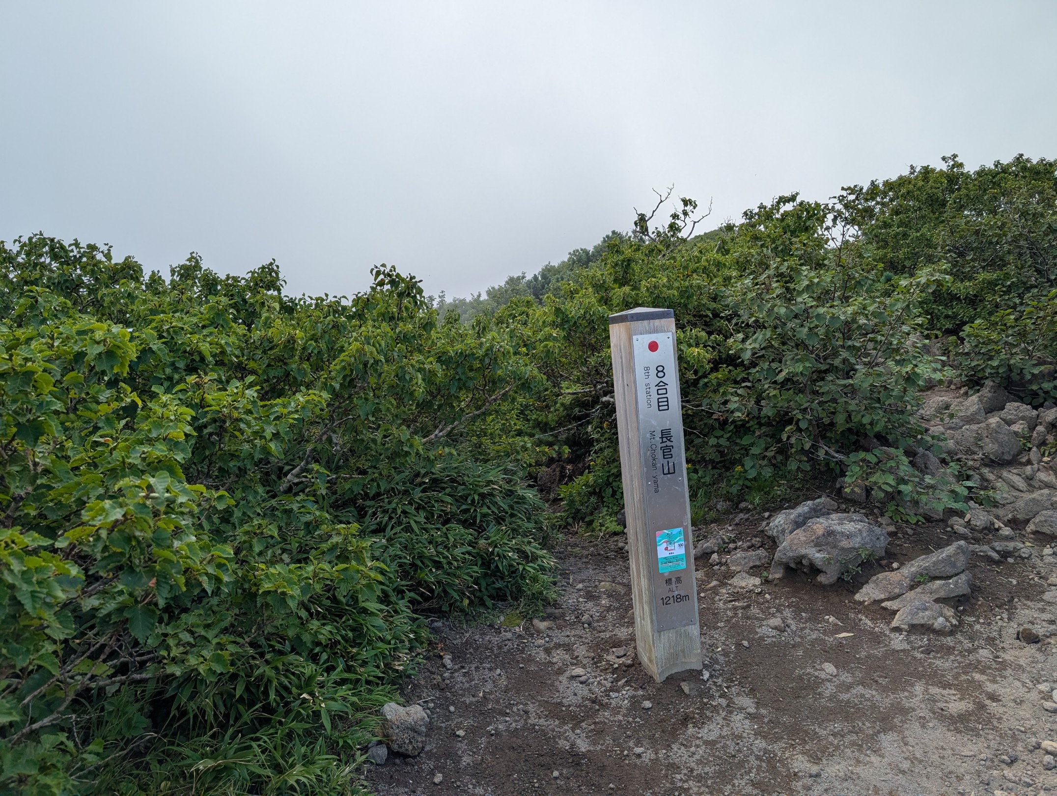
The 8th station is the summit of Mount Chokan, and it’s only here that you finally get a clear view of Mount Rishiri’s peak. From this point, Mount Rishiri has such a beautifully balanced shape that the name Rishiri-Fuji (Mount Rishiri-Fuji) truly fits. According to a mountain guide at my hotel, this spot is essentially the halfway point, and guides have decided to turn back if it takes more than 4 hours to reach here.
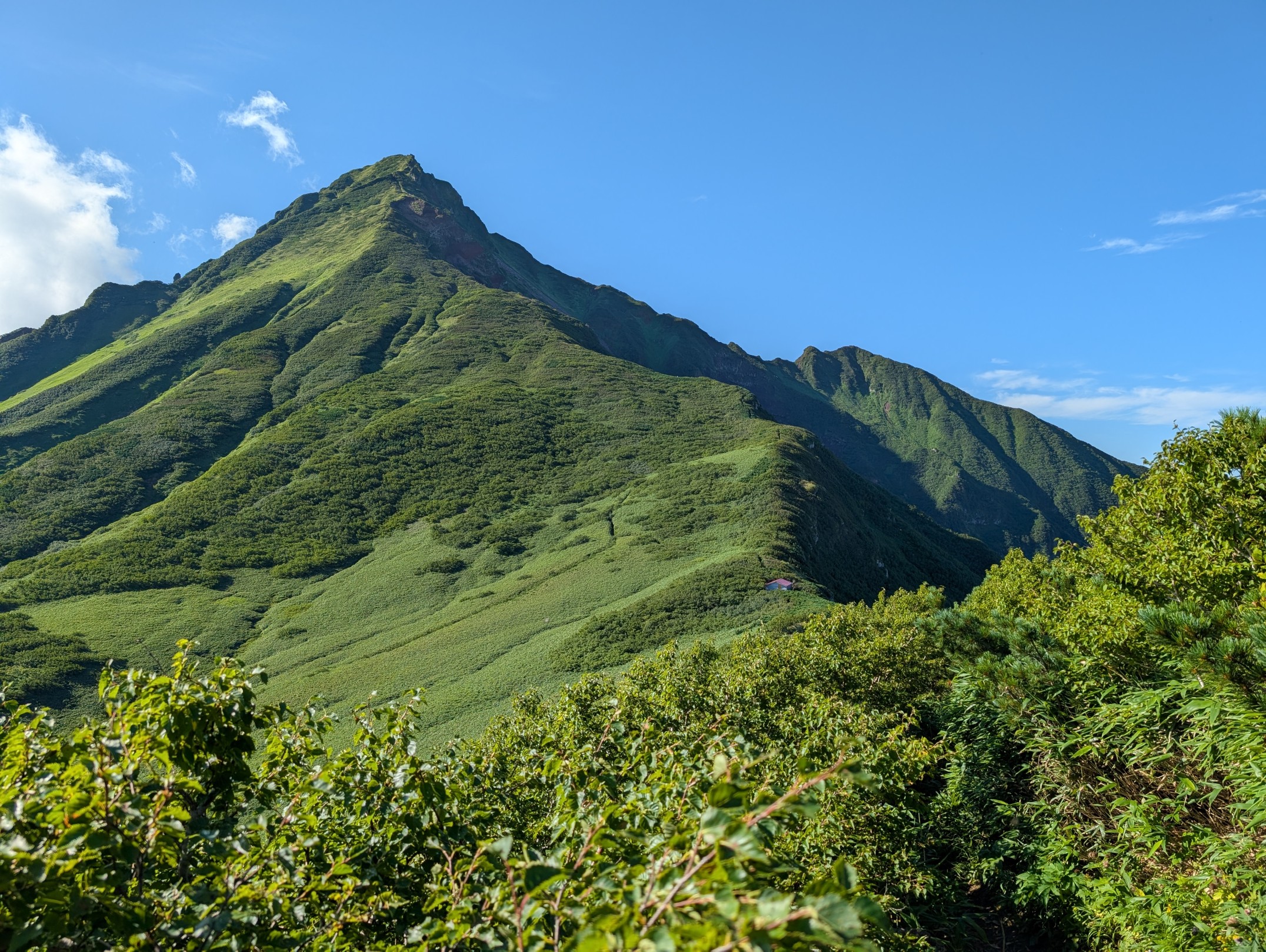
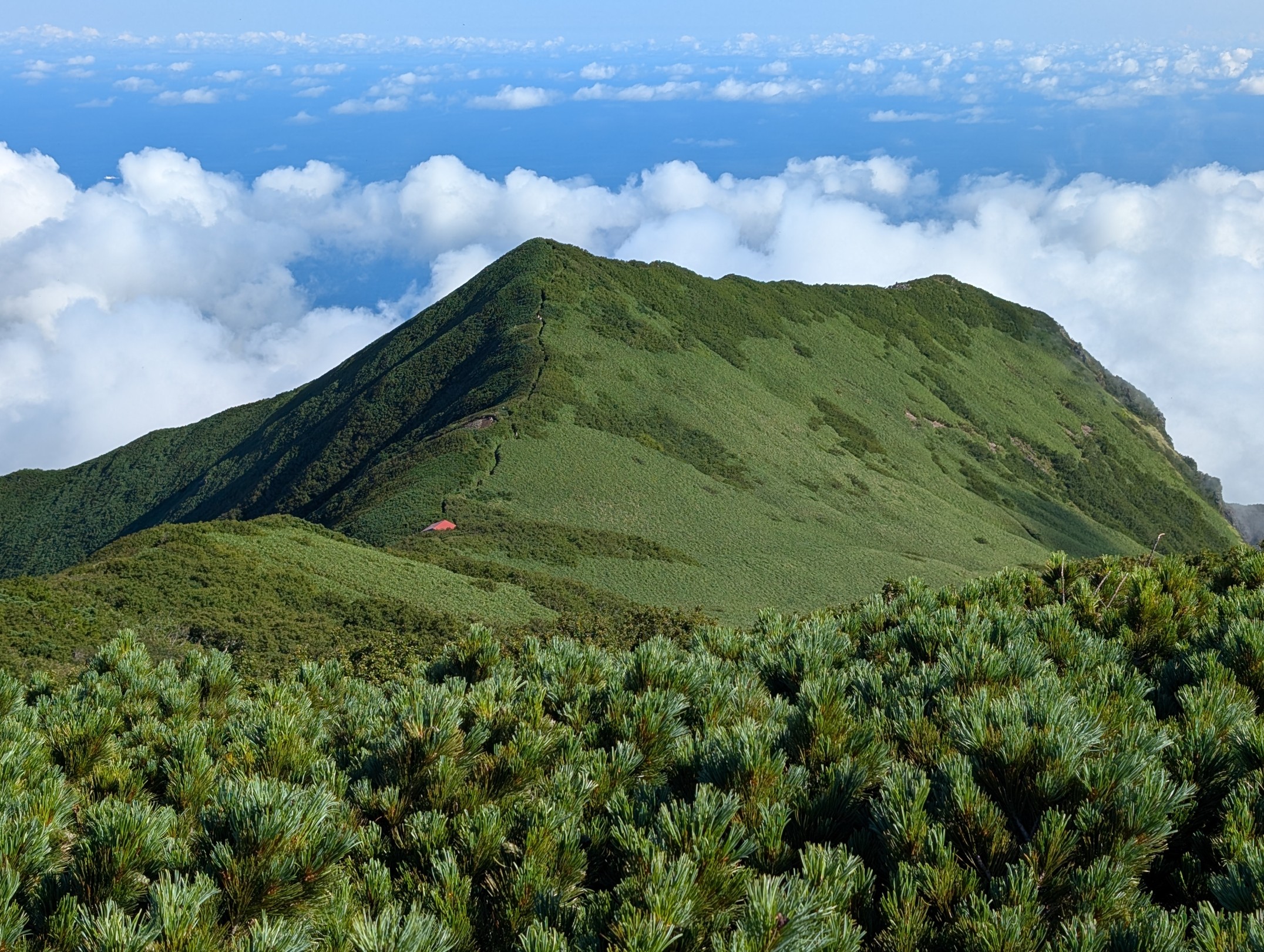
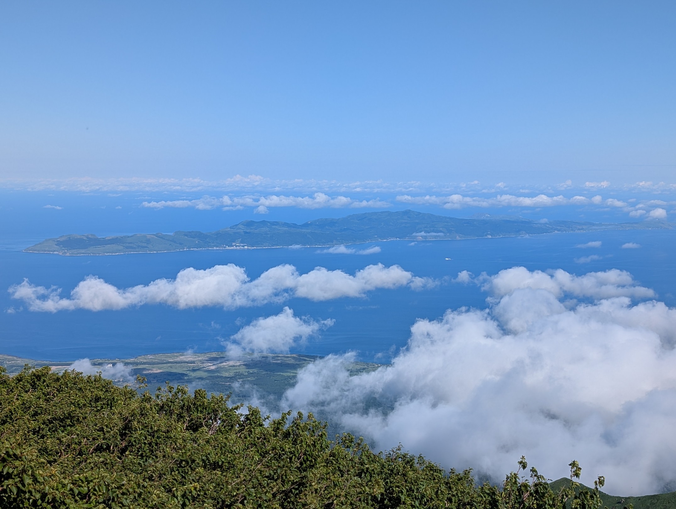
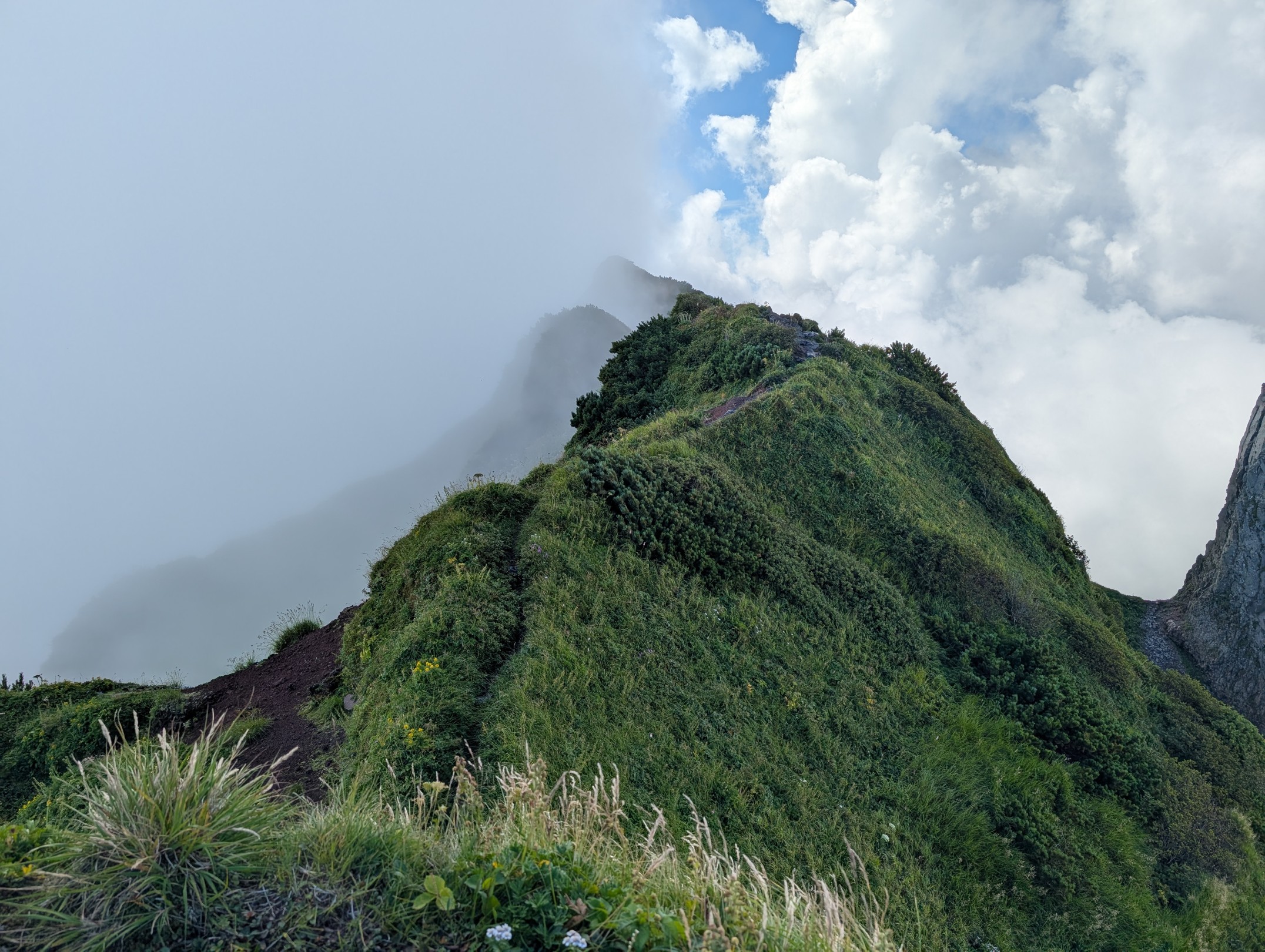
The ascent towards the 9th station becomes an incredibly pleasant ridge walk, with beautiful Mount Rishiri in front of you and the sea and Rebun Island to your right. I’m really glad I checked the weather carefully and chose this day.
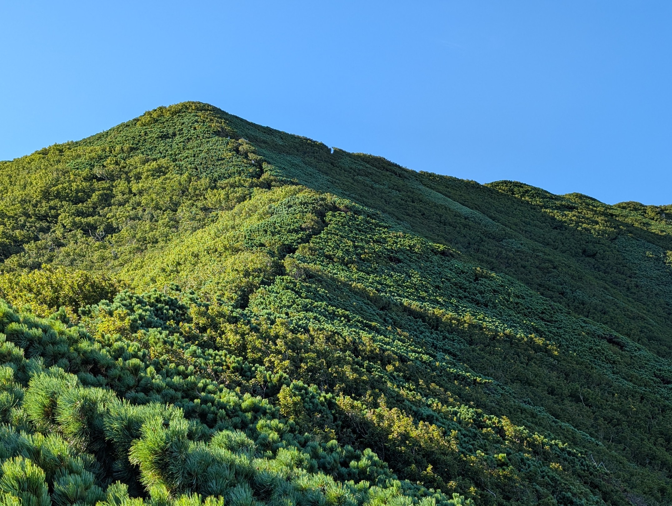
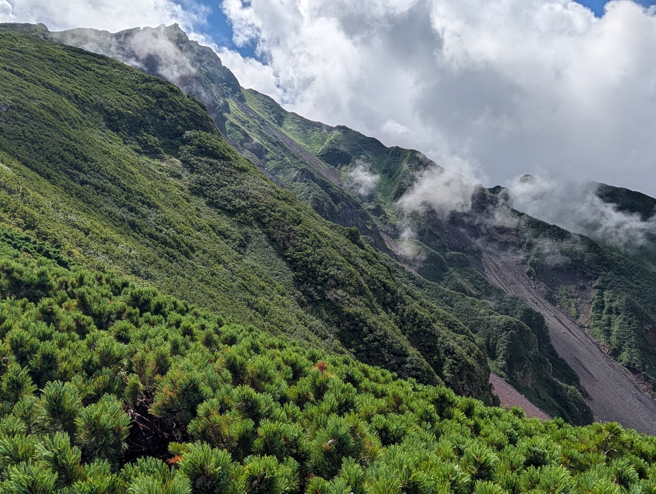
As we approached the 9th station, collapsed sections became visible, revealing the rugged side of Mount Rishiri that we had seen from the base. It’s said that beyond the 9th station, there are many collapsed areas and you need to be careful about falling, and looking at it from here, I can totally see why.
9th Station ~ Summit: This is Where the Real Challenge Begins

We arrived at the 9th station after a pleasant ridge walk, having hiked for a considerable time, thinking we were almost at the summit! But then I looked next to the sign, and it read ‘This is where the real challenge begins.’… Everyone around me saw it too, and we all exchanged wry smiles, thinking, ‘Oh, really?’ Looking back after actually climbing it, that steep, scree-covered ascent from there truly was the real challenge.
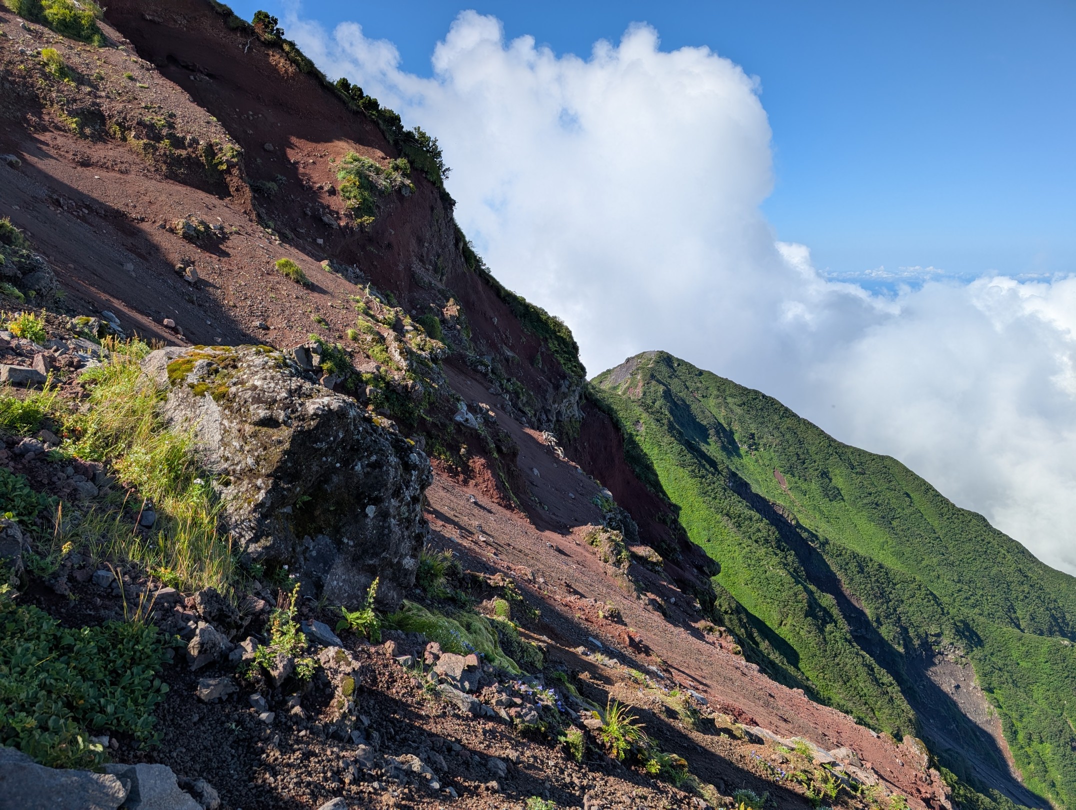
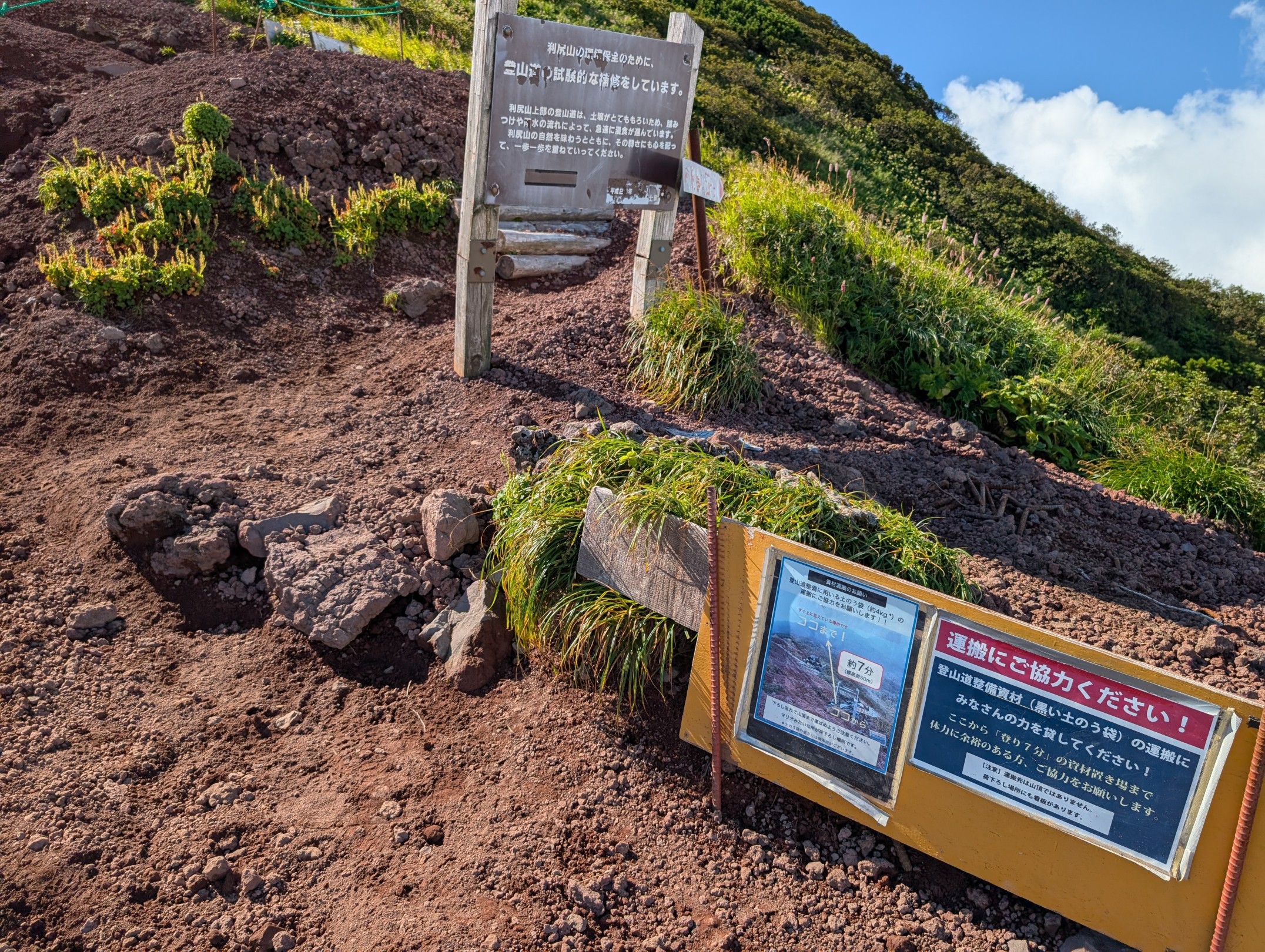
Perhaps due to the harsh natural environment, the climbing trail near the summit has significantly deteriorated due to collapses, and in some sections, it had to be artificially supported like this. Considering that hiking itself can contribute to these collapses, such sights are somewhat heartbreaking and make you ponder.


After carefully climbing the treacherous path, the summit finally came into view. The dramatic sight of clouds billowing up and Candle Rock beyond the peak was fantastic. It reminded me of how the mountain had that “Demon King’s Castle” vibe when viewed from the island’s southern side.
Summit: Majestic Candle Rock and 360-Degree Views Surrounded by the Sea
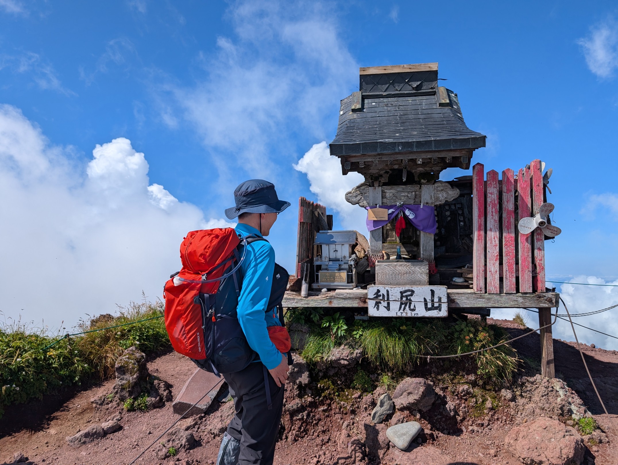
One of the reasons I’ve come to love climbing so much is being moved by events like TJAR (Trans Alps Japan Race), which traverses the Northern, Central, and Southern Alps from Toyama to Shizuoka, and Yoiki Tanaka’s “One-Stroke Journey Through Japan’s 300 Famous Mountains ~ Great Traverse 3 ~” . Since the goal of Great Traverse 3 was right here on Mount Rishiri, standing before this shrine filled me with a profound sense of emotion.

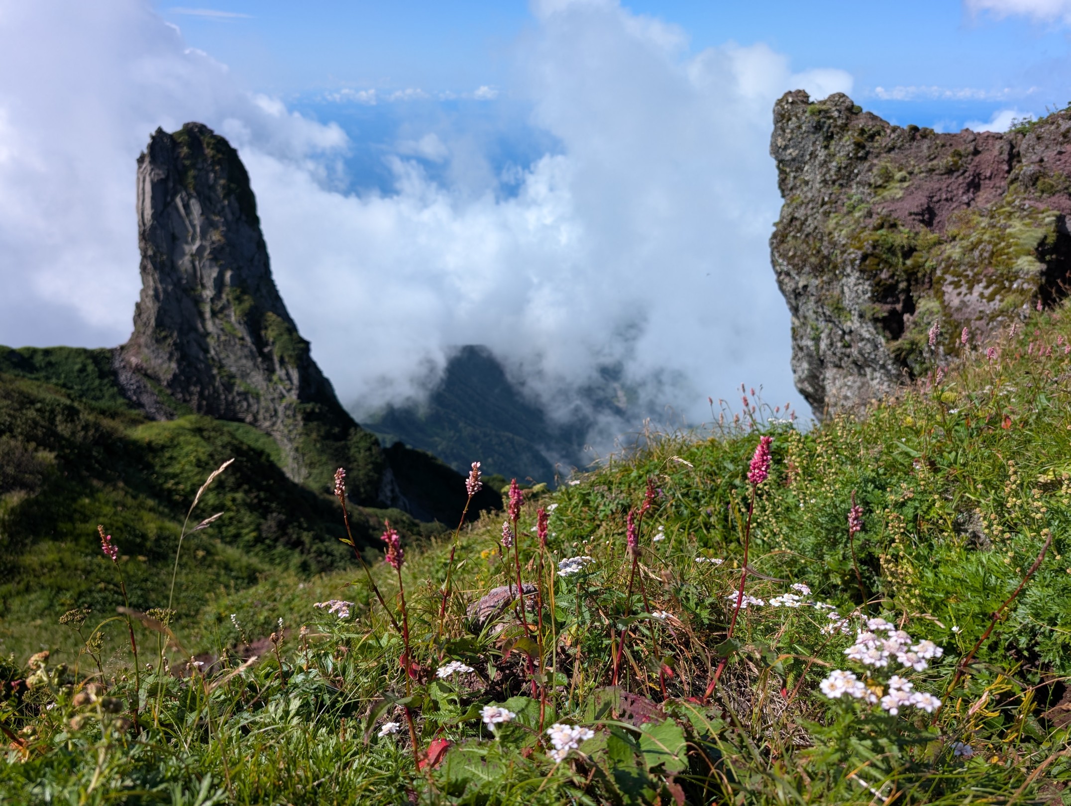
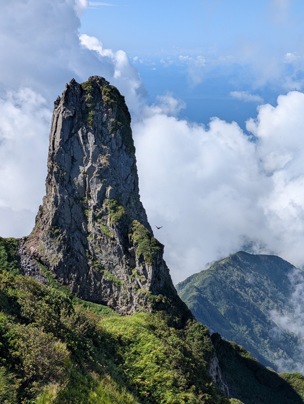
Looking towards the South Peak from Rishiri North Peak, where I was standing, Candle Rock stood tall, piercing the sky. It’s said to be a magma conduit that remained without collapsing, taking on this shape, and it truly makes you feel the wonder of nature all over again.
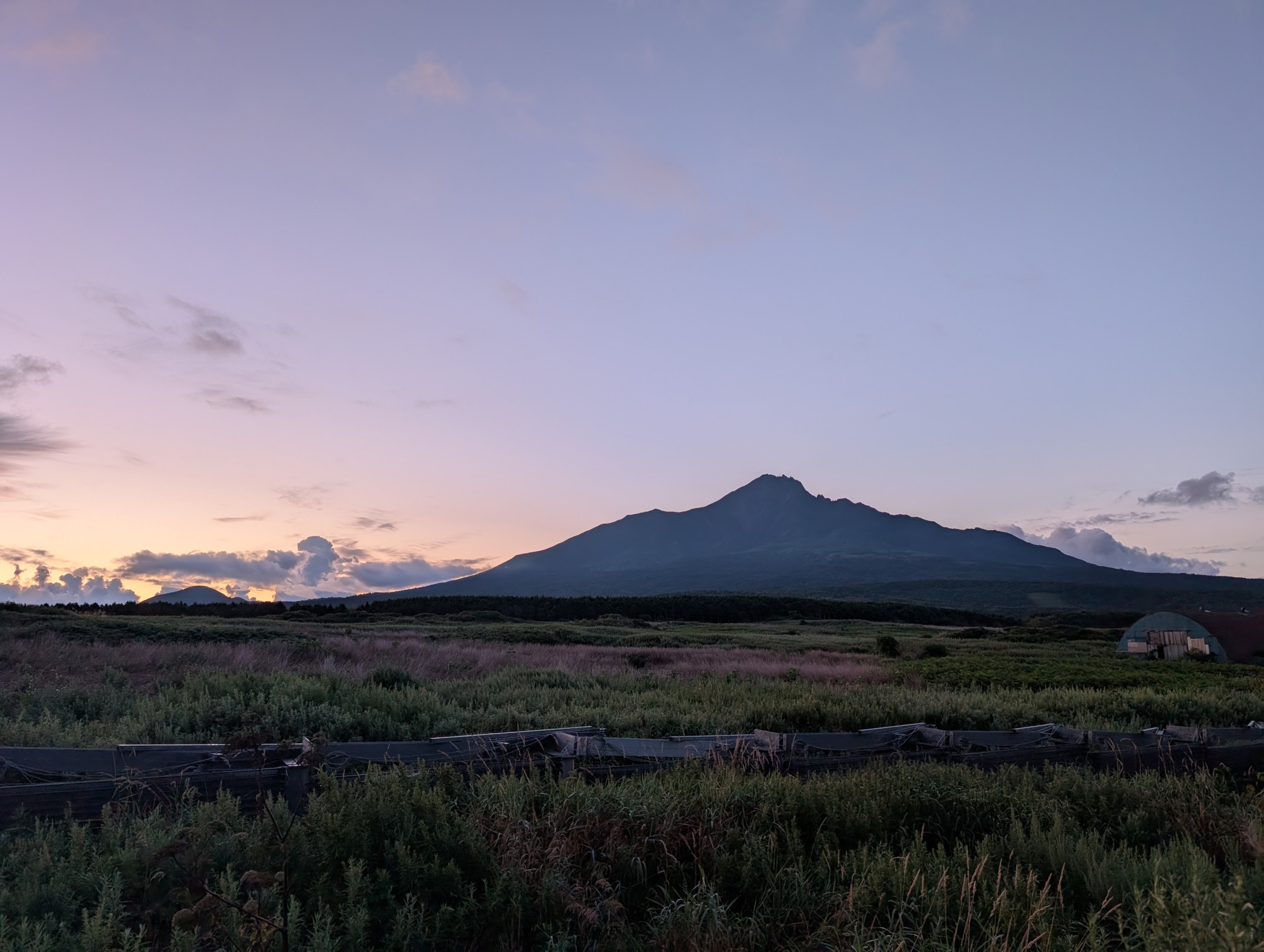
While the highest point of Mount Rishiri is the South Peak, it’s considered very dangerous due to its steep slopes, so the North Peak, where the triangulation station is located, is designated as Mount Rishiri’s summit. As I was gazing at the South Peak, clouds rapidly ascended from the east, and the atmosphere started to look ominous. Mount Rishiri’s weather is prone to sudden changes, especially in July and August. Even the day before my climb, I observed the mountain: I thought the base was clear and the summit visible, but then thick clouds quickly covered it. So, you need to be careful.
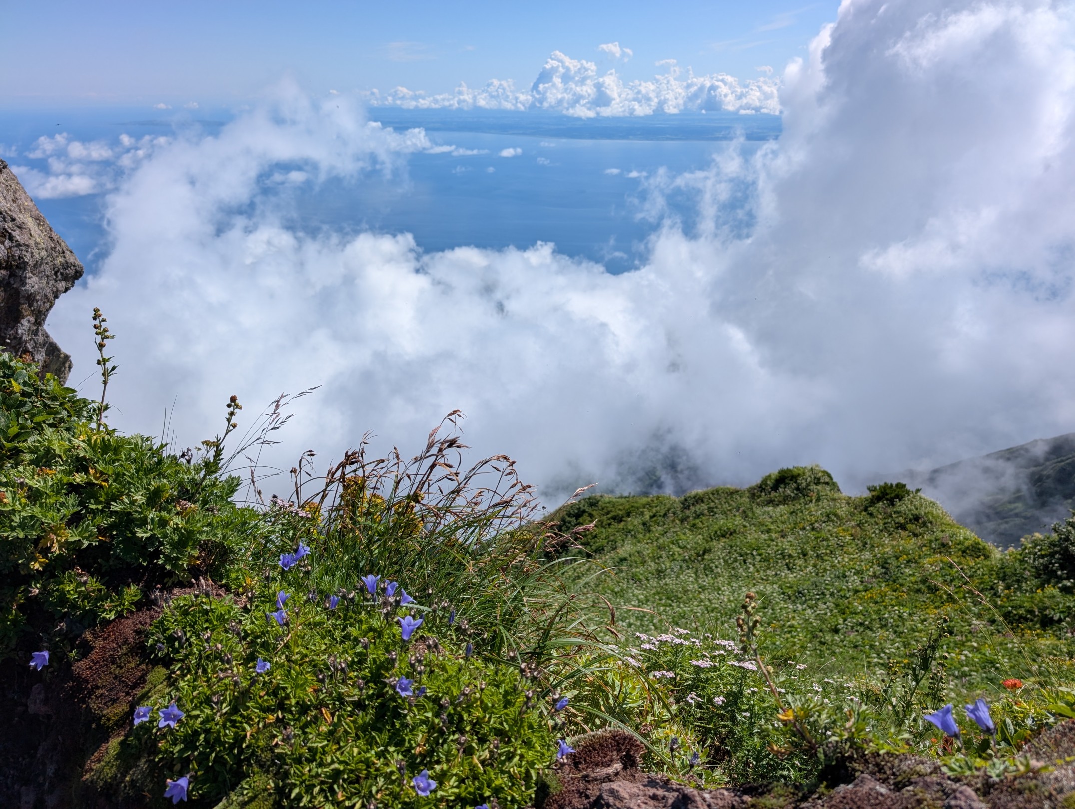
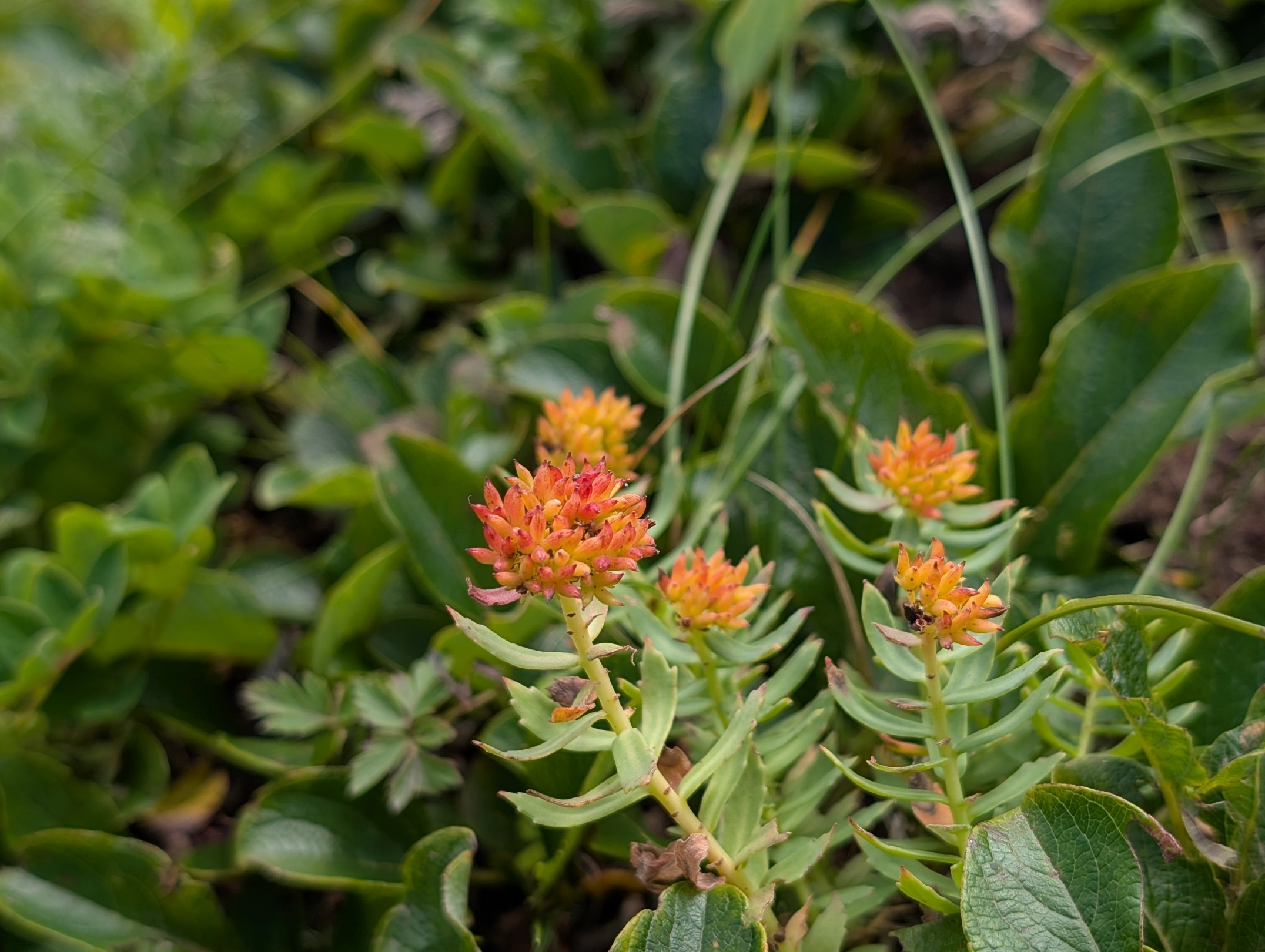
Many flowers were still blooming at the summit, creating a beautiful flower garden. The vibrant colors of the flowers, the clear blue sky, pure white clouds, the green mountain, and the reddish-brown soil of the collapsed slopes – these contrasts were stunning. With no strong winds and a pleasant temperature, gazing at all of this, I truly had the best time.
Descending While Spotting Rare Insects
I stayed at the summit for about an hour. Honestly, I wanted to enjoy the spectacular view a bit longer, but judging by the clouds, I decided to descend, anticipating a possible sudden change in weather during the hot afternoon.
Soon after starting our descent, we reached the junction to the Kutsugata Route. Initially, I had considered ascending via Oshidomari and descending via Kutsugata. However, seeing the state of the collapses firsthand, I was glad I chose the Oshidomari out-and-back, even if the Kutsugata Route had been open.
Soon after starting our descent, we were covered by clouds. Rishiri-Fuji, which we’d seen from the 8th station Mount Chokan on the way up, was completely hidden, and from the 6th station observatory, it was all white, with nothing visible. It might have been pure luck that we enjoyed such a magnificent view on the ascent.
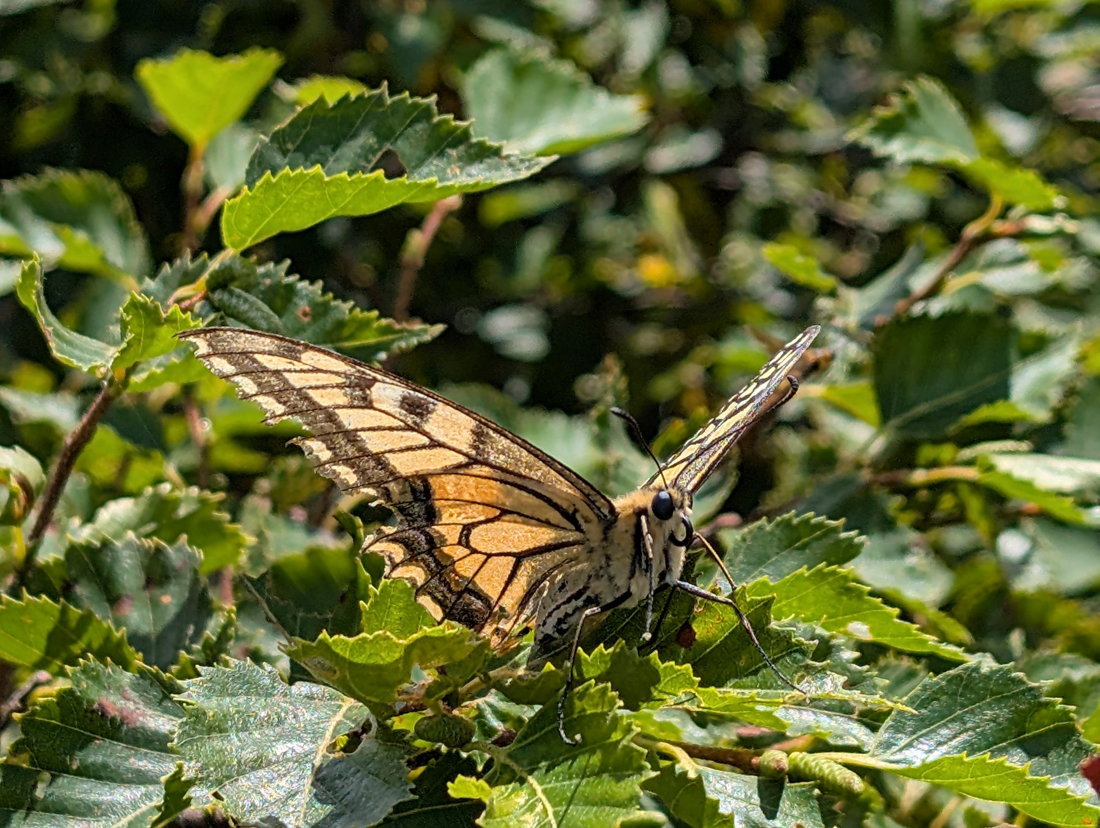
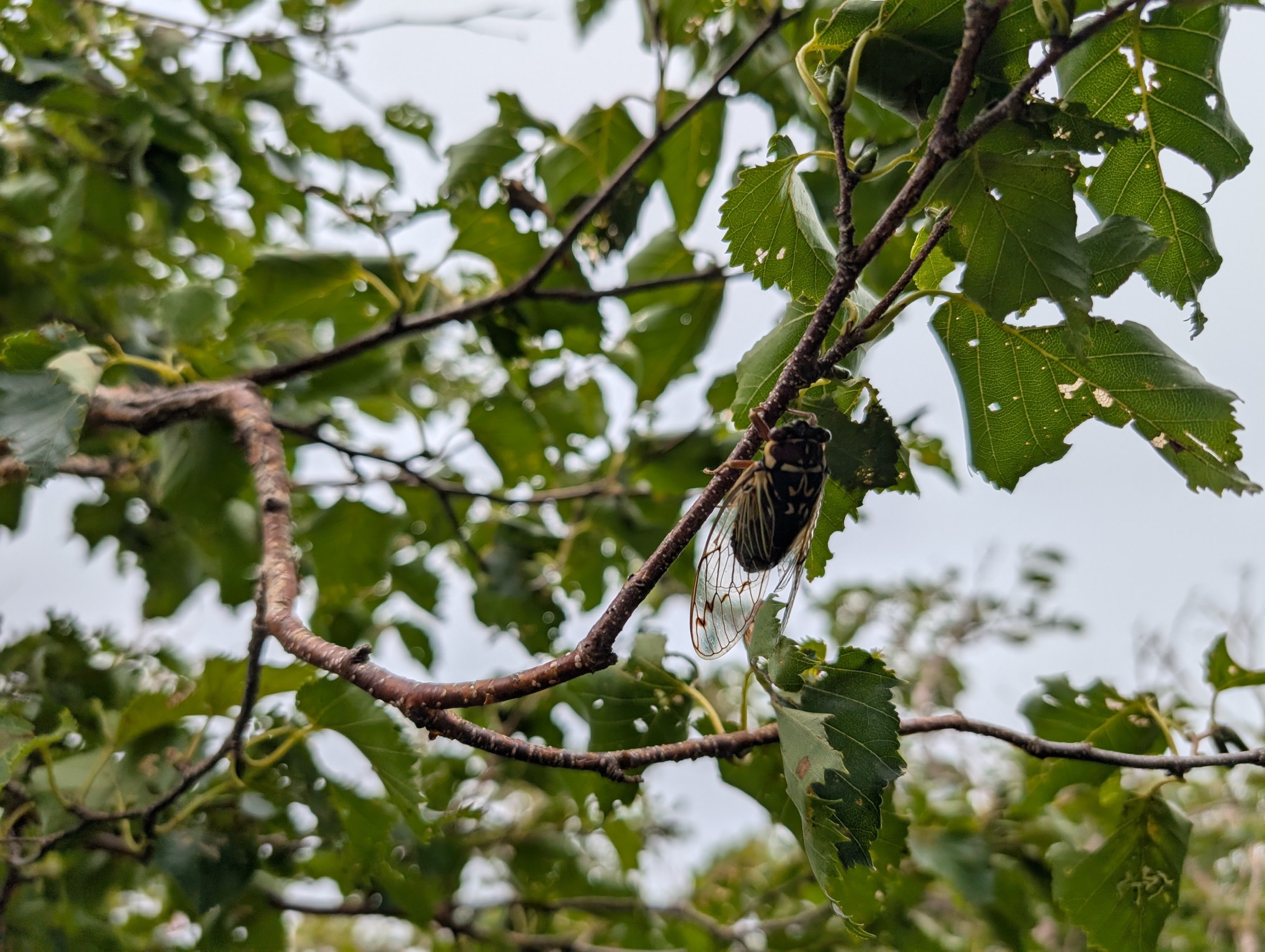
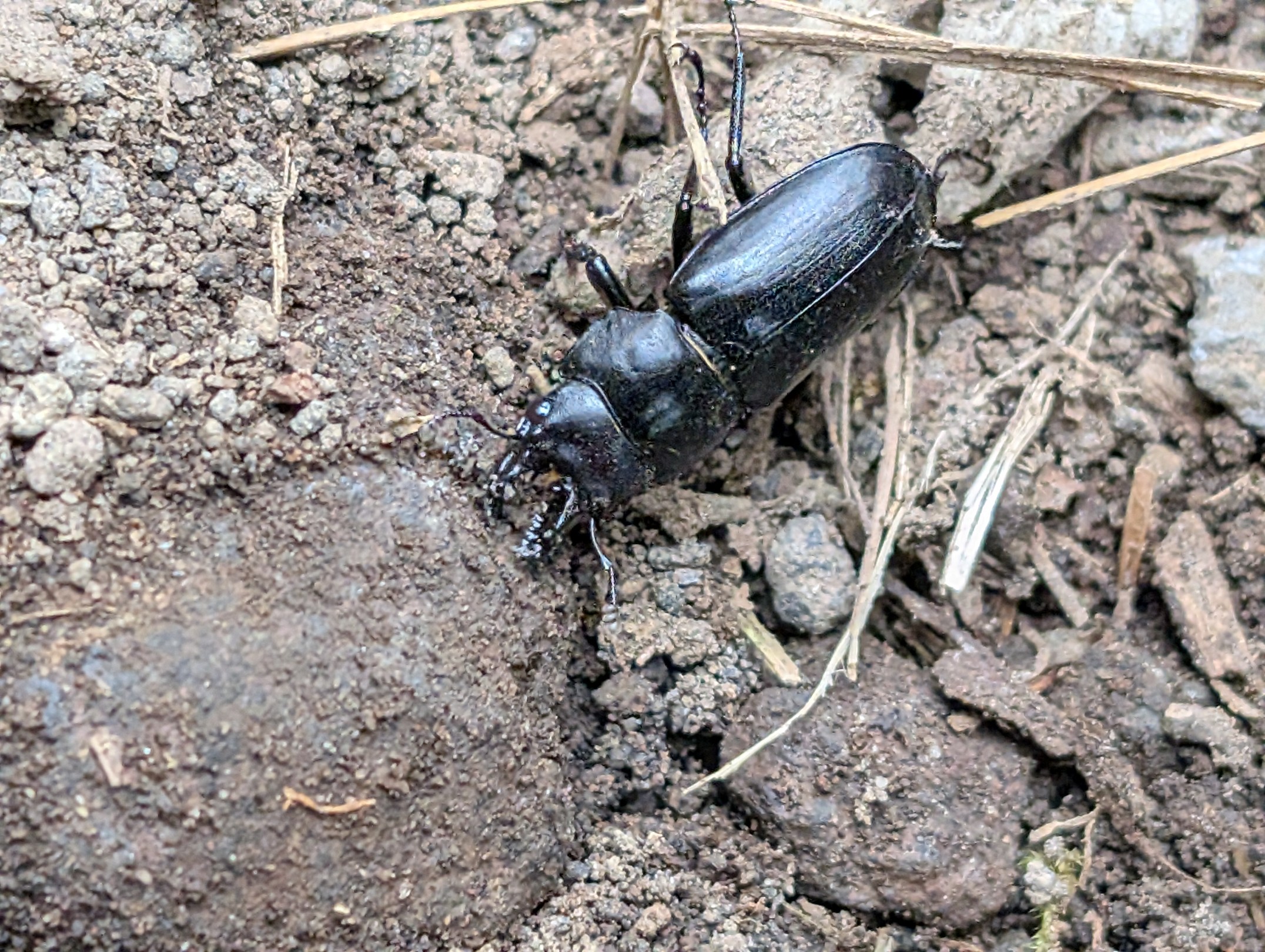

During the descent, I encountered some rare insects, like the Ezo cicada and a small stag beetle less than 2 cm long, which are quite difficult to spot. Although I couldn’t get a photo, I also saw squirrels twice near the 5th station. Ezo cicadas are hard to find because you can hear their calls, but they don’t move or fly away even when you get close. And that stag beetle was surprisingly tiny! Honestly, I was also surprised to see an Asagimadara butterfly flying in such a place.
Thanks to the clouds, the descent was relatively cool and somewhat easier, but with an accumulated elevation gain of over 1500 meters from the trailhead to the summit, the strain on my knees and thighs was considerable. In fact, it’s been a while since I had muscle soreness that lasted nearly a week after a hike, making it quite a tough climb.
A mountain completely surrounded by the sea is quite rare, and its magnificent views were truly spectacular. Including the fact that it wasn’t an easy climb, it became a deeply memorable hiking experience.


コメント