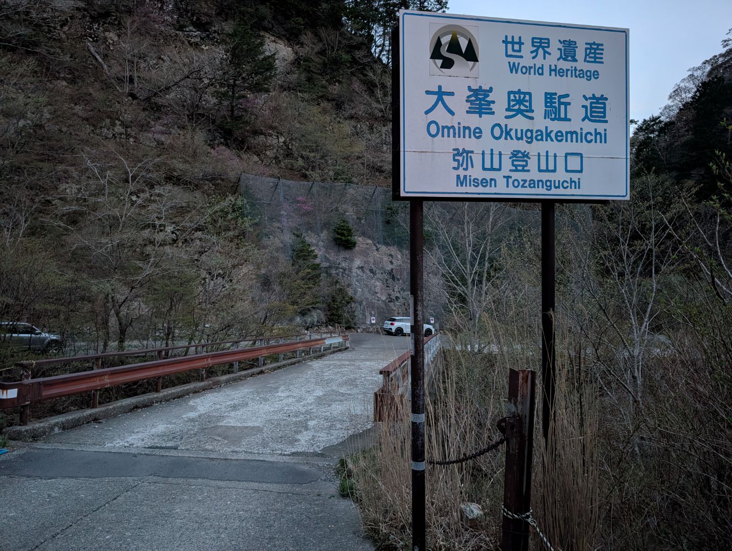
The Omine Okugake Trail, connecting Yoshino and Kumano, is a Shugendo path that traverses rugged mountain terrain, forming part of the World Heritage site “Sacred Sites and Pilgrimage Routes in the Kii Mountain Range.” I’d always wanted to walk it, and I recently found out that I could hike a section of it while climbing Mt. Hakkyogatake, one of Japan’s 100 Famous Mountains, so I decided to go for it right away!
A day trip to Mt. Hakkyogatake seemed quite difficult unless it was a round trip from the trailhead at the west exit of Gyojagaeri Tunnel. Plus, it looked like a pretty long drive, over 5 hours from Hamamatsu, and I’d heard the trailhead parking lot fills up super fast. So, I decided to leave around 8 PM to arrive in the middle of the night. I’d expected the roads around Kitayama and Totsukawa to be narrow and rough, and sure enough, the Gyojagaeri Forest Road leading to Gyojagaeri Tunnel was narrow, steep, and tough for passing, making driving at midnight quite nerve-wracking. I arrived just before 2 AM, and the parking lot was already almost full – just barely got a spot! But what greeted me was an unbelievable number of stars, perfectly fitting the phrase “a night with falling stars.” My Pixel phone has an astrophotography mode, so I gave it a try, and it captured the night sky pretty well!
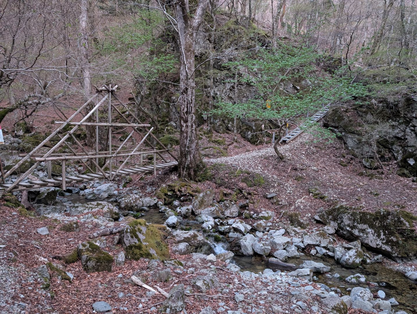
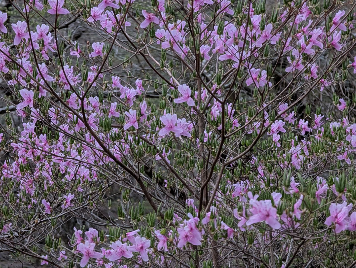
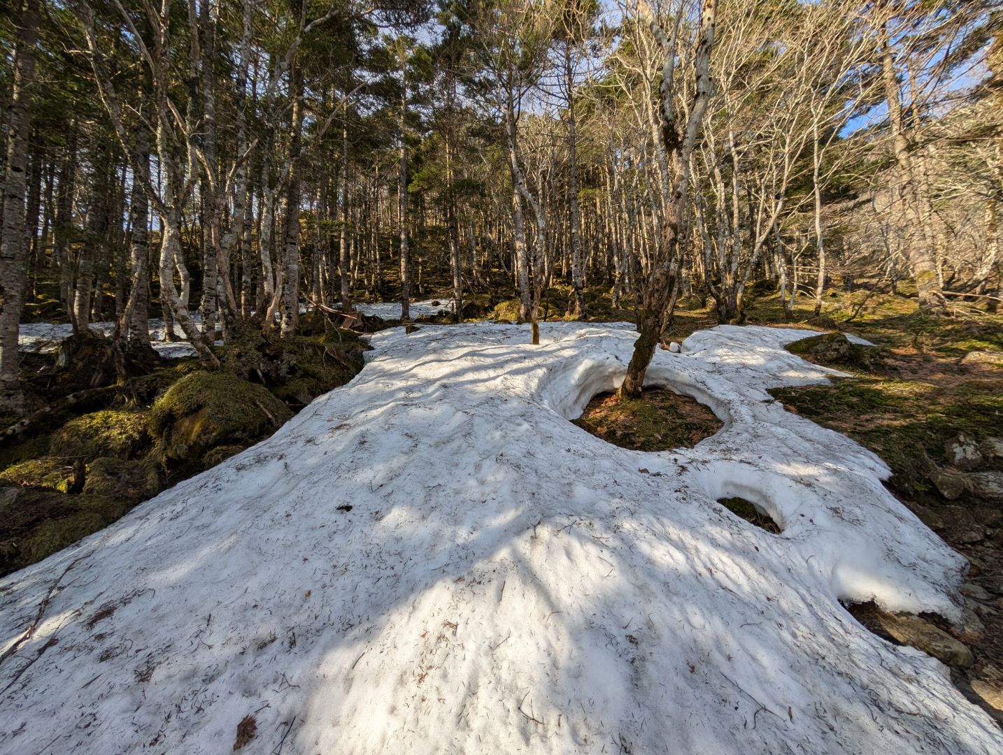
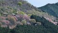
The sky started to lighten before 5 AM. It was much colder than I expected, so I couldn’t sleep soundly and started my hike at 5 AM. Just as I hadn’t anticipated the cold, my expectation of climbing through mountains of fresh green leaves was also completely off. However, the rhododendron flowers blooming here and there added a bright splash of color to the brown landscape and were absolutely beautiful.
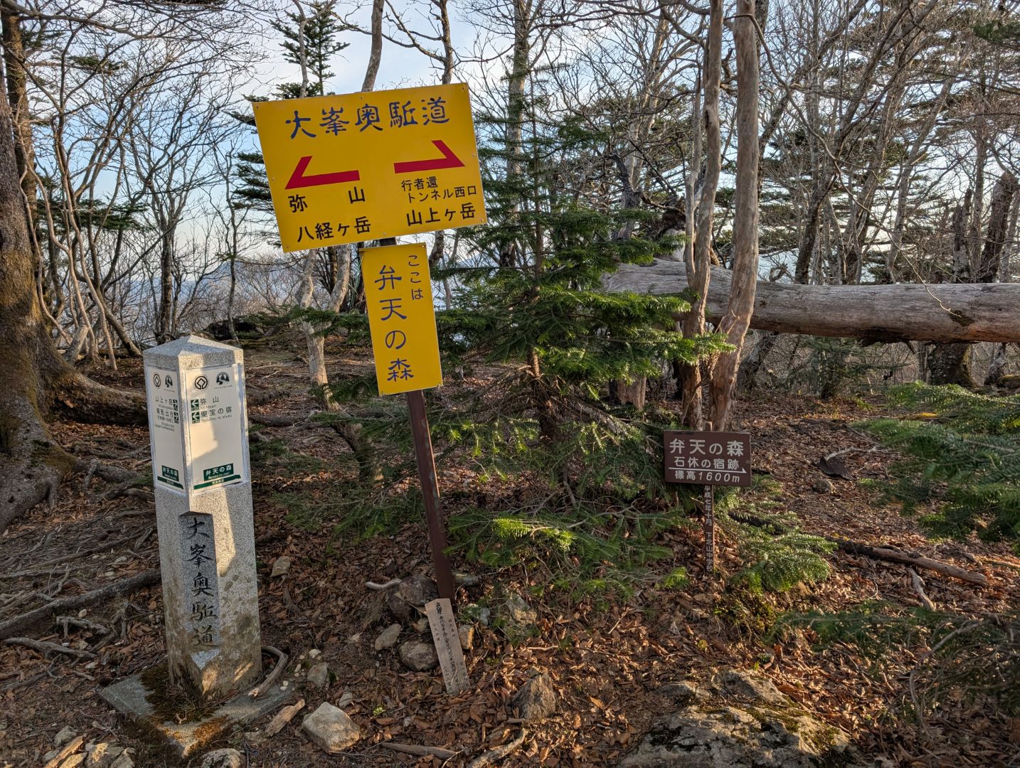
After about an hour of steep climbing from the trailhead, I finally joined the Omine Okugake Trail, a path I’d always dreamed of hiking! Knowing that the trail from Mt. Sanjogatake, which is still off-limits to women even today, connects here, and that the rugged path continues from here through Mt. Myosen and Mt. Hakkyogatake all the way to Kumano, gives me a strange, unique feeling, different from my usual mountain traverses.
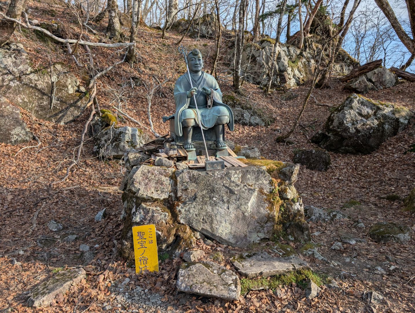
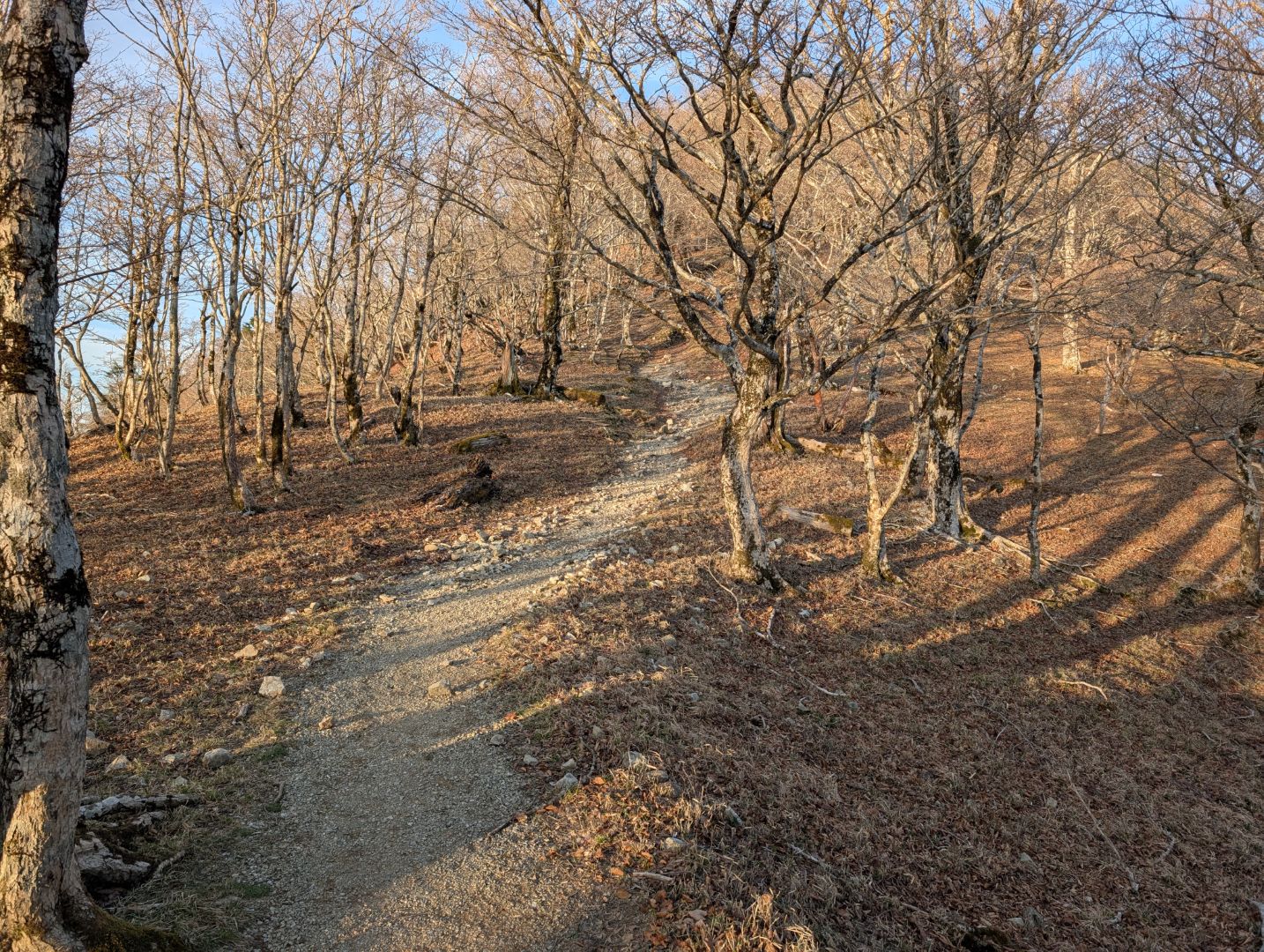
Shobo no Shuku is where you’ll find a statue of Shobo Rigen Daishi, one of the five great masters of Sanuki, who was the founder of Daigo-ji Temple and studied under Shinga, Kukai’s younger brother. The ridge path around here was gentle and easy to walk, quite different from the image I had of a rugged Shugendo trail.
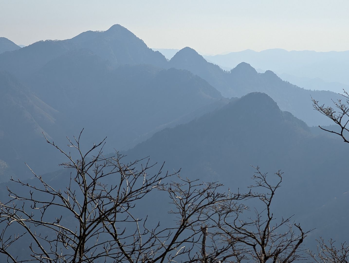
A short walk from Shobo no Shuku, there were spots where the view opened up, reminding me just how rugged and deep the mountains of the Kii Mountain Range are. Perhaps it was also because I started relatively early from the trailhead, but the lack of people further intensified that feeling of being deep in the mountains.
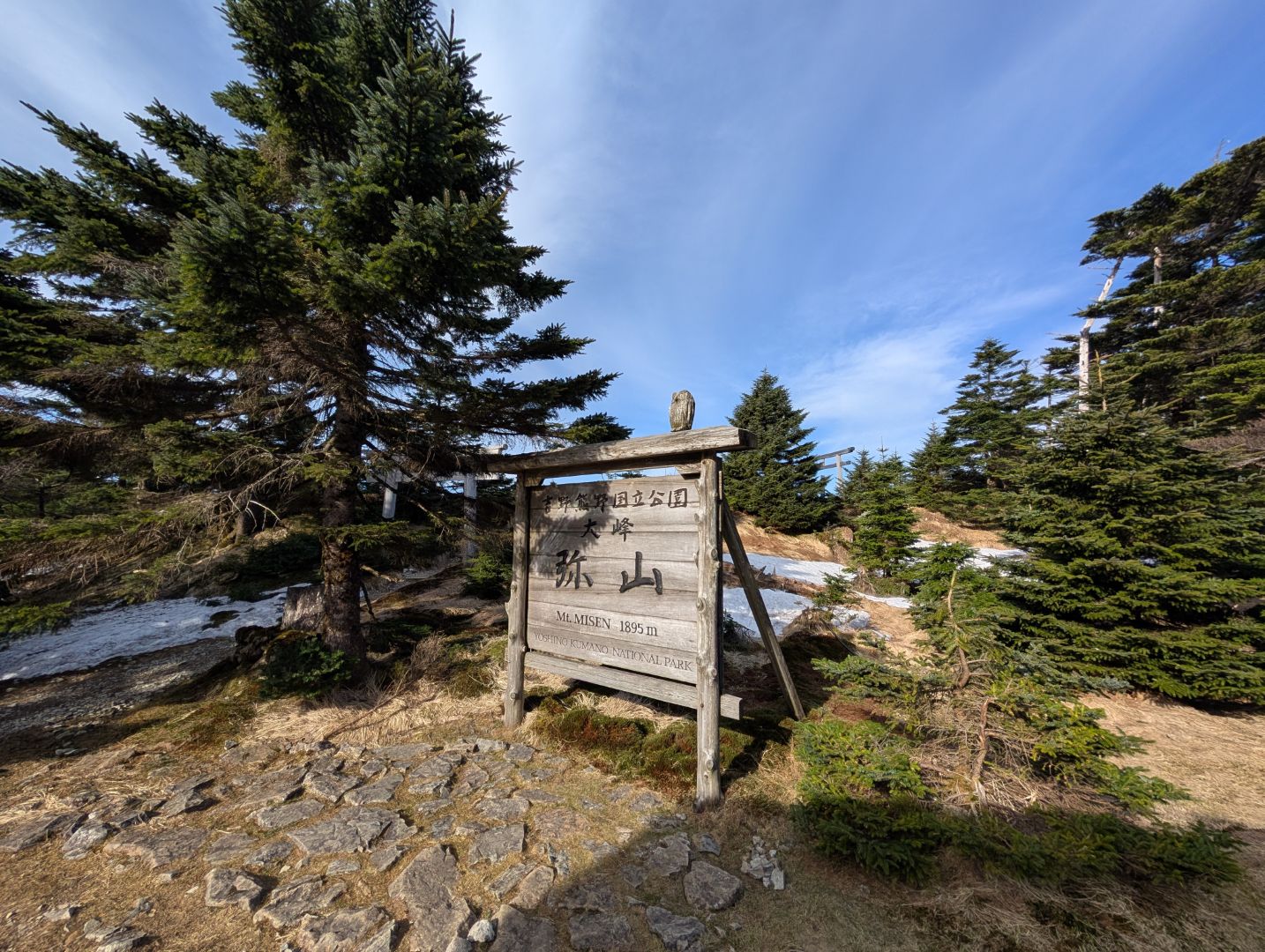
I arrived at Mt. Myosen, which stands at an elevation of 1,895 meters. There’s a mountain hut here, Myosen Hut, which is a perfect overnight stop if you’re doing a traverse. It always amazes me how such large mountain huts exist so deep in the mountains.
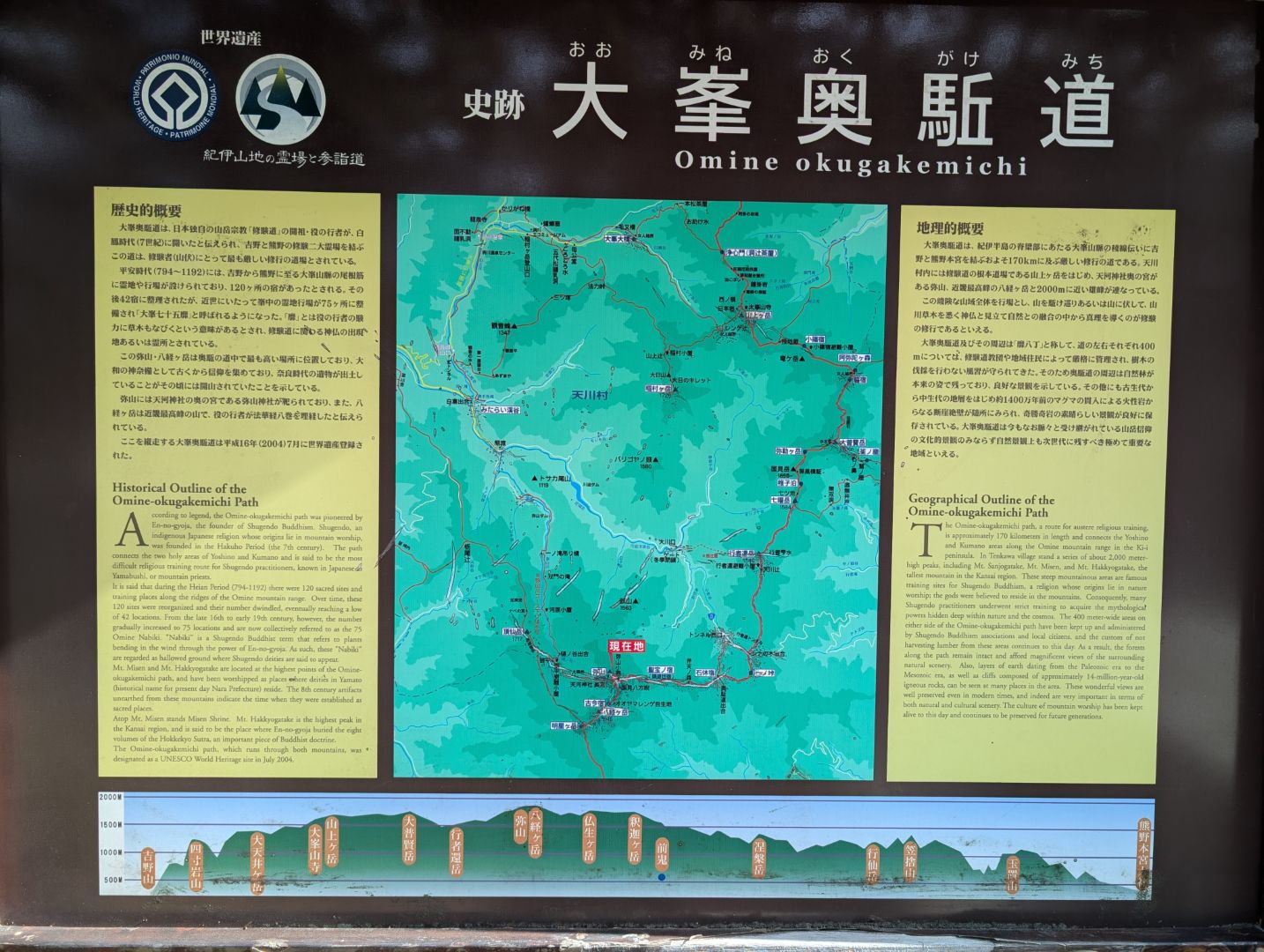
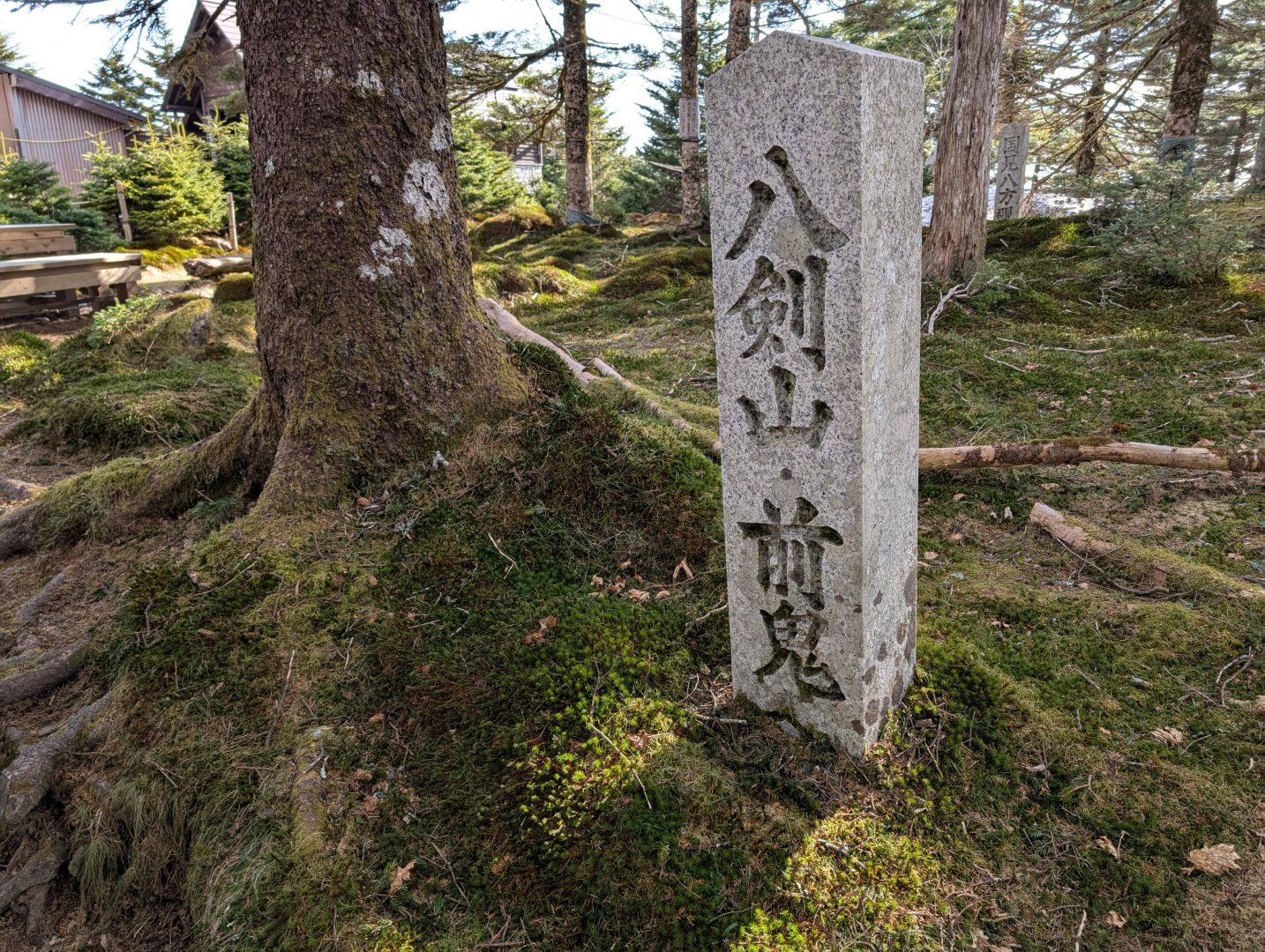
When I saw the trail marker for Hakken-san and Zenki, I wasn’t quite sure what they meant. Hakken-san refers to Mt. Hakkyogatake, where I was headed, and Zenki is the name of a village further south along the Omine Okugake Trail, past Mt. Myojogatake, Mt. Busshogatake, and Mt. Shakagatake. I really hope that someday I can traverse the entire Omine Okugake Trail, starting from the Yoshino side, passing through the Nyonin Kekkai (women’s restricted area) gate to Mt. Sanjogatake and Omine-san-ji Temple, then hiking this current route, and finally reaching Kumano.
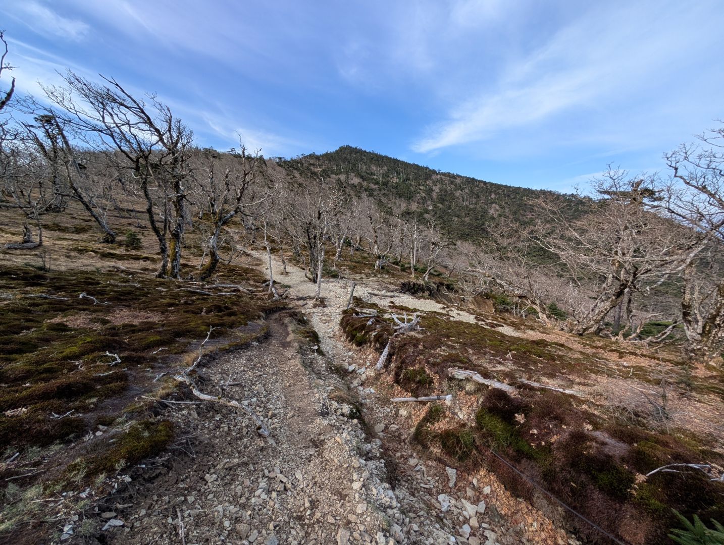
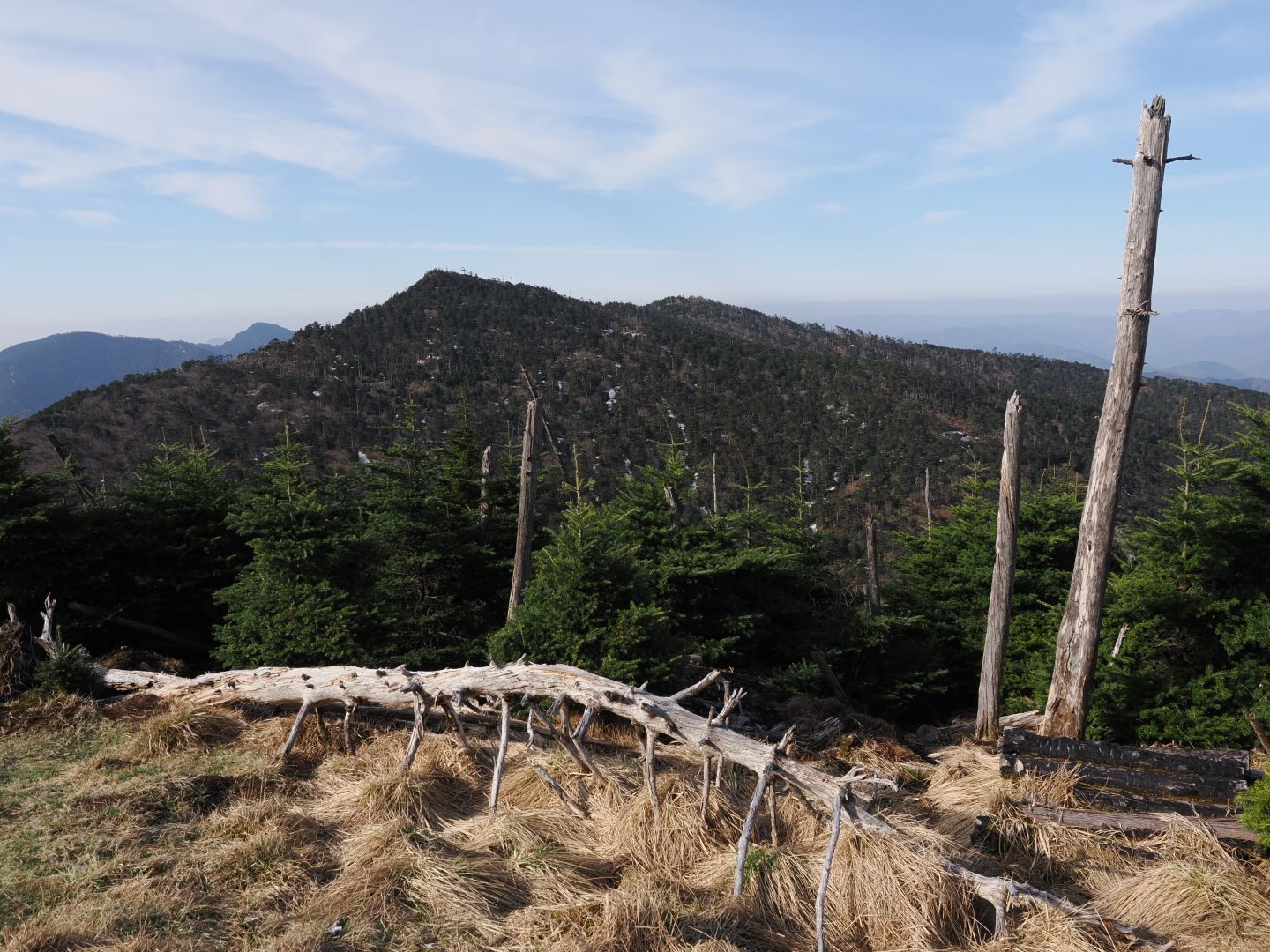
From Mt. Myosen, the path descends once before climbing back up to Mt. Hakkyogatake. From this vantage point, Mt. Hakkyogatake looks a bit oddly shaped.
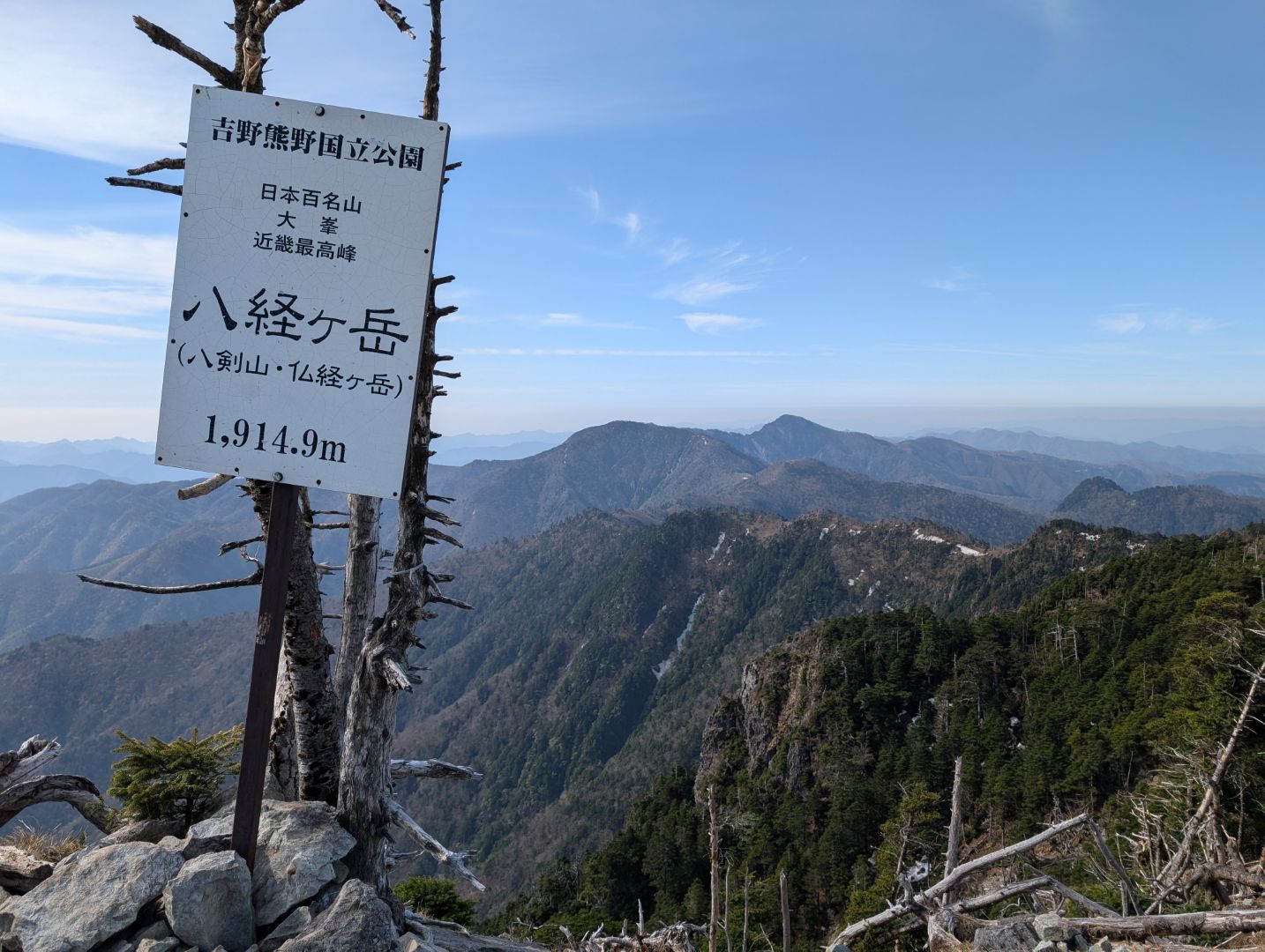
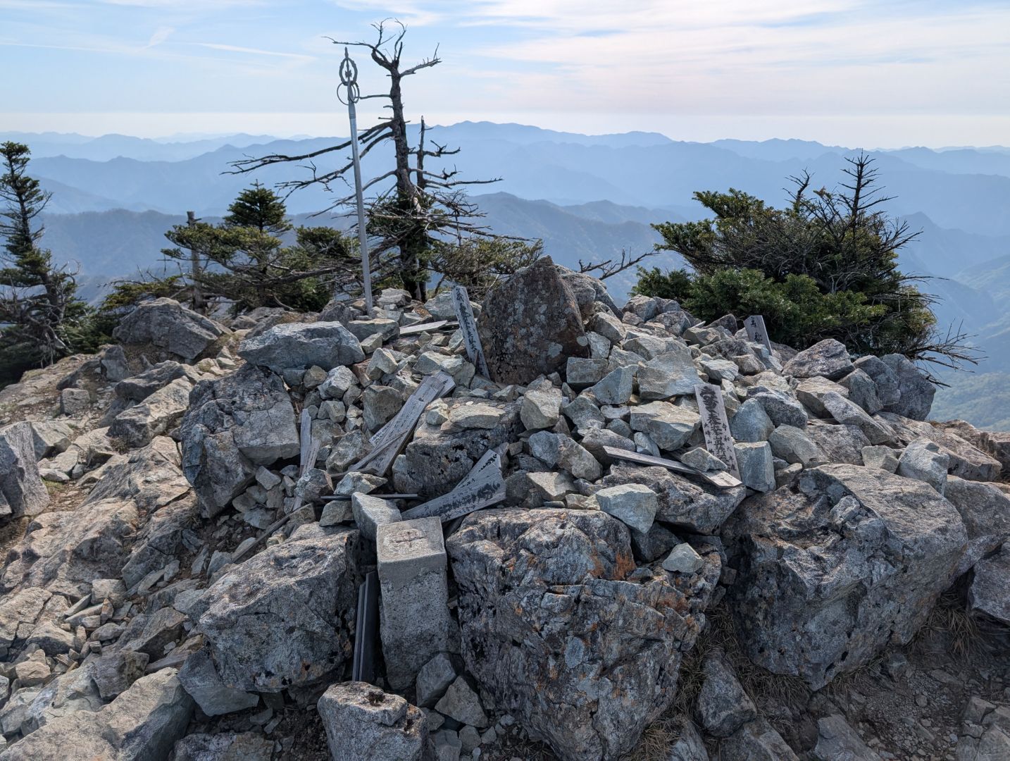
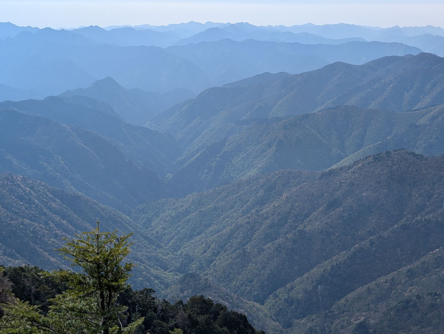
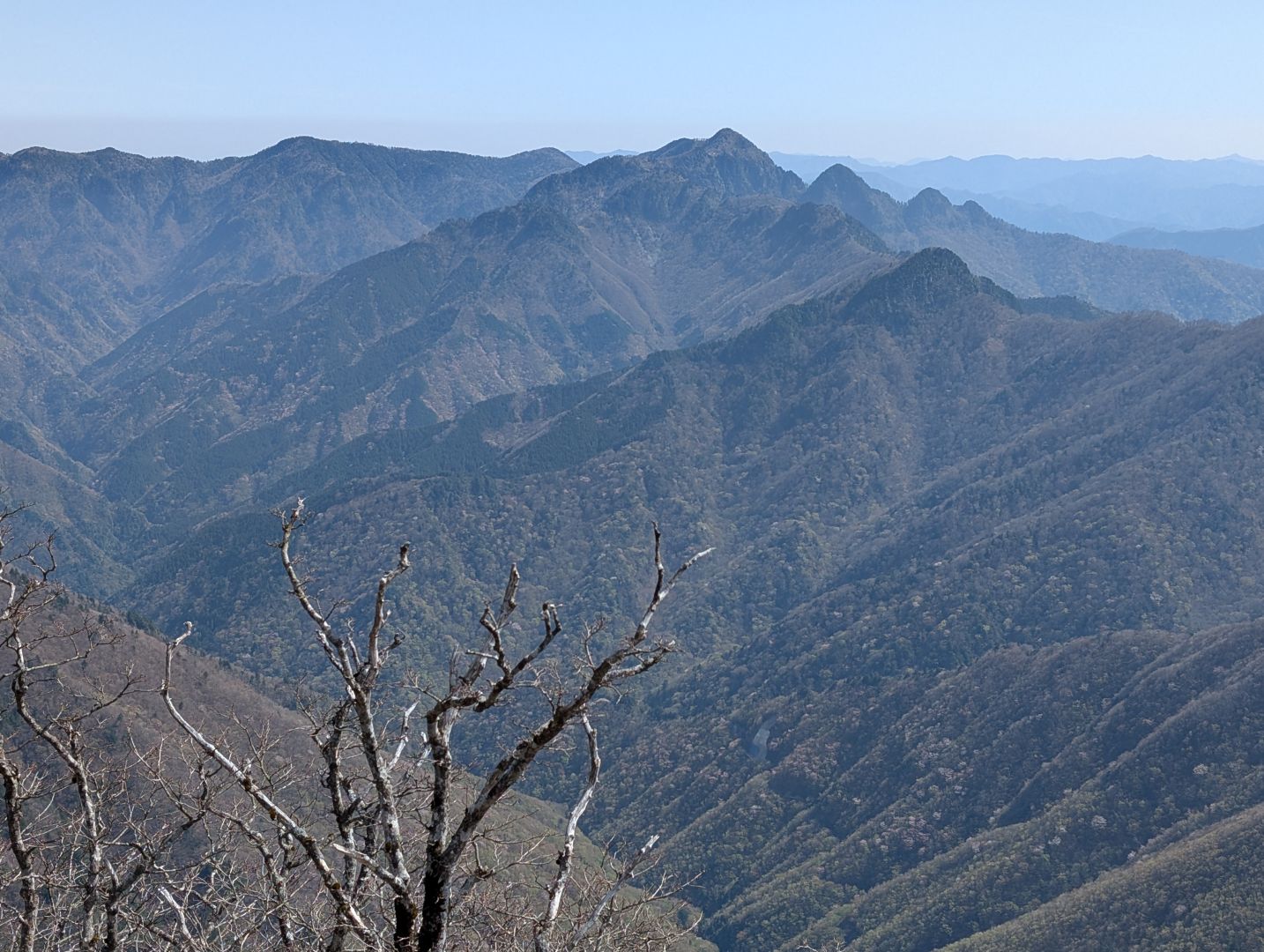
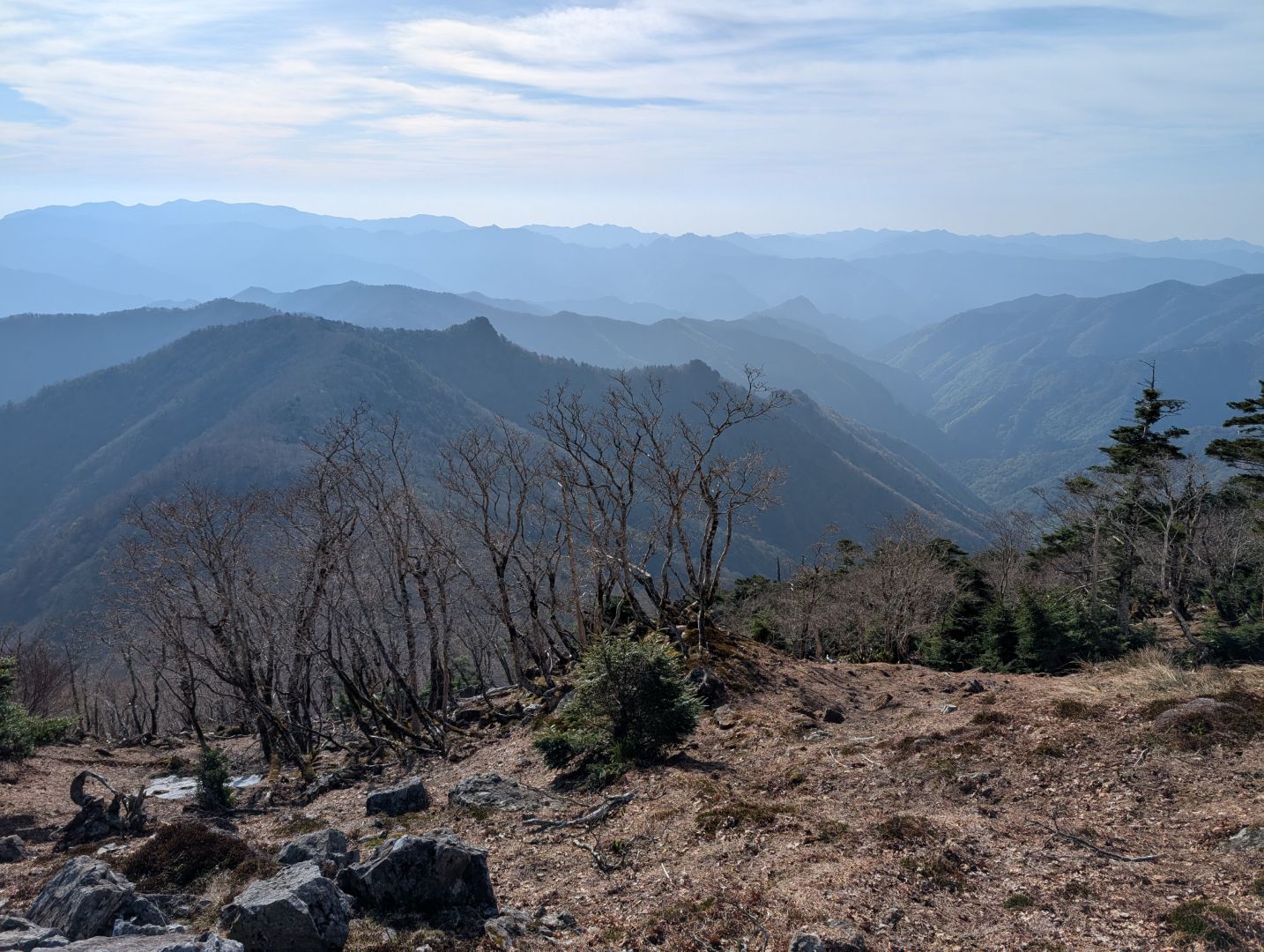
It was only at the summit marker that I realized Mt. Hakkyogatake is actually the highest peak in the Kinki region! Naturally, the 360-degree views were absolutely breathtaking. This area doesn’t get clear weather very often, so I felt truly lucky to have hiked on such a beautiful day. The way the mountains overlapped and stretched far into the distance was incredibly impressive.
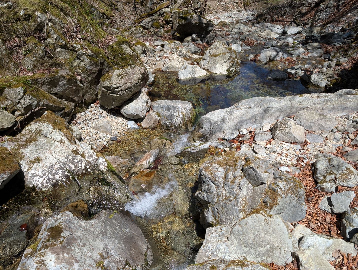
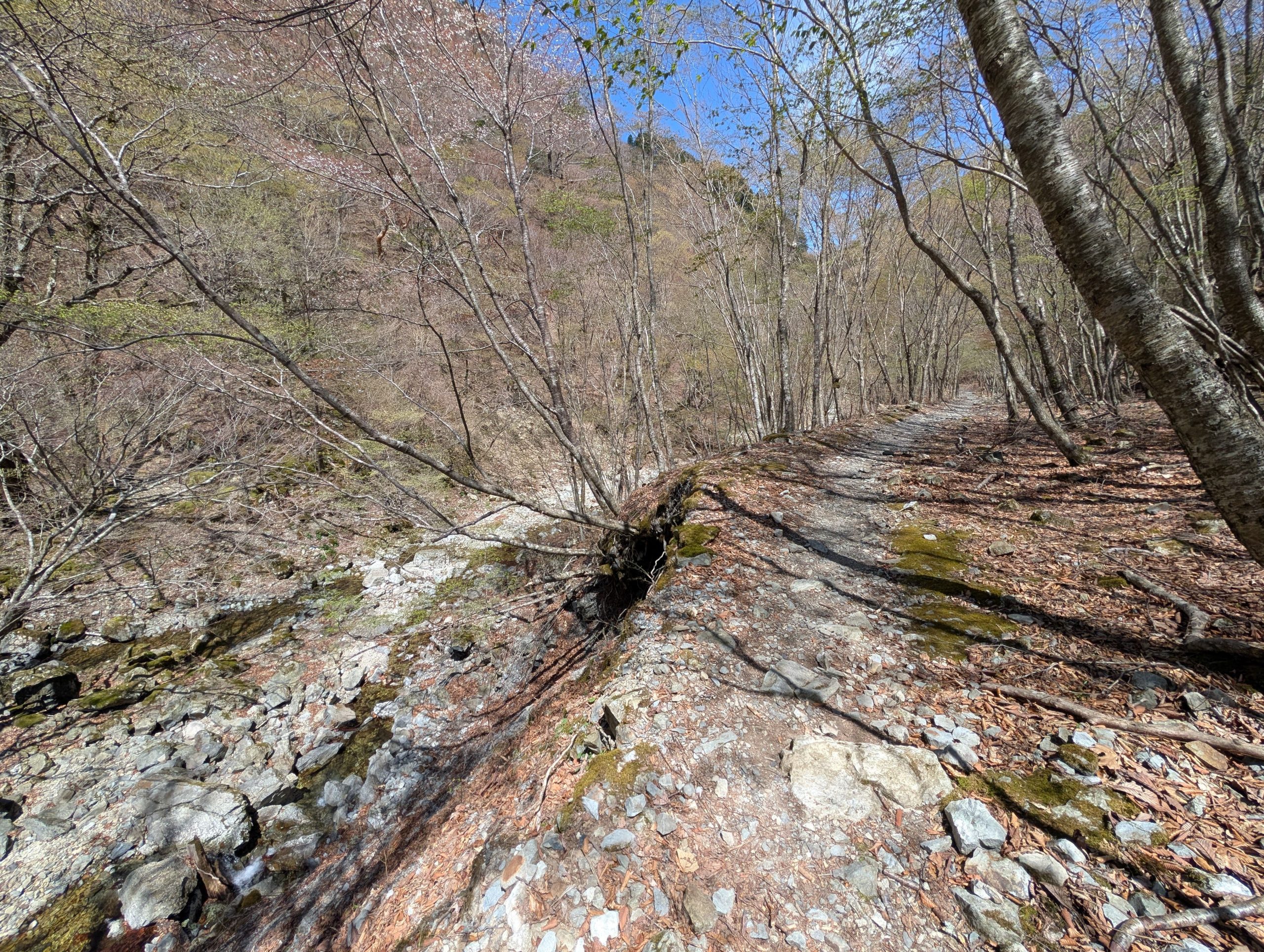
We made it back near the trailhead from Mt. Hakkyogatake. The path was so pleasant, with the sound of the babbling river and the bright sky. I had barely noticed it on the early morning ascent, but now it felt so refreshing, making me forget all the fatigue I’d accumulated.
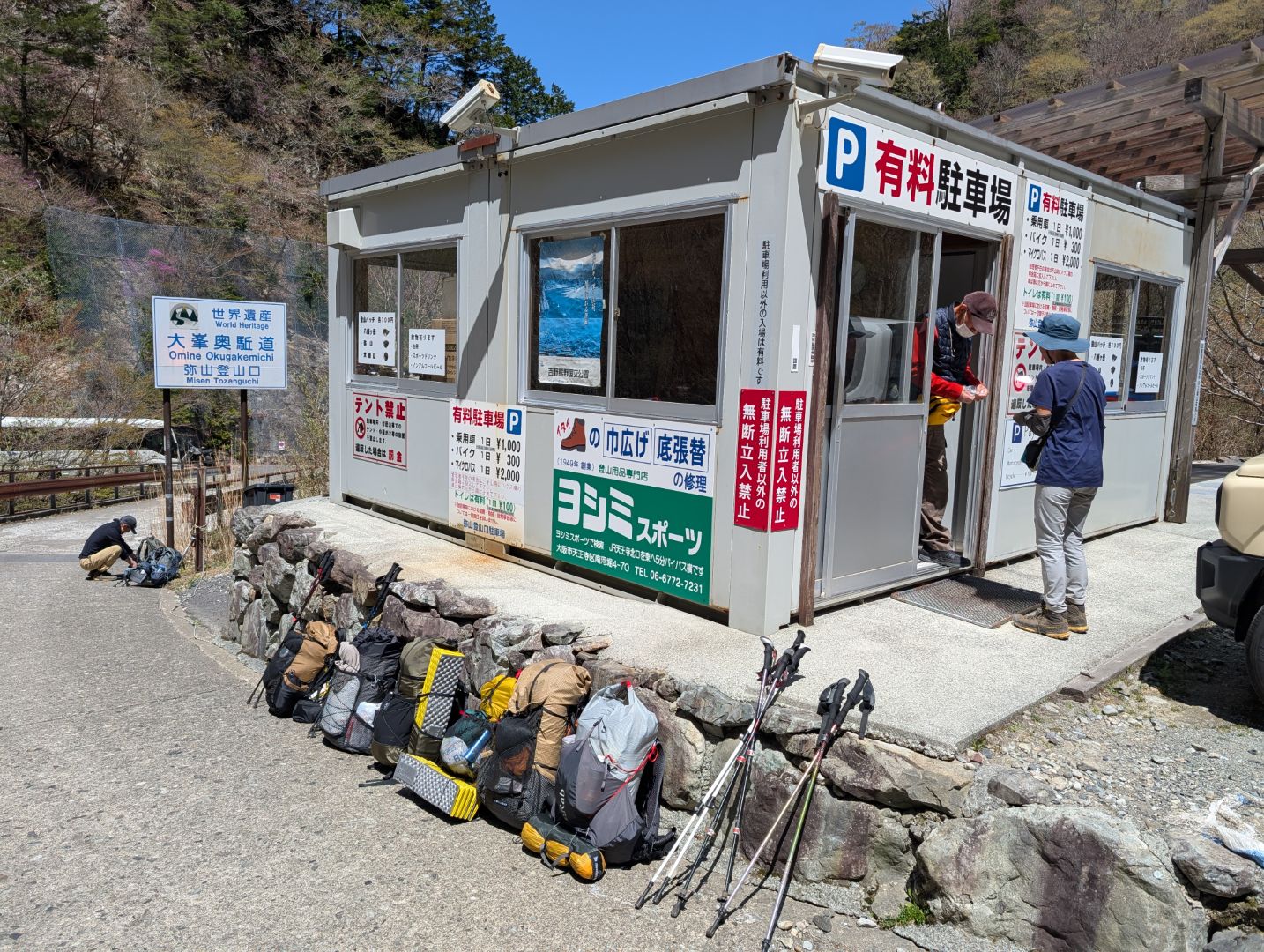
Since I started pretty early, I was already back down by late morning. Because of this, there were lots of people arriving to start their hike, and the parking lot was packed. Once it got brighter, I noticed that people who couldn’t find a spot were even parking further along the road. The tricky part was, the accommodation I had booked for the night was in Tenkawa Village, further down this road, but it turned out the road had been closed due to a landslide a few weeks ago… Luckily, I hadn’t known about it and approached the trailhead from this side, not the other! Still, I confirmed with the parking attendant that there was no other option but to make a 70-80 km detour to get to my inn that day, so coming down early was definitely the right move.
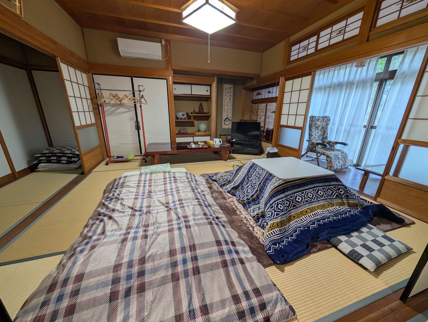
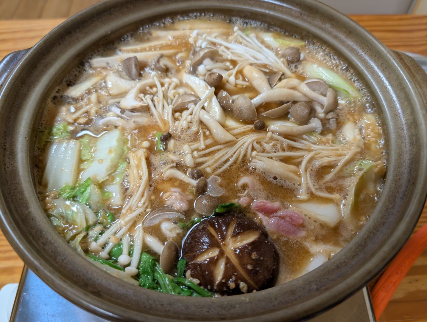
The inn where I stayed in Tenkawa Village was an entire house rental (which was unexpected!), and they even provided a kotatsu since it was still cold at night and in the early morning. And the miso hotpot, packed with mushrooms and vegetables and made with their special homemade miso, was absolutely exquisite! After a relaxing soak in a nearby hot spring, I was able to unwind completely.
Since I stayed overnight, I also got to do a bit of sightseeing the next day, but that’s a story for another time. The hike to Mt. Hakkyogatake via the Omine Okugake Trail wasn’t an especially long one in terms of duration, but it was a really memorable and wonderful climb.
コメント