I stumbled upon Shimoguri no Sato when I was looking at a map to find Yarodo, one of the trailheads for Mt. Hijiri in the Southern Alps. After some research, I found it’s described as Japan’s Tyrol, a place of stunning beauty with a small village clinging to the side of a mountain. I’d wanted to visit someday. Since I recently discovered I could load my eBike into the car for a cycling trip, I decided to climb from Roadside Station Toyamago to enjoy the magnificent views of the Southern Alps, which are still covered in snow.

There are several routes from Hamamatsu to Roadside Station Toyamago, and one of them is National Route 152. This road has a pass called Aokuzure Pass on the border between Shizuoka and Nagano. Construction of a tunnel through here began over 40 years ago but was temporarily halted due to fragile ground. Since that part was impassable, the road turned into a narrow mountain path, crossing the Hyoetsu Pass to get to the Nagano side – and this road is truly a “Koku-do” (a notoriously difficult national highway). Even though I knew what kind of place it was from having driven it before, I set my navigation without much thought and ended up on this road, which was a problem. The drive from the Shizuoka side to Hyoetsu Pass was fine, but there was still snow in places on the descent to the Nagano side from the pass, and since I didn’t have snow tires, I had to drive very cautiously and slowly to get down. It was good that I had plenty of time, but it was quite stressful.

Actually, there was news that the Aokuzure Pass tunnel was completed this March! That means in the future, we won’t have to go through such hardships to get from Shizuoka to Nagano, or take a significant detour. This should be a huge benefit for tourism and logistics. However, it seems like the entire road will take more time to complete, so whether I’ll get to enjoy the full benefits is still a bit uncertain.
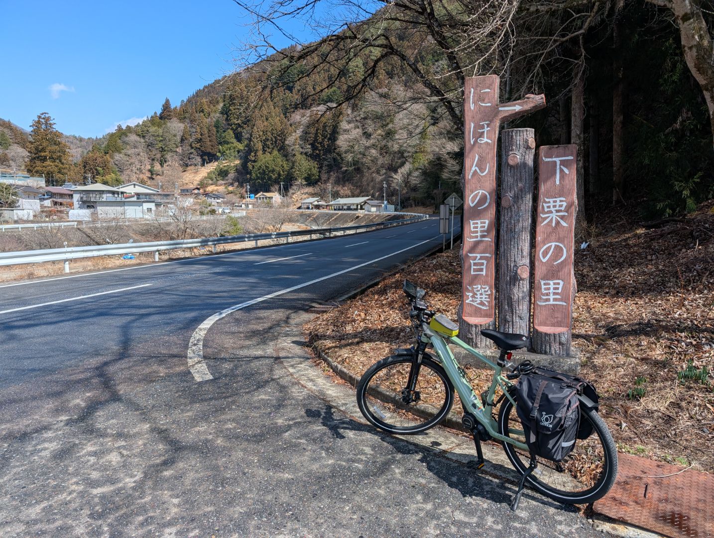
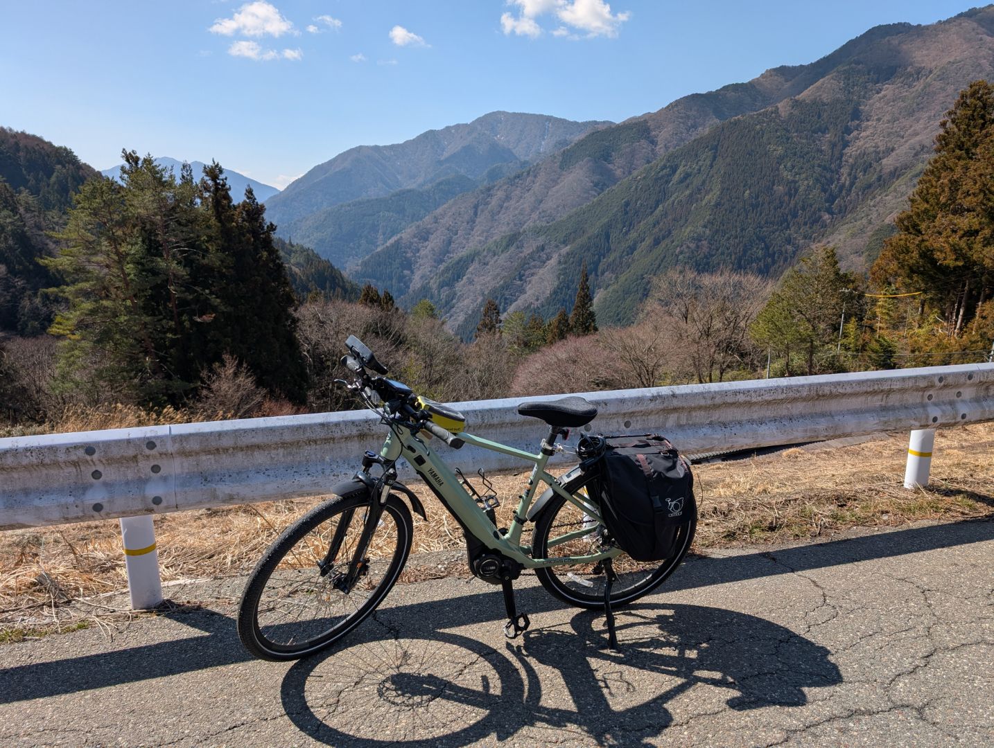
From Roadside Station Toyamago to Shimoguri no Sato, it’s a climb of just over 12 kilometers with an elevation gain of about 600 meters. Roughly half of that is a gentle ascent along Route 152, but from the first fork in the road shown in this photo, it suddenly becomes a steep climb, which is quite tough. It’s okay for me because I have an eBike, but there are people who apparently ride up here on regular road bikes, which is truly amazing!
The road is a moderately narrow mountain path, so I definitely felt it was more relaxing and better to come by bicycle than by car in a place like this.
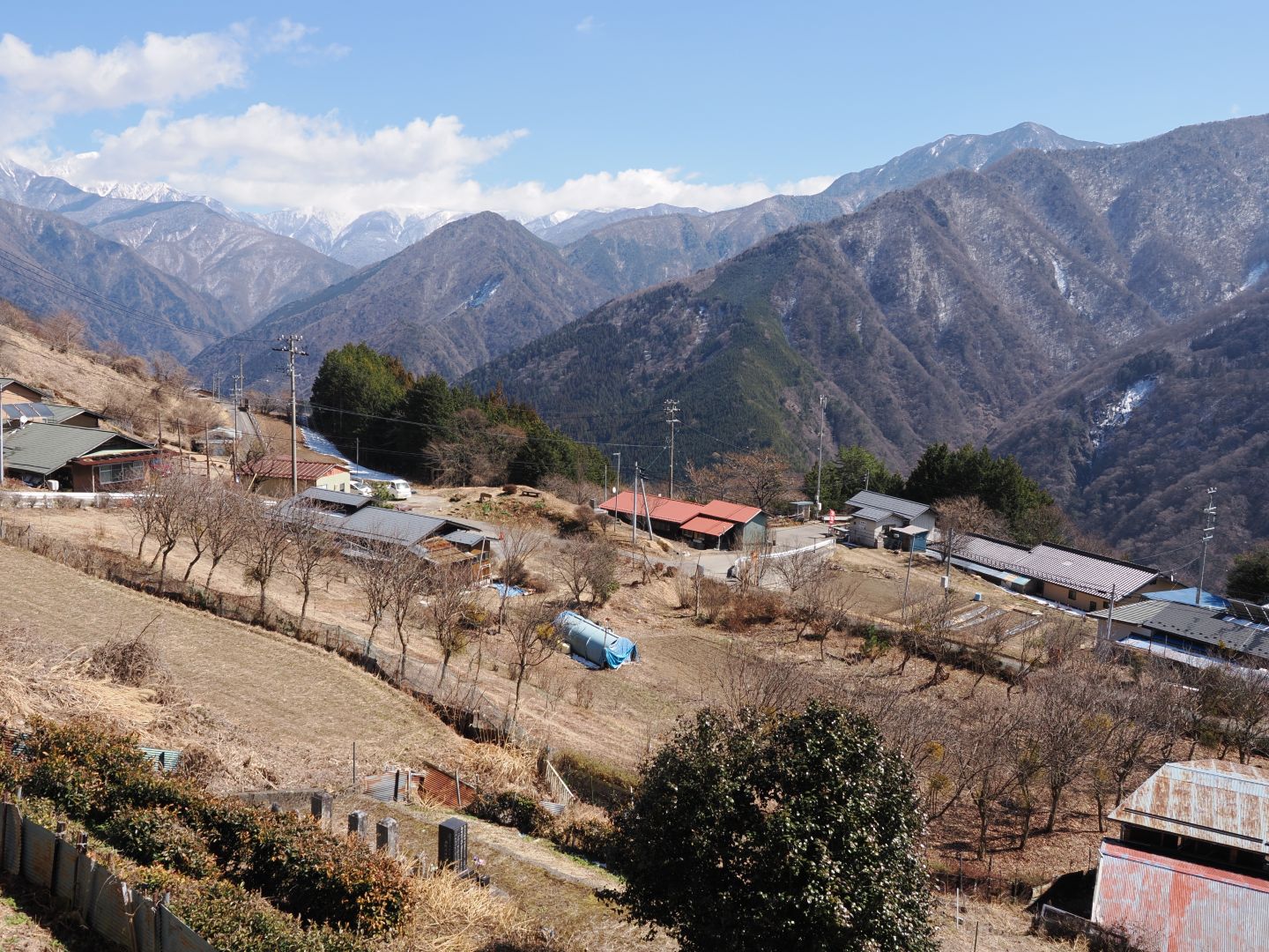
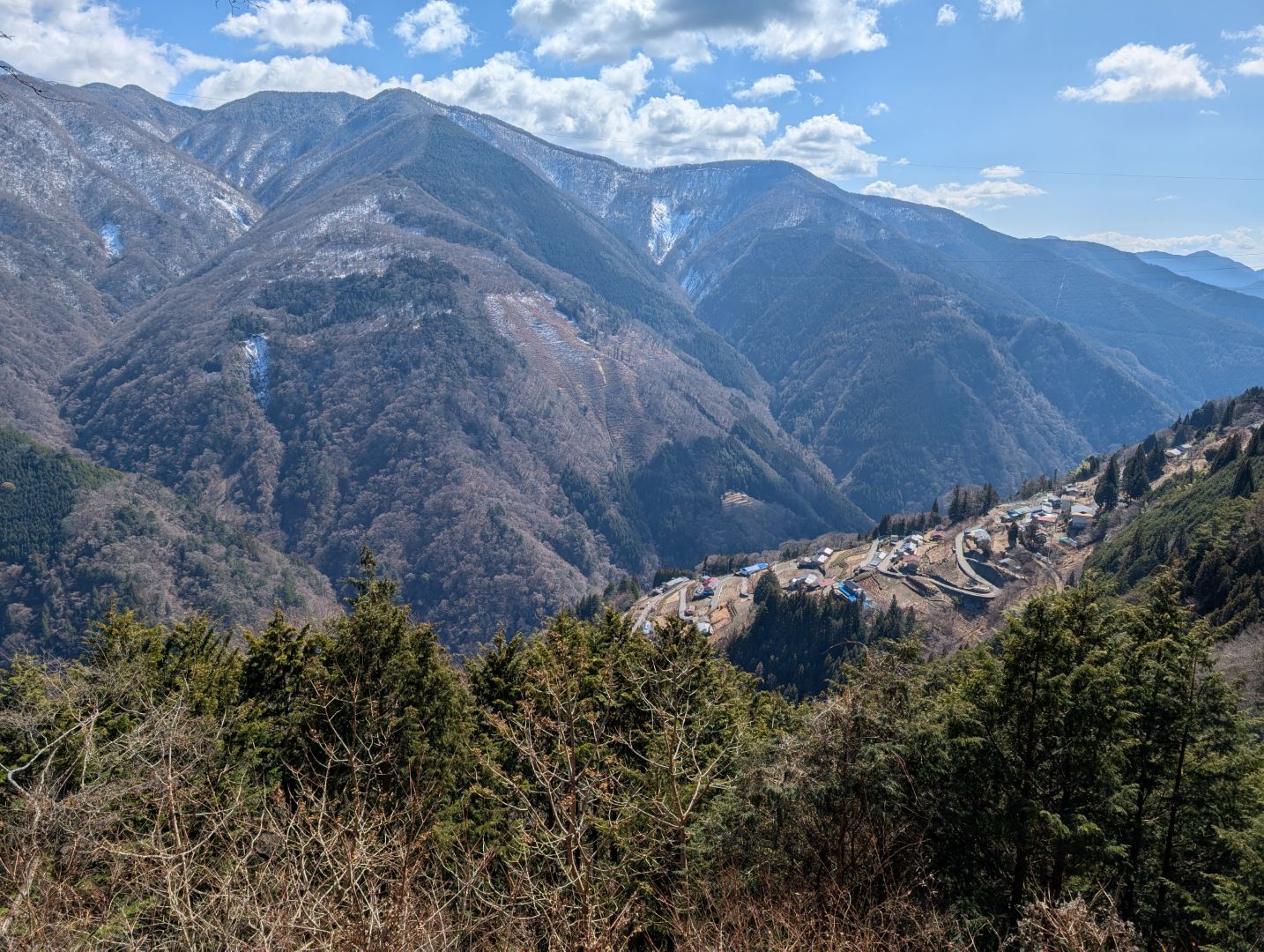
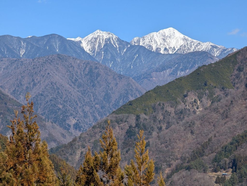
Finally arrived at Shimoguri no Sato using Google Maps navigation. Mt. Kamikochi and Mt. Usagi in the Southern Alps look beautiful, which is great, but there’s no sign of the panoramic view of Shimoguri no Sato that I wanted to see… It’s obvious when you think about it, but you can’t see the entire village when you’re inside it. I first came to the Shimoguri no Sato Observatory I found nearby, but there’s no way to see the full panorama from this observatory right next to the village…
So, searching nearby on Google Maps, I found “Oogibira Observatory,” and the photos posted confirmed it looked like the right place. When I set this as my destination and searched for a route, it seemed like I could get to the observatory from the middle of the Southern Alps Echo Line, so I continued climbing.
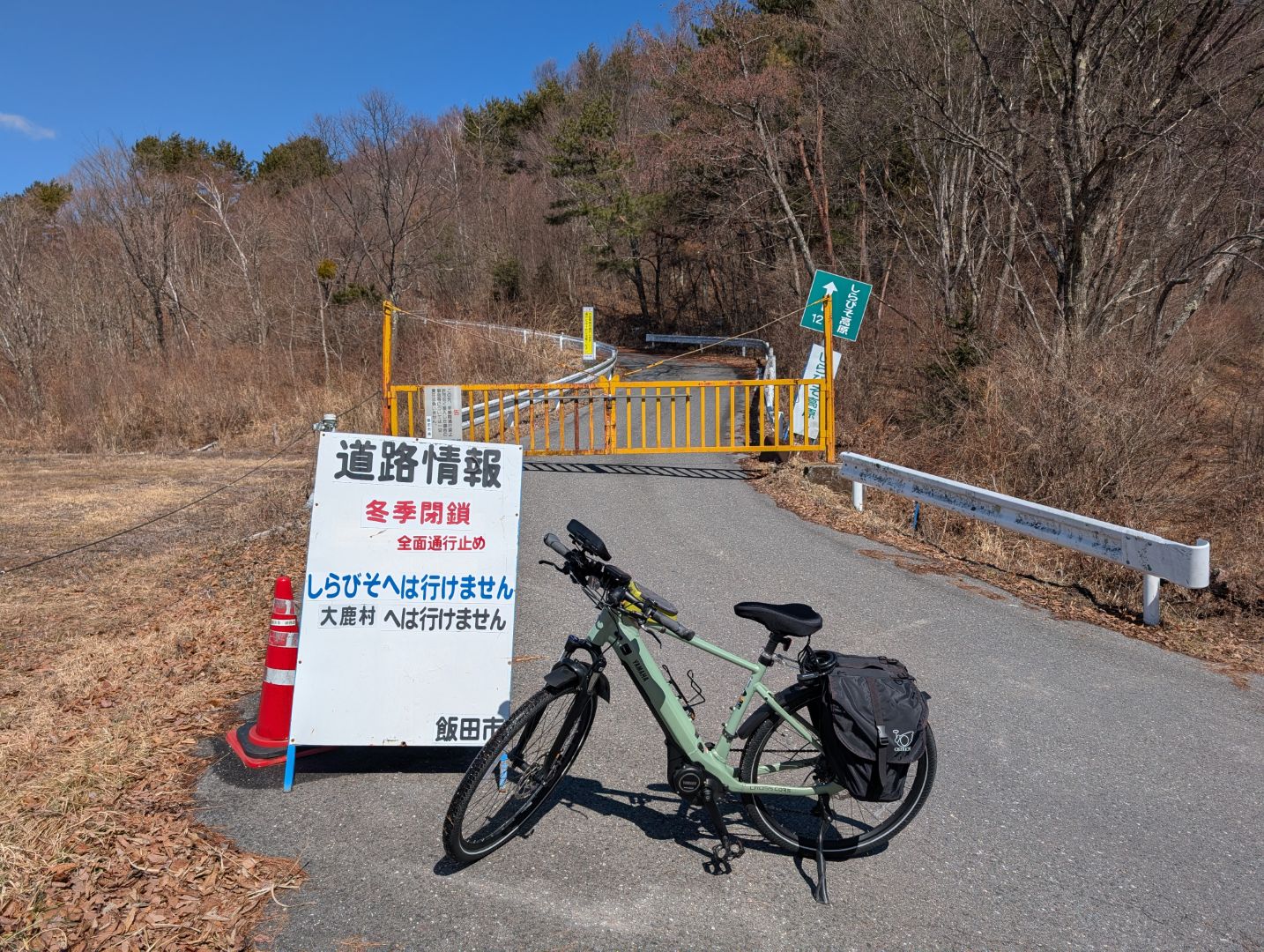
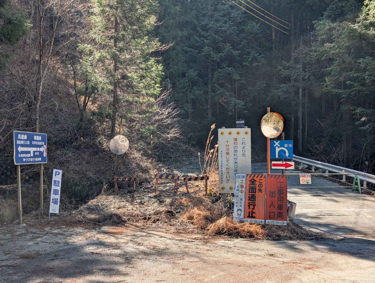
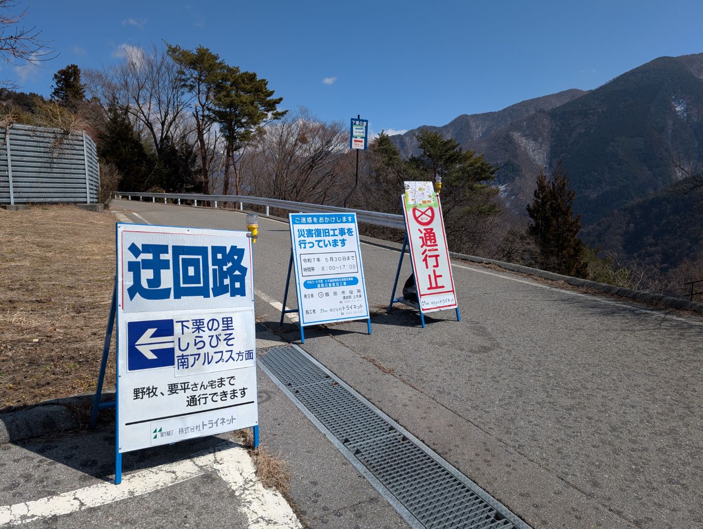
I was thinking, “This road looks familiar even though I’ve never been here,” and it turned out to be the road that leads to Shirabiso Kogen, a place I’d visited before. It’s still closed for winter, so I couldn’t pass. Anyway, I got onto the Southern Alps Echo Line and reached the vicinity of my destination, but there was absolutely no road or sign leading to an observatory… Something was off.

It seems I overlooked this entrance because the observatory name was different, and there was no “Shimoguri no Sato” notation. The viewpoint for Shimoguri no Sato is apparently a walking trail, and it was originally intended for visitors to walk about 1 kilometer from the Shimoguri no Sato Observatory parking lot. Since I was on my bike, I just zoomed past it, lol.
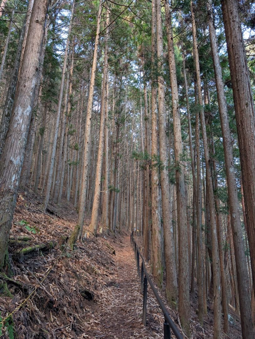
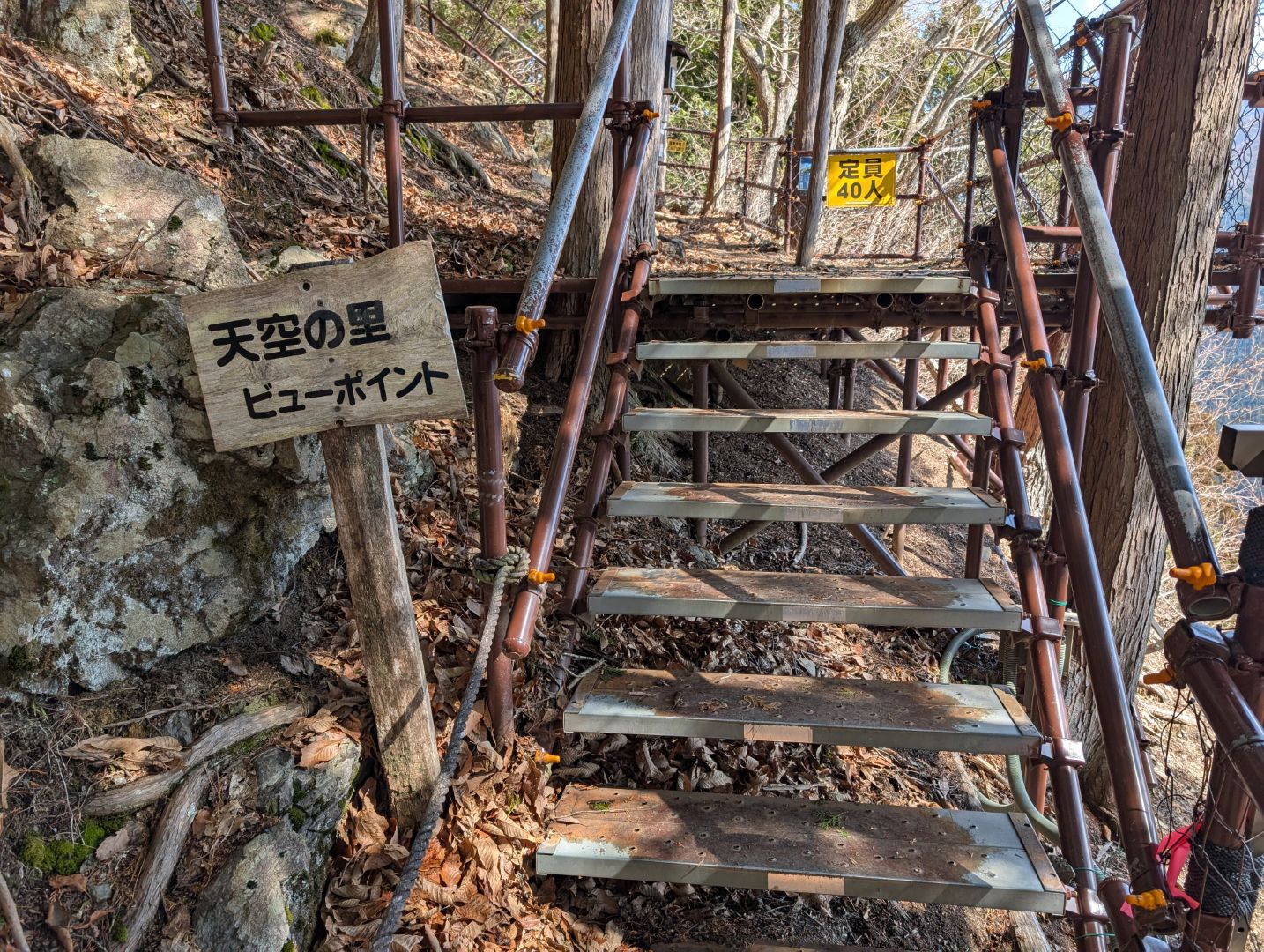
Although it’s quite a narrow promenade, it’s well-maintained, and after walking for about 10-15 minutes, I arrived at the Tenku no Sato Viewpoint. Perhaps because it was still the season when snow remained on the mountains, there was no one else there that day.
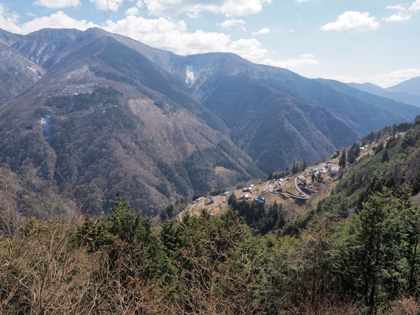
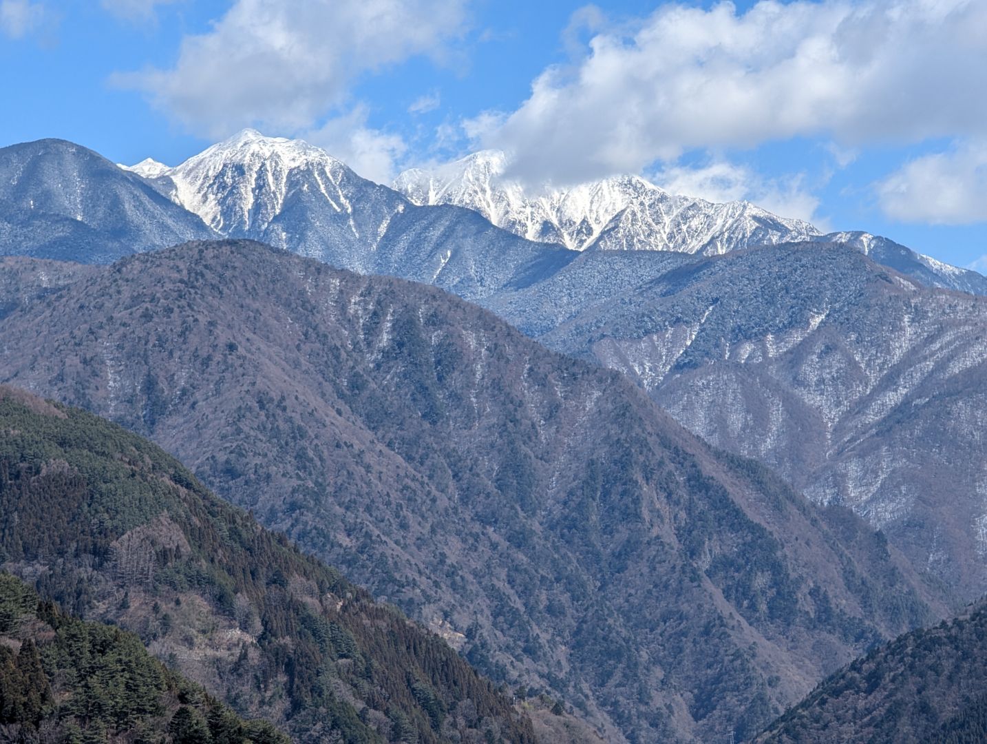
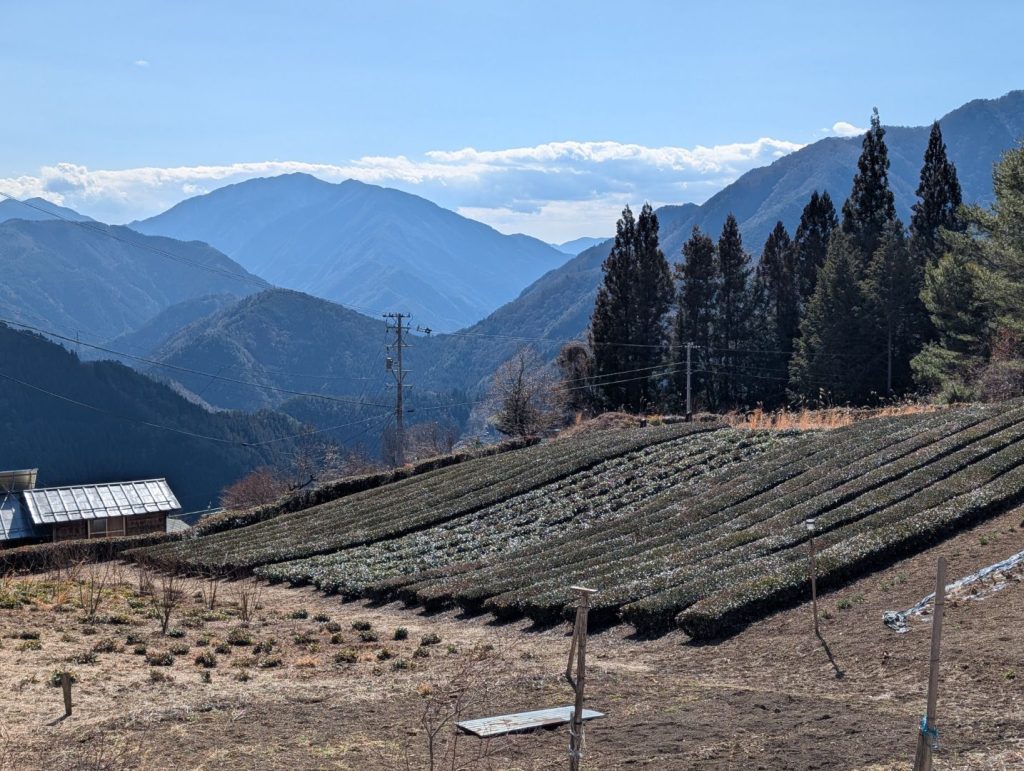
The panoramic view of Shimoguri no Sato from this observatory was truly magnificent, and it was well worth the effort to get here. If I had to nitpick, I did think it was a bit of a shame that I couldn’t see the snow-capped 3,000-meter class peaks of the Southern Alps at the same time from this angle, but I’m still extremely satisfied!
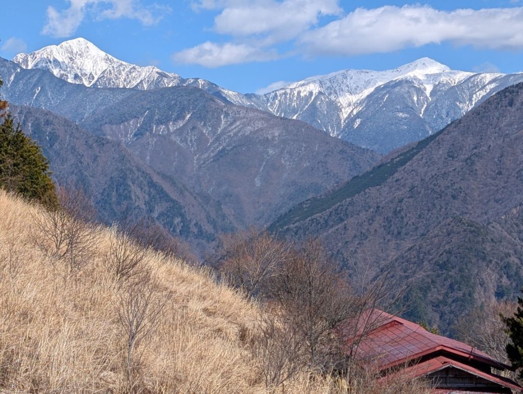

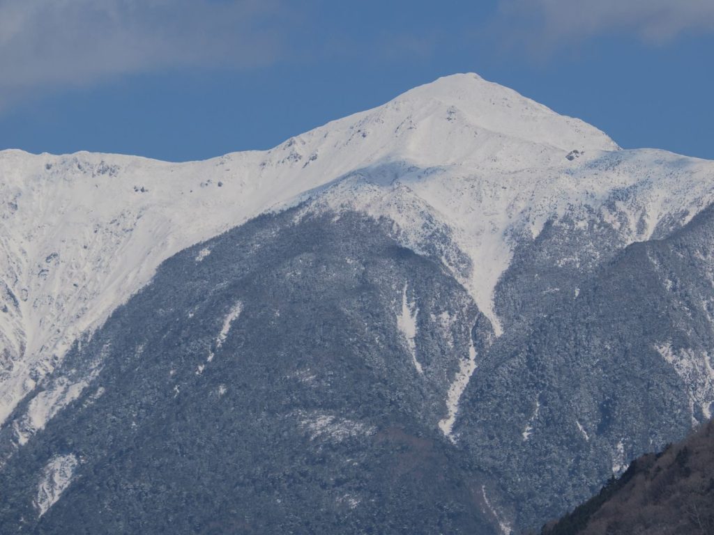
As I descended from Oogibira Observatory to Shimoguri no Sato Observatory, the clouds cleared, revealing the majestic figures of Mt. Kamikochi and Mt. Usagi. I’d love to traverse the Southern Alps someday, but it seems like a pretty high hurdle even without snow.
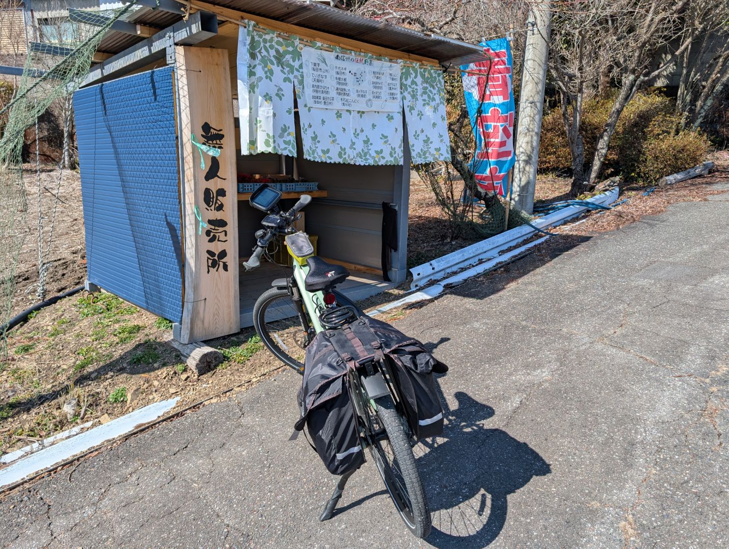
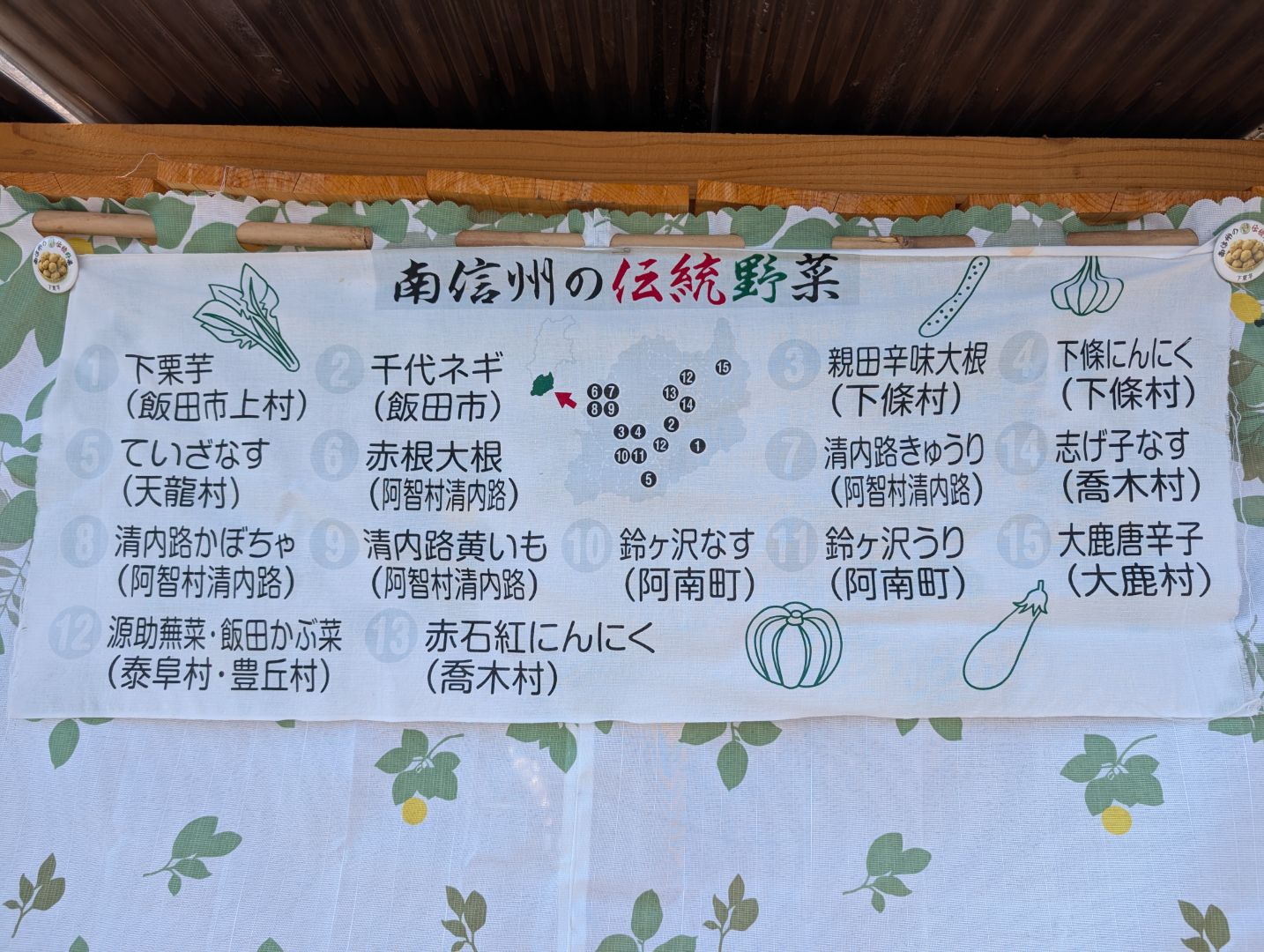
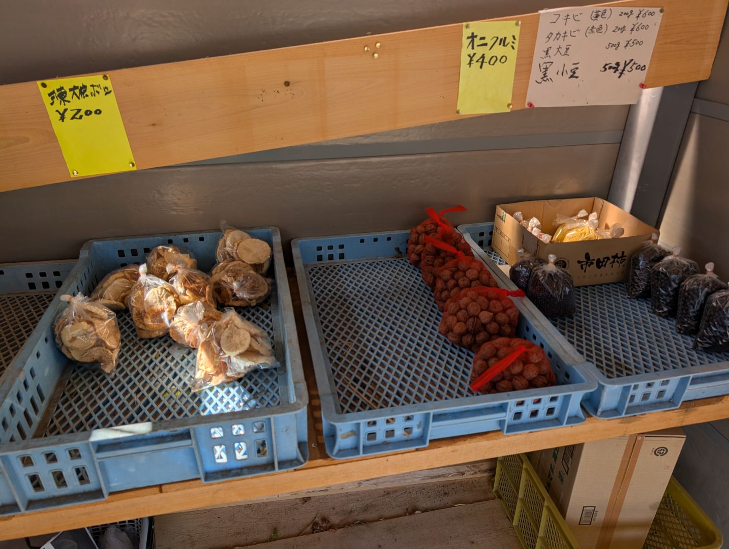
Unmanned stands in places like this always have so many delicious-looking things, I can’t help but stop. I was really curious about “daikon-hoshi” (dried daikon radish) rather than “kiriboshi daikon,” but more than that, I was in the mood for black beans, so I just stocked up on those, haha.

I came down a different route than the one I took up, and the scenery was absolutely amazing. However, the road was incredibly narrow, which made me wonder how the residents get around!

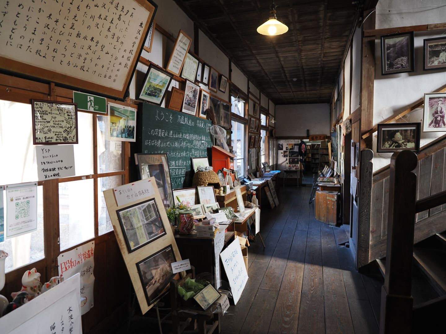
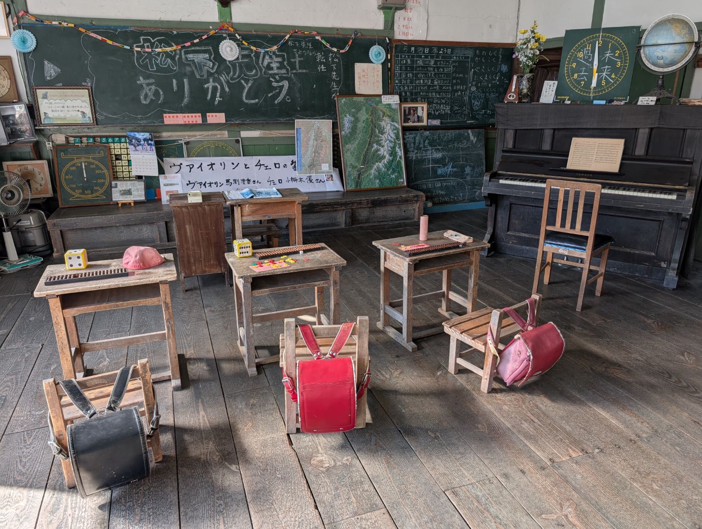
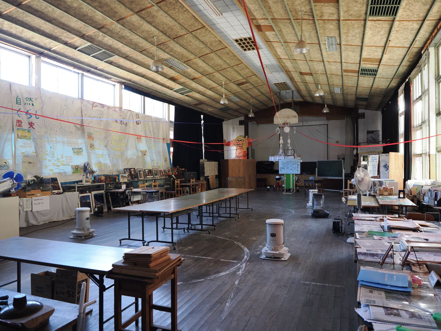
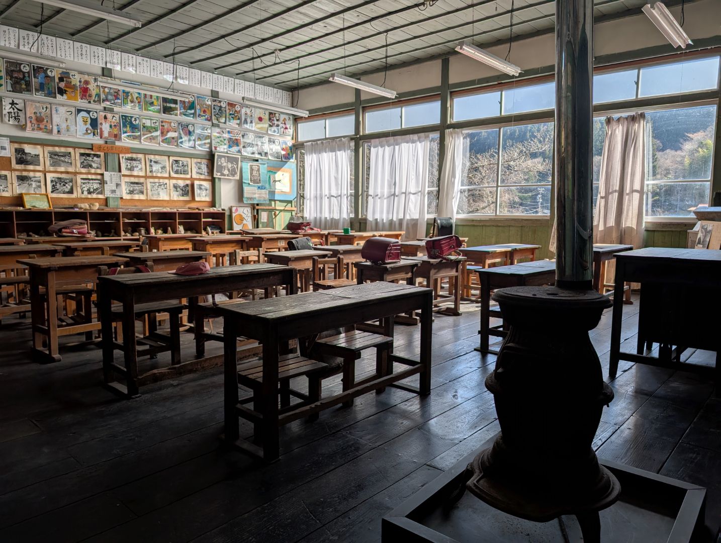
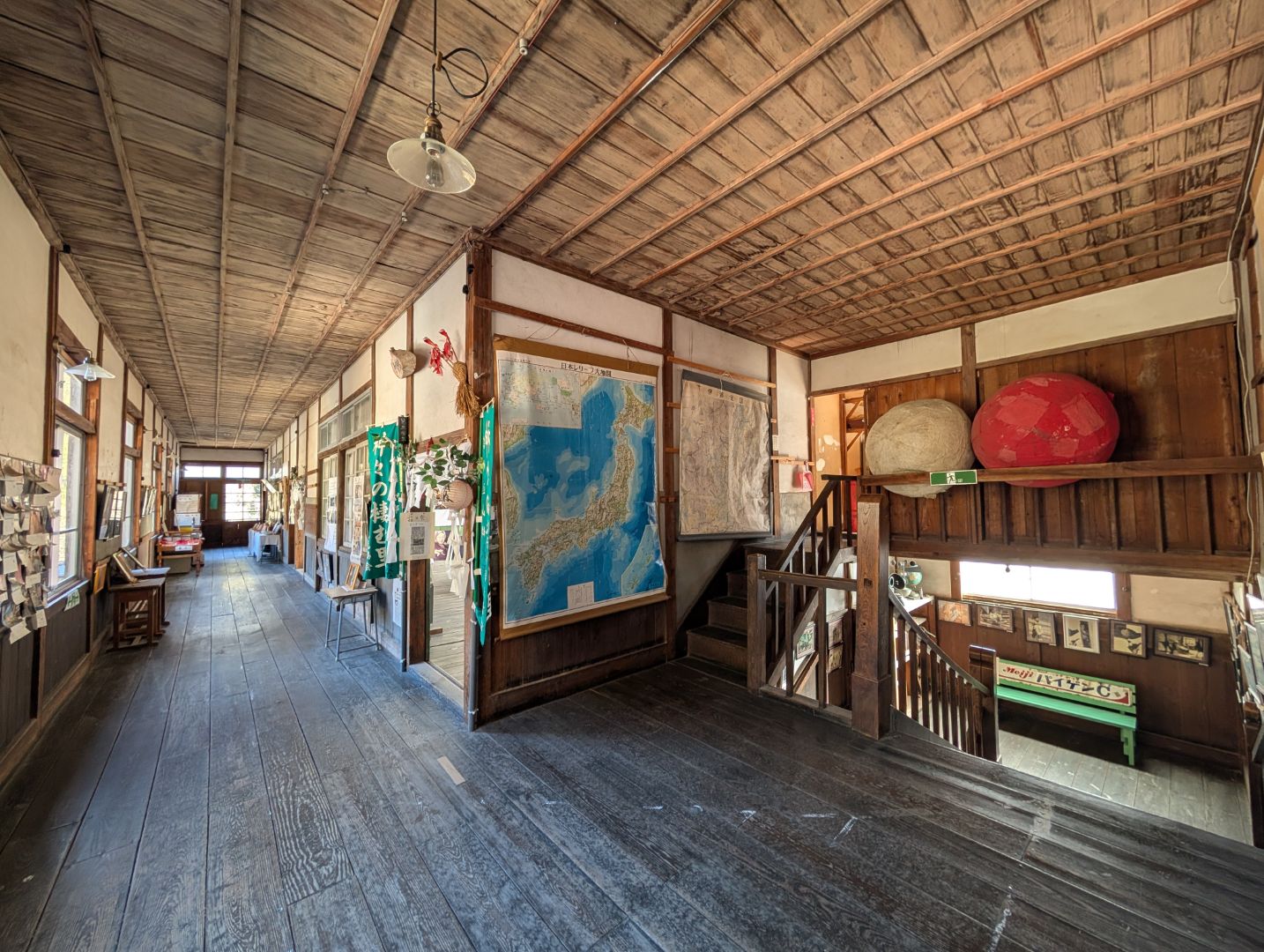
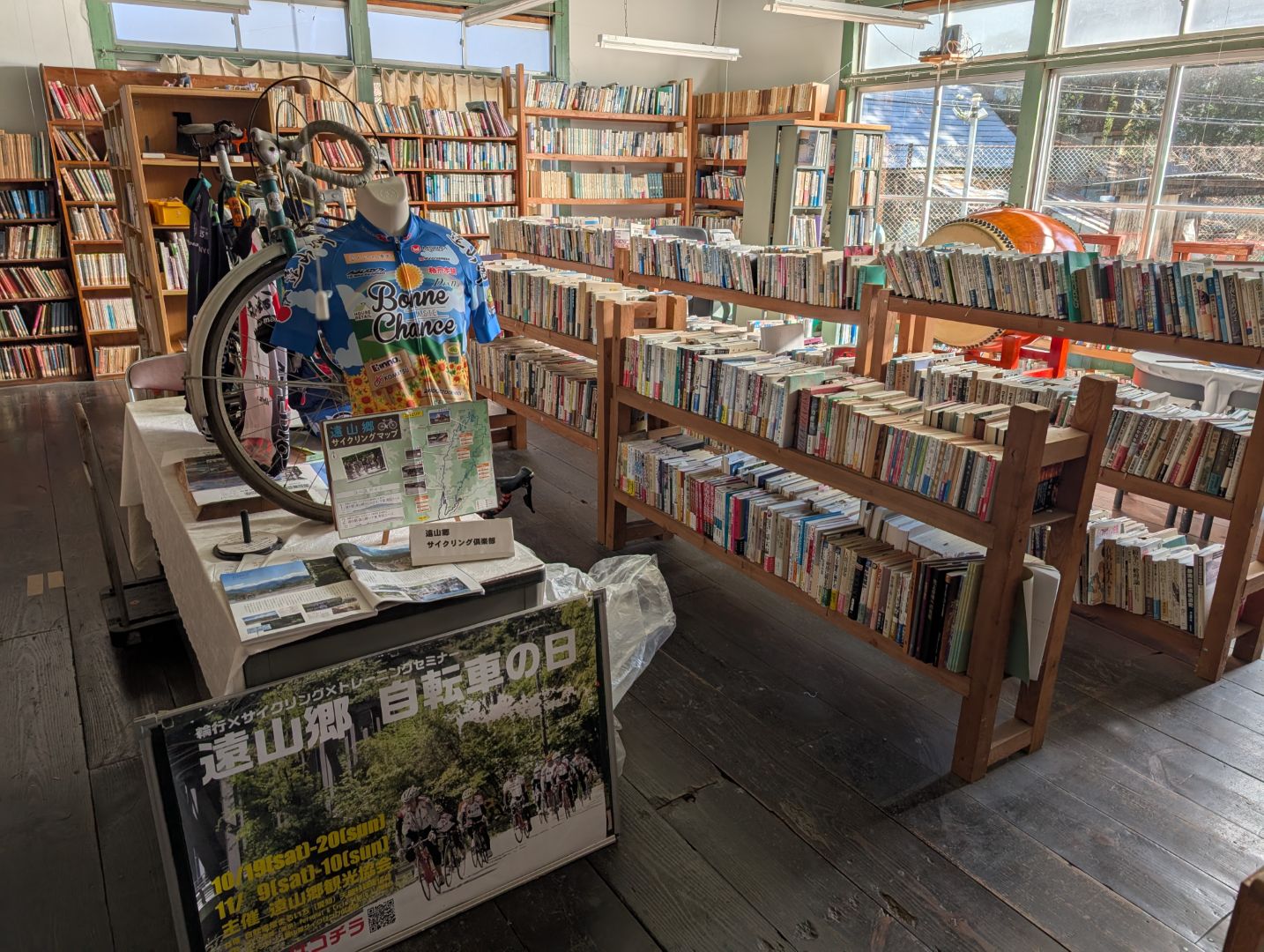
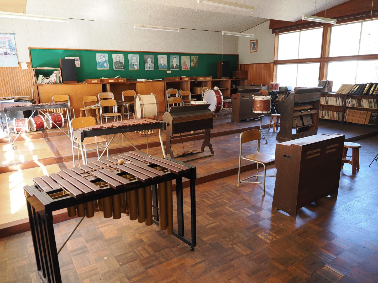
On the way from Roadside Station Toyamago to Shimoguri no Sato, there was a handwritten sign that had really caught my eye on a previous trip. It was like, “Hey, there’s a wooden schoolhouse, come visit!” complete with a strong sense of local charm. When driving, you zoom past it quickly, so even though I was curious, I’d never stopped. But since I was on my bike this time, I decided to drop by on my way back to the roadside station.
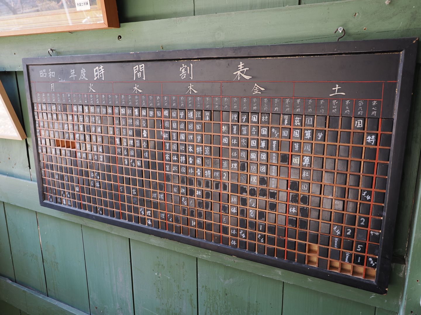
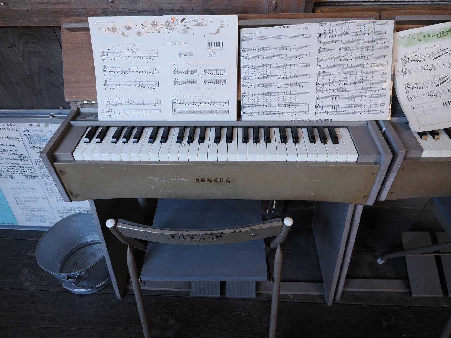
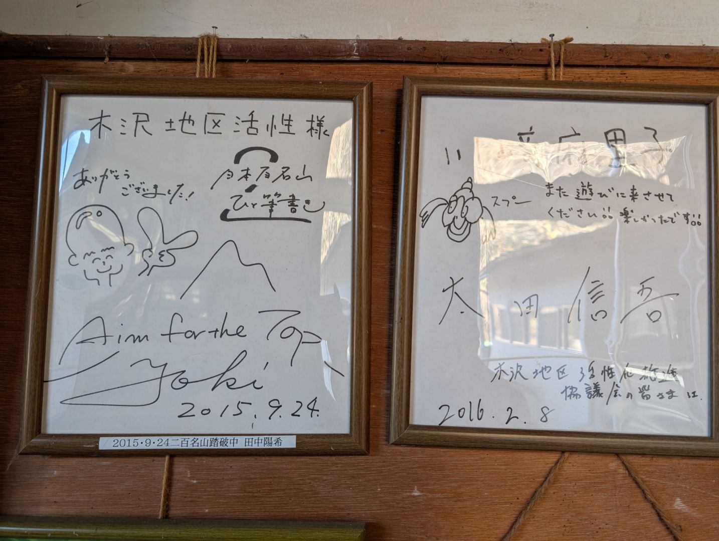
It seems that volunteers are making efforts to preserve the history and customs of the area, as well as the atmosphere of the old Kizawa Elementary School, just as it was. It felt a bit cluttered but also very lively, and I really enjoyed it. I actually thought the sign along the road was a bit suspicious-looking and might be doing the place a disservice, haha.

I truly enjoyed both Shimoguri no Sato and the Old Kizawa Elementary School. Highly recommended!
コメント